Logan Township, Blair County, Pennsylvania
Logan Township is a township in Blair County, Pennsylvania, United States. It is part of the Altoona, PA Metropolitan Statistical Area. It is the most populous township in Blair County, with a population of 12,289 at the 2010 census.[3] Logan Township is home to Horseshoe Curve, a National Historic Landmark.[4]
Logan Township, Blair County, Pennsylvania | |
|---|---|
 Three trains passing on triple-track mainline of Norfolk Southern Railway at Horseshoe Curve in Logan Township | |
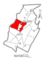 Map of Blair County, Pennsylvania highlighting Logan Township | |
 Logan Township Location of Logan Township in Pennsylvania | |
| Coordinates: 40°31′30″N 78°30′29″W | |
| Country | United States |
| State | Pennsylvania |
| County | Blair |
| Settled | 1770 |
| Incorporated | 1850 |
| Government | |
| • Type | Board of Supervisors |
| Area | |
| • Total | 46.84 sq mi (121.31 km2) |
| • Land | 46.51 sq mi (120.46 km2) |
| • Water | 0.33 sq mi (0.85 km2) |
| Population (2010) | |
| • Total | 12,289 |
| • Estimate (2016)[2] | 12,561 |
| • Density | 270.06/sq mi (104.27/km2) |
| Time zone | UTC-5 (Eastern (EST)) |
| • Summer (DST) | UTC-4 (EDT) |
| Area code(s) | 814 |
| FIPS code | 42-013-44328 |
| Website | www |
General information
- ZIP codes: 16601, 16602, 16603
- Area code: 814
- Local telephone exchanges: 940, 941, 942, 943, 944, 946, 947, 949
Geography
Logan Township is located in west-central Blair County and nearly encloses the city of Altoona. The township includes the unincorporated communities of Greenwood, to the northeast of Altoona, and Lakemont, to the southeast. The Interstate 99/U.S. Route 220 freeway passes through Logan Township as it bypasses Altoona to the east, with access from Exits 31, 32, and 33.
Horseshoe Curve is located in the southwest part of the township where the Norfolk Southern Railway's Pittsburgh Line climbs the Allegheny Front, a major escarpment at the edge of the Allegheny Mountains of central Pennsylvania.
According to the United States Census Bureau, the township has a total area of 46.7 square miles (121.0 km2), of which 46.4 square miles (120.1 km2) is land and 0.31 square miles (0.8 km2), or 0.70%, is water.[3]
Demographics
| Historical population | |||
|---|---|---|---|
| Census | Pop. | %± | |
| 2010 | 12,289 | — | |
| 2016 (est.) | 12,561 | [2] | 2.2% |
| U.S. Decennial Census[5] | |||
As of the census[6] of 2010, there were 12,289 people, 4,875 households, and 3,111 families residing in the township. The population density was 262.4 people per square mile (101.3/km2). There were 5,111 housing units at an average density of 109.1/sq mi (42.1/km2). The racial makeup of the township was 96.6% White, 1.2% African American, 0.1% Native American, 0.9% Asian, 0.02% Pacific Islander, 0.2% from other races, and 0.8% from two or more races. Hispanic or Latino of any race were 0.9% of the population.
There were 4,875 households, out of which 36.4% had children under the age of 18 living with them, 63.8% were married couples living together, 9.1% had a female householder with no husband present, and 36.2% were non-families. 25.4% of all households were made up of individuals, and 16.4% had someone living alone who was 65 years of age or older. The average household size was 2.42 and the average family size was 2.8.
In the township the population was spread out, with 16.3% under the age of 18, 18.5% from 18 to 24, 19.0% from 25 to 44, 29.7% from 45 to 64, and 16.4% who were 65 years of age or older. The median age was 41.5 years. For every 100 females, there were 96.8 males. For every 100 females age 18 and over, there were 95.6 males.
The median income for a household in the township was $36,993, and the median income for a family was $48,943. Males had a median income of $45,988 versus $32,051 for females. The per capita income for the township was $26,033. About 6.6% of families and 14.1% of the population were below the poverty line, including 14.9% of those under age 18 and 7.5% of those age 65 or over.
References
- "2016 U.S. Gazetteer Files". United States Census Bureau. Retrieved Aug 13, 2017.
- "Population and Housing Unit Estimates". Retrieved June 9, 2017.
- "Geographic Identifiers: 2010 Demographic Profile Data (G001): Logan township, Blair County, Pennsylvania". U.S. Census Bureau, American Factfinder. Archived from the original on February 12, 2020. Retrieved March 12, 2014.
- 2007 General Highway Map Blair County Pennsylvania (PDF) (Map). 1:65,000. Pennsylvania Department of Transportation, Bureau of Planning and Research, Geographic Information Division. Retrieved 2008-04-02. Note: shows Horseshoe Curve
- "Census of Population and Housing". Census.gov. Retrieved June 4, 2016.
- "U.S. Census website". United States Census Bureau. Retrieved December 15, 2018.
External links
Municipalities and communities of Blair County, Pennsylvania, United States | ||
|---|---|---|
| City | 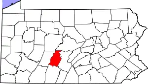 | |
| Boroughs | ||
| Townships | ||
| CDPs | ||
| Unincorporated communities | ||
| Footnotes | ‡This populated place also has portions in an adjacent county or counties | |
| ||
| Authority control |
|
|---|