North Fremantle, Western Australia
North Fremantle is a suburb of Perth, Western Australia, located within the City of Fremantle, a local government area of the state. Its dedicated postcode is 6159.[2]
| North Fremantle Perth, Western Australia | |||||||||||||||
|---|---|---|---|---|---|---|---|---|---|---|---|---|---|---|---|
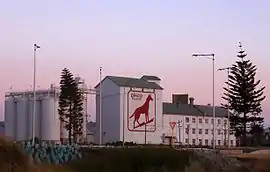 Dingo Flour mill | |||||||||||||||
 North Fremantle Location of North Fremantle (red pin) respecting to the City of Perth (CBD of Perth metropolitan area; shaded in red) and inner suburbs of Perth metropolitan area (area shaded in grey) | |||||||||||||||
| Coordinates | 32.034°S 115.756°E | ||||||||||||||
| Population | 3,340 (2016 census)[1] | ||||||||||||||
| Postcode(s) | 6159 | ||||||||||||||
| Location | |||||||||||||||
| LGA(s) | City of Fremantle | ||||||||||||||
| State electorate(s) | Cottesloe | ||||||||||||||
| Federal Division(s) | Fremantle | ||||||||||||||
| |||||||||||||||
North Fremantle is situated on a peninsula, with the Indian Ocean bounding the west side and the Swan River the east side. On the north side it is separated from the suburb of Mosman Park by McCabe Street. North Fremantle has one train station located on Stirling Highway. It provides train services into Fremantle and Perth City. Various bus stations can be found in North Fremantle providing access to outer Perth suburbs.[3]
History
North Fremantle became an independent municipality in 1895. The municipality reunited with the City of Fremantle by an order of the Governor in Executive Council as from 1 November 1961.[4]
Marshalling yards
The suburb was once the site of Western Australian Government Railways Leighton Marshalling Yards, which linked the North Fremantle industrial area and North Quay. [5][6]
The area has been considered for redevelopment by the state government.[7][8]
Businesses
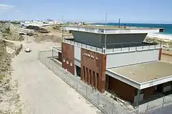
North Fremantle is home to Mojos bar;[9] the Railway Hotel; the North Fremantle Bowling Club, a local community run club that supports local live music, and holds private functions and community events; and River Beach, Leighton Beach and Port Beach. North Fremantle has seen an increase of locally owned business along Stirling Highway including various cafes, restaurants[10] and bars. The area's strong afternoon sea breeze (known as the "Fremantle Doctor") makes its ocean beaches a prime location for wind and kite surfing. The Fremantle Surf Life Saving Club has been active since the 1930s.[11]
References
- Australian Bureau of Statistics (27 June 2017). "North Fremantle(State Suburb)". 2016 Census QuickStats. Retrieved 30 January 2021.

- "Postcodes Australia | Postcode Search & Finder - Australia Post". Australia Post. Retrieved 1 April 2020.
- Wagovau. (2016). Wagovau. Retrieved 17 May 2016, from http://www.transperth.wa.gov.au/
- Ewers, J.K. (1971). The Western Gateway: a history of Fremantle, 2nd Ed. p.179.
- Aerial Surveys Australia; HRRC (1967), Aerial photographs of North Fremantle and Leighton Beach, 31 May 1967, retrieved 30 January 2021
- Smith, Betty (1985), Yardmaster's Office, Leighton, control centre for the marshalling yards, October 1985, retrieved 30 January 2021
- Fremantle Regional Strategy Implementation Committee; Ministry for Planning (Western Australia) (2000), Leighton Rail Marshalling Yards : regional planning guidelines : scoping paper for information and discussion, Ministry for Planning, ISBN 978-0-7309-9138-0
- Planning Group Pty. Ltd; LandCorp (W.A.) (2003), Leighton Marshalling Yards structure plan, Planning Group, retrieved 5 March 2017
- http://www.mojosbar.com.au/main.asp
- Home - Habitue Restaurant. (2016). Habitue Restaurant. Retrieved 17 May 2016, from http://habituerestaurant.com.au/
- Walton, Graham (2001). Fremantle Surf Lifesaving Club History Archived 14 April 2011 at the Wayback Machine, freosurf.com.au. Retrieved 17 May 2011.