Garda Mountains
The Garda Mountains (Italian: Prealpi Gardesane, German: Gardaseeberge), occasionally also the Garda Hills, are an extensive mountain range of the Southern Limestone Alps in northern Italy.
| Garda Mountains | |
|---|---|
.png.webp) Location of the Garda Mountains.
The borders of the range according to Alpine Club classification of the Eastern Alps | |
| Highest point | |
| Peak | Monte Cadria |
| Elevation | 2,254 m (7,395 ft) |
| Geography | |
| State | Trentino-South Tyrol, Lombardy, Venetia; Italy |
| Range coordinates | 45°43′25″N 10°50′31″E |
| Parent range | Southern Limestone Alps |
Boundaries and countryside
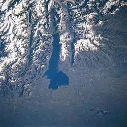
The Garda Mountains are bounded in the south by the Po Valley and in the north by the Brenta Dolomites, in the east by the Adige Valley and in the west by the Valli Giudicarie. Their precise boundary, according to the Alpine Club classification of the Eastern Alps, is as follows: Lake Iseo – Col di San Zeno – Val Trompia – Passo di Manivia – Bagolino – Storo – Tione – Vezzano – Trento – Val d'Adige/Etschtal – Verona – Brescia – Lake Iseo.
Their highest summit is the Monte Cadria, at 2,254 m s.l.m.
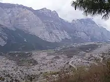
The climate of the Garda Mountains is very mild as a result of its southerly location and the influence of the Mediterranean Sea. Snow rarely falls in the Sarca valley and on the shores of Lake Garda, and, in spring and autumn, temperatures of between 15-20 °C are often experienced. The Garda Mountains have very few glaciers and ski resorts. The Alpinist centre of the range is the town of Arco. In the vicinity of Arco there are countless sport climbing areas.
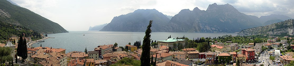
Lake Garda and its surrounding mountains are a popular destination for water sportsmen, mountain bikers, hikers and climbers.
On the western shore of Lake Garda is the Parco Alto Garda Bresciano nature park.
Lakes
- Lake Garda (Lago di Garda)
- Lago di Ledro
- Lago di Valvestino
- Lago di Cei
- Lago di Tenno
- Lago pra de la Stua
- Lagetto d'Ampola
- Lago di Cavedine
- Lago di Toblino
Valleys
- Valle d'Ampolla
- Val Cavedine
- Val di Cei
- Valle di Concei
- Valle dei Laghi (Sarca Valley)
- Val di Ledro
- Valle Toscolano
- Valle di Vesta
Significant peaks
- Monte Cadria, 2,254 m
- Cima Valdritta, 2,218 m
- Punta Telegrafo, 2,200 m
- Monte Bondone, 2,180 m
- Monte Altissimo di Nago, 2,079 m
- Monte Caplone, 1,976 m
- Monte Tremalzo, 1,974 m
- Monte Casale, 1,632 m
- Monte Pizzocolo, 1,581 m
Vie ferrate
- Sentiero attrezzato del Colodri (Cima Colodri)
- Sentiero attrezzato Fausto Susatti (Cima Capi)
- Via dell'Amicizia (Cima SAT)
- Che Guevara (Monte Casale, 1632 m)
- Via ferrata Rino Pisetta (Dain Picol, 971 m)
- Sentiero attrezzato Gerardo Sega (Malga Cola)
- Monte Albano (Mori)
Literature
External links
| Wikimedia Commons has media related to Mountains around Lake Garda. |
Mountain ranges of the Southern Limestone Alps according to the AVE | ||
|---|---|---|