Gaultois
Gaultois is a small settlement in the Coast of Bays area in Newfoundland and Labrador, Canada. Gaultois had a population of 136 people as of 2016.[1] The town has a K-12 school called Victoria Academy, as well as a fire department, public library, Lion's Club, and town hall. The town is only accessible by ferry or helicopter. The ferry runs from the nearby town of Hermitage several times daily and the crossing takes approximately 20 minutes. This ferry also services the more remote community of McCallum once to twice daily with a crossing time of around one hour and fifteen minutes.[2]
Gaultois | |
|---|---|
 | |
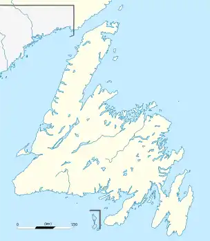 Gaultois Location of Gaultois in Newfoundland | |
| Coordinates: 47°36′N 55°55′W | |
| Country | |
| Province | |
| Area | |
| • Land | 4.33 km2 (1.67 sq mi) |
| Population (2016)[1] | |
| • Total | 136 |
| • Density | 31.4/km2 (81/sq mi) |
| Time zone | UTC-3:30 (Newfoundland Time) |
| • Summer (DST) | UTC-2:30 (Newfoundland Daylight) |
| Area code(s) | 709 |
Before confederation with Canada in 1949, Gaultois was the customs town for those wishing to travel to the islands of Saint Pierre and Miquelon. Prior to resettlement, the population had declined to 107 in 1956 from a peak of 252 five years earlier. After resettlement in 1966 Gaultois population rose to 594 with the fish plant and its draggers as the main employer of the town. The first Waymaster in 1877, was Richard Bradshaw.
A fishing community, Gaultois went into a decline when the Lake Group first announced the closure of its fish plant in 1981[3] and again in 1990 when Fishery Products International closed the plant permanently.[4] As of 2017, the population has plunged by 80 percent since the 1990s.[5]
Though small, Gaultois has four distinct areas:
- The Room near the wharf where, traditionally salt fish was dried for market, on flakes.
- The Valley up the hill a little then surrounded by high rock faces, home to about 10 homes.
- The Point across the harbour from the rooms. The most populated part of town. The point and the rooms are joined by a wooden boardwalk at the base of the rock face.
- The Bottom up the hill and down the other side from the point. The most isolated part of town.
See also
- List of cities and towns in Newfoundland and Labrador
- List of people of Newfoundland and Labrador
| Wikimedia Commons has media related to Gaultois, Newfoundland and Labrador. |
References
- "Census Profile, 2016 Census: Gaultois, Town [Census subdivision], Newfoundland and Labrador". Statistics Canada. Retrieved December 16, 2019.
- Hillier, Bernice (Jan 17, 2019). "Isolated towns fear new ferry contract will be the same old boat". CBC News. Retrieved Oct 17, 2020.
- Antle, Angela (December 16, 2017). "Land & Sea: Gaultois in 1981, a town on the brink". CBC News. Retrieved December 16, 2019.
- "Land & Sea: Gaultois in 1990 on the day they call Black Thursday". CBC News. December 2, 2017. Retrieved December 16, 2019.
- Roberts, Terry (November 26, 2017). "Hands up for resettlement in Gaultois as island community braces for winter". CBC News. Retrieved December 16, 2019.
