Burnt Islands, Newfoundland and Labrador
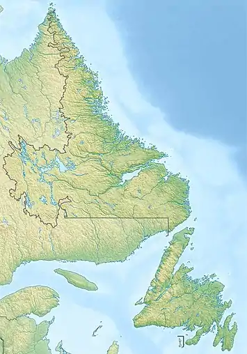
Burnt Islands is a small coastal community found in God Bay on the southwest coast of Newfoundland, Canada.
Burnt Islands | |
|---|---|
Town | |
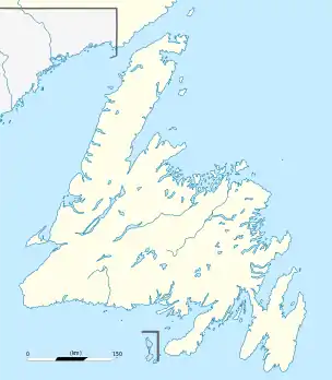 Burnt Islands Location of Burnt Islands in Newfoundland | |
| Coordinates: 47°35′50.40″N 58°53′07.84″W | |
| Country | Canada |
| Province | |
| Government | |
| • Mayor | Paul Strickland |
| Area | |
| • Land | 9.52 km2 (3.68 sq mi) |
| Population (2016)[1] | |
| • Total | 622 |
| • Density | 65.3/km2 (169/sq mi) |
| Time zone | UTC-3:30 (Newfoundland Time) |
| • Summer (DST) | UTC-2:30 (Newfoundland Daylight) |
| Area code(s) | 709 |
| Highways | |
| Website | http://www.burntislandsnl.ca/ |
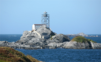
.jpg.webp)
 Colombier Islands Lighthouse Newfoundland and Labrador | |
| |
| Location | Burnt Islands Newfoundland Canada |
|---|---|
| Coordinates | 47°35′30.9″N 58°53′50.5″W |
| Year first constructed | 1929 (fog alarm) |
| Year first lit | 1971 (current tower) |
| Foundation | concrete base |
| Construction | aluminium skeletal tower |
| Tower shape | quadrangular skeletal tower with balcony and lantern |
| Tower height | 11 metres (36 ft) |
| Focal height | 18 metres (59 ft) |
| Light source | solar power |
| Range | 15 nautical miles (28 km; 17 mi) |
| Characteristic | Fl W 5s. |
| Fog signal | 1 blast every 30s. |
| Admiralty number | H0238 |
| CHS number | CCG 156 |
| NGA number | 2436 |
| ARLHS number | CAN-837 |
| Managing agent | Canadian Coast Guard[2][3] |
Geography
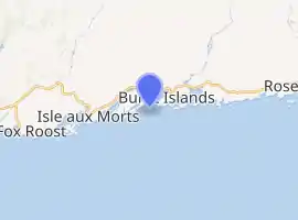
It is 27 kilometres east from Port-aux-Basques. This community consists of an "island" section and a "main" section that were connected by a causeway in 1969. The community is built on the rocky, barren coastline of the harbour. The countryside consists largely of bogs and marshes with many species of plant and animal life native to Newfoundland being present.
History
Burnt Islands, like many Newfoundland coastal communities, developed around the fishery. The sheltered harbour and proximity to rich fishing grounds were the principal factors in attracting early fishermen to this area between 1839 and 1841. The first recorded settlers settled on what is locally known as the "Main" in 1839, while families settled the "Island" in 1841.
Throughout the late 19th century and well into the 20th century the community continued to thrive with many business firms establishing in the area providing goods, services and employment for people in the area. The community supported a lumber and glue industry at one time.
In 1968 the first fish processing plant was started by Eric King fisheries, employing a large number of the towns residents and continuing to do so to the present day. Also it was in 1969 that the two main areas of settlement were linked together by a causeway, making it the community of Burnt Islands.
Climate
The climate for Burnt Islands is a maritime climate which consists of fairly cool weather in the summer and somewhat mild temperatures in the winter caused by the moderating effects of the nearby ocean. This area of the southwest coast is well known for its infamous winds that sometimes gust over 150 km per hour.
People
The population for Burnt Islands according to the 1996 census is 919, down over 100 from the 1991 census. This loss of population represents the collapse of the inshore fishery and the subsequent cod moratorium that came into effect in 1991, forcing many to leave the area in search of new economic opportunities.
Like many rural Newfoundland communities, the population of Burnt Islands is aging. Many of the remaining residents are well into their senior years and those of the younger generation rely on outside sources for employment such as neighbouring communities or other parts of Canada. Burnt Islands had about 622 people living in it as of the 2016 Census.[1]
| Year | Pop. | ±% |
|---|---|---|
| 1996 | 919 | — |
| 2001 | 801 | −12.8% |
| 2006 | 703 | −12.2% |
| 2011 | 651 | −7.4% |
| 2016 | 622 | −4.5% |
| [4][1] | ||
Transportation
The community is linked to the Trans Canada Highway by route 470 at Port aux Basques. From Port aux Basques, known as the Gateway to Newfoundland, Burnt Islands is linked by the Marine Atlantic ferries to Nova Scotia and mainland Canada.
See also
References
- "Census Profile, 2016 Census: Burnt Islands, Town [Census subdivision], Newfoundland and Labrador". Statistics Canada. Retrieved October 24, 2019.
- Central and Western Newfoundland The Lighthouse Directory. University of North Carolina at Chapel Hill. Retrieved 12 February 2017
- List of Lights, Pub. 110: Greenland, The East Coasts of North and South America (Excluding Continental U.S.A. Except the East Coast of Florida) and the West Indies (PDF). List of Lights. United States National Geospatial-Intelligence Agency. 2016.
- "2006 Community Profiles: Burnt Islands, NL". Statistics Canada. Retrieved October 24, 2019.
External links
- Burnt Islands
- Grandy's River Collegiate
- Picture of the lighthouse
- Burnt Islands -Encyclopedia of Newfoundland and Labrador, vol. 1, p. 298.
- Aids to Navigation Canadian Coast Guard