Gibbs, Tennessee
Gibbs is an unincorporated community of Knox County, Tennessee, United States, located approximately 10 miles Northeast of Knoxville.
Gibbs, Tennessee | |
|---|---|
| Harbison Crossroads | |
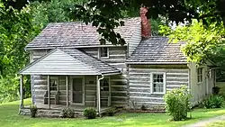 Nicholas Gibbs cabin | |
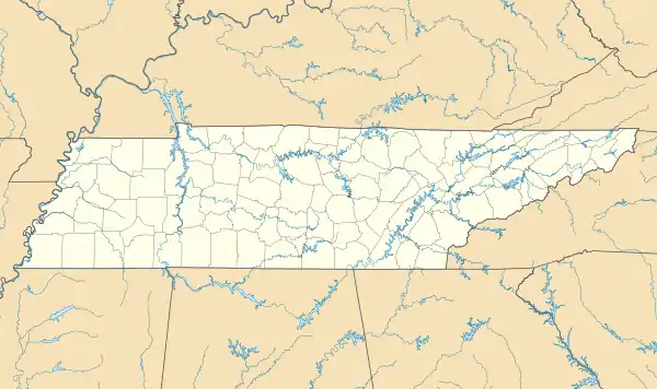 Gibbs Location in Tennessee and the United States  Gibbs Gibbs (the United States) | |
| Coordinates: 36°07′15″N 83°51′09″W | |
| Country | United States |
| State | Tennessee |
| County | Knox |
| Elevation | 1,109 ft (338 m) |
| Time zone | UTC-5 (Eastern (EST)) |
| • Summer (DST) | UTC-4 (EDT) |
| ZIP codes | 37721, 37918, 37938 |
| Area code(s) | 865 |
| FIPS code | US47 |
| GNIS feature ID | 1281332[1] |
History
Gibbs was originally known by the name of Harbison Crossroads. The area had received this name from American Revolutionary War veteran James Harbison, who settled the area in the 1790s and operated a toll gate at the crossroads of Emory Road and Tazewell Pike.[2]
Nicholas Gibbs, settled in the area following Harbison in a log cabin. Gibbs would later be used as the name of the area following Harbison Crossroads. The different names of the area has led to confusion, as state and county maps designate the area as Harbison Crossroads and public schools located within the community are named for Gibbs, including Gibbs Elementary, Middle and High schools.[2]
Geography
The location of Harbison Crossroads today aligns with the intersection of State Route 131 and State Route 331 and known locally as East Emory Road and Tazewell Pike.[3]
Economy
Several gas stations, restaurants, a grocery store and Rural/Metro Fire Station are all found in Gibbs.[4]
Education
Gibbs High School, Gibbs Middle School and Gibbs Elementary School are all located on Tazewell Pike, just north of the crossroads.
References
- "Harbison Crossroads, Tennessee". Geographic Names Information System. United States Geological Survey.
- Steely, Mike (April 16, 2017). "How Knox County places were named". The Knoxville Focus. Retrieved January 13, 2021.
- "State Highway and Interstate List 2003". Tennessee Department of Transportation. 24 January 2003. Missing or empty
|url=(help) - "2015 Northeast County Sector Plan" (PDF). Knoxville-Knox County Metropolitan Planning Commission. December 10, 2015. Retrieved October 17, 2020.
External links
Municipalities and communities of Knox County, Tennessee, United States | ||
|---|---|---|
| City | ||
| Town | ||
| CDP | ||
| Other unincorporated communities | ||
| Footnotes | ‡This populated place also has portions in an adjacent county or counties | |
| ||