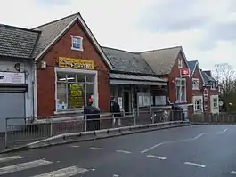
Gipsy Hill railway station
Gipsy Hill railway station is in the London Borough of Lambeth in south London. It is situated on the Crystal Palace Line, 7 miles 77 chains (12.8 km) measured from London Victoria. The station, and all trains serving it, are operated by Southern, and it is in Travelcard Zone 3.
| Gipsy Hill | |
|---|---|
 Gipsy Hill (prior to 2009 refurbishment works) | |
 Gipsy Hill Location of Gipsy Hill in Greater London | |
| Location | Gipsy Hill |
| Local authority | London Borough of Lambeth |
| Managed by | Southern |
| Station code | GIP |
| DfT category | E |
| Number of platforms | 2 |
| Fare zone | 3 |
| National Rail annual entry and exit | |
| 2015–16 | |
| 2016–17 | |
| 2017–18 | |
| 2018–19 | |
| 2019–20 | |
| Key dates | |
| 1 December 1856 | opened |
| Other information | |
| External links | |
| WGS84 | 51.4246°N 0.084°W |
The station is located at grid reference TQ333712.
Ticket barriers were installed in February 2009.
Accidents and incidents
- On 14 February 1990, Class 455 electric multiple unit 5802 collided with a fallen tree obstructing the line. Unit 5820 then collided with 5802.[2]
Services
The typical off-peak service frequency is:
- 4tph (trains per hour) to London Victoria
- 4tph to London Bridge (2tph go northbound via Tulse Hill and 2tph go via Crystal Palace and Forest Hill)
- 2tph to Beckenham Junction via Crystal Palace
- 2tph to Sutton via West Croydon
After 7pm the 2tph services to Sutton(Surrey) are extended to:
- 1tph to Epsom
- 1tph to Epsom Downs
On Sunday this is reduced to:
- 2tph to London Victoria
- 2tph to Sutton
- 2tph to London Bridge via Tulse Hill
- 2tph terminating Crystal Palace
| Preceding station | Following station | |||
|---|---|---|---|---|
| West Norwood | Southern London Victoria to London Bridge (via Crystal Palace) |
Crystal Palace | ||
| Southern London Bridge to Beckenham Junction (Monday to Saturday) |
||||
| Southern London Victoria to Sutton via Crystal Palace |
||||
Gallery
| Wikimedia Commons has media related to Gipsy Hill railway station. |
 Detail of the London, Brighton and South Coast Railway's coat of arms, displayed above the entrance to Gipsy Hill station
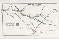
 A 1908 Railway Clearing House map of lines around the Gipsy Hill railway station, as well as surrounding lines
 A 1908 Railway Clearing House map of lines around Gipsy Hill railway station.
References
- "Station usage estimates". Rail statistics. Office of Rail Regulation. Please note: Some methodology may vary year on year.
- McCrickard, John P (6 October 2016). "January 1990 to December 1990". Network South East Railway Society. Archived from the original on 26 June 2018. Retrieved 26 June 2018.
External links
- Train times and station information for Gipsy Hill railway station from National Rail
This article is issued from Wikipedia. The text is licensed under Creative Commons - Attribution - Sharealike. Additional terms may apply for the media files.