Glenham, South Dakota
Glenham is a town in Walworth County, South Dakota, United States. The population was 105 at the 2010 census.
Glenham, South Dakota | |
|---|---|
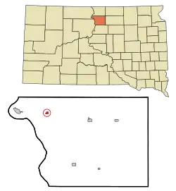 Location in Walworth County and the state of South Dakota | |
| Coordinates: 45°31′58″N 100°16′17″W | |
| Country | United States |
| State | South Dakota |
| County | Walworth |
| Incorporated | 1907[1] |
| Area | |
| • Total | 0.33 sq mi (0.85 km2) |
| • Land | 0.33 sq mi (0.85 km2) |
| • Water | 0.00 sq mi (0.00 km2) |
| Elevation | 1,683 ft (513 m) |
| Population | |
| • Total | 105 |
| • Estimate (2019)[4] | 105 |
| • Density | 321.10/sq mi (124.11/km2) |
| Time zone | UTC-6 (Central (CST)) |
| • Summer (DST) | UTC-5 (CDT) |
| ZIP code | 57631 |
| Area code(s) | 605 |
| FIPS code | 46-24620[5] |
| GNIS feature ID | 1255262[6] |
Glenham was laid out in 1900, and named for a glen near the town site.[7]
Geography
Glenham is located at 45°31′58″N 100°16′17″W.[8]
According to the United States Census Bureau, the town has a total area of 0.33 square miles (0.85 km2), all land.[9]
Glenham has been assigned the ZIP code 57631 and the FIPS place code 24620.
Demographics
| Historical population | |||
|---|---|---|---|
| Census | Pop. | %± | |
| 1910 | 182 | — | |
| 1920 | 135 | −25.8% | |
| 1930 | 187 | 38.5% | |
| 1940 | 131 | −29.9% | |
| 1950 | 168 | 28.2% | |
| 1960 | 171 | 1.8% | |
| 1970 | 178 | 4.1% | |
| 1980 | 169 | −5.1% | |
| 1990 | 134 | −20.7% | |
| 2000 | 139 | 3.7% | |
| 2010 | 105 | −24.5% | |
| 2019 (est.) | 105 | [4] | 0.0% |
| U.S. Decennial Census[10] | |||
2010 census
As of the census[3] of 2010, there were 105 people, 55 households, and 30 families residing in the town. The population density was 318.2 inhabitants per square mile (122.9/km2). There were 67 housing units at an average density of 203.0 per square mile (78.4/km2). The racial makeup of the town was 95.2% White, 1.9% Native American, 1.9% from other races, and 1.0% from two or more races. Hispanic or Latino of any race were 2.9% of the population.
There were 55 households, of which 10.9% had children under the age of 18 living with them, 47.3% were married couples living together, 5.5% had a female householder with no husband present, 1.8% had a male householder with no wife present, and 45.5% were non-families. 43.6% of all households were made up of individuals, and 18.2% had someone living alone who was 65 years of age or older. The average household size was 1.91 and the average family size was 2.63.
The median age in the town was 53.8 years. 6.7% of residents were under the age of 18; 11.5% were between the ages of 18 and 24; 15.4% were from 25 to 44; 37.2% were from 45 to 64; and 29.5% were 65 years of age or older. The gender makeup of the town was 52.4% male and 47.6% female.
2000 census
As of the census[5] of 2000, there were 139 people, 56 households, and 38 families residing in the town. The population density was 425.5 people per square mile (162.6/km2). There were 69 housing units at an average density of 211.2 per square mile (80.7/km2). The racial makeup of the town was 94.24% White, 0.72% Asian, and 5.04% from two or more races. Hispanic or Latino of any race were 1.44% of the population.
There were 56 households, out of which 26.8% had children under the age of 18 living with them, 55.4% were married couples living together, 10.7% had a female householder with no husband present, and 32.1% were non-families. 32.1% of all households were made up of individuals, and 12.5% had someone living alone who was 65 years of age or older. The average household size was 2.48 and the average family size was 3.16.
In the town, the population was spread out, with 24.5% under the age of 18, 8.6% from 18 to 24, 22.3% from 25 to 44, 23.7% from 45 to 64, and 20.9% who were 65 years of age or older. The median age was 42 years. For every 100 females, there were 110.6 males. For every 100 females age 18 and over, there were 94.4 males.
The median income for a household in the town was $31,125, and the median income for a family was $32,321. Males had a median income of $25,313 versus $17,500 for females. The per capita income for the town was $15,348. There were 9.3% of families and 13.9% of the population living below the poverty line, including 18.2% of under eighteens and none of those over 64.
References
- "SD Towns" (PDF). South Dakota State Historical Society. Archived from the original (PDF) on 2010-02-10. Retrieved 2010-02-12.
- "2019 U.S. Gazetteer Files". United States Census Bureau. Retrieved July 30, 2020.
- "U.S. Census website". United States Census Bureau. Retrieved 2012-06-21.
- "Population and Housing Unit Estimates". United States Census Bureau. May 24, 2020. Retrieved May 27, 2020.
- "U.S. Census website". United States Census Bureau. Retrieved 2008-01-31.
- "US Board on Geographic Names". United States Geological Survey. 2007-10-25. Retrieved 2008-01-31.
- Federal Writers' Project (1940). South Dakota place-names, v.1-3. University of South Dakota. p. 38.
- "Glenham". Geographic Names Information System. United States Geological Survey. Retrieved 2009-05-03.
- "US Gazetteer files 2010". United States Census Bureau. Archived from the original on January 12, 2012. Retrieved 2012-06-21.
- "Census of Population and Housing". Census.gov. Retrieved June 4, 2015.
Municipalities and communities of Walworth County, South Dakota, United States | ||
|---|---|---|
| Cities | 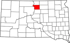 | |
| Towns | ||
| ||
| Authority control |
|
|---|
