Mobridge, South Dakota
Mobridge (Lakota: Kȟowákataŋ Otȟúŋwahe;[6] lit. "Over-the-River Town") is a city in Walworth County, South Dakota, United States. The population was 3,465 according to the 2010 census.
Mobridge
kȟowákataŋ otȟúŋwahe Bridge City | |
|---|---|
| Mobridge, South Dakota | |
 Scrap metal sculpture of a cowboy riding a walleye on the south end of main street in Mobridge | |
| Nickname(s): Mo-Town | |
| Motto(s): Make It Mobridge | |
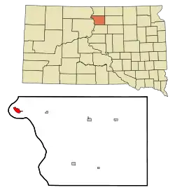 Location in Walworth County and the state of South Dakota | |
| Coordinates: 45°32′23″N 100°26′5″W | |
| Country | United States |
| State | South Dakota |
| County | Walworth |
| Founded | 1906[1] |
| Government | |
| • Type | Municipal |
| • Mayor | Gene Cox |
| • City Administrator | Steve Gasser |
| Area | |
| • Total | 1.96 sq mi (5.08 km2) |
| • Land | 1.96 sq mi (5.08 km2) |
| • Water | 0.00 sq mi (0.00 km2) |
| Elevation | 1,660 ft (506 m) |
| Population | |
| • Total | 3,465 |
| • Estimate (2019)[4] | 3,444 |
| • Density | 1,757.14/sq mi (678.47/km2) |
| Time zone | UTC−6 (Central (CST)) |
| • Summer (DST) | UTC−5 (CDT) |
| ZIP code | 57601 |
| Area code(s) | 605 |
| FIPS code | 46-43180 |
| GNIS feature ID | 1265670[5] |
| Website | City of Mobridge |
History
Located in territory that had long been occupied by the Lakota Sioux, Mobridge was founded by European Americans in 1906 following construction of the railroad through here. The town was named Mobridge for its railroad designation, a contracted form of Missouri Bridge, after the original railroad bridge over the Missouri River.[7] The bridge was demolished by the Corps of Engineers in the early 1960s and replaced by a higher bridge due to the construction of the Oahe Dam.[8]
There are disputed claims that some or all of chief Sitting Bull's remains were moved by his surviving relatives and the Dakota Memorial Association on April 8, 1953 from Fort Yates, North Dakota, where he had been killed and buried, to Mobridge, which was near his birthplace. The Mobridge burial site is marked by a monument consisting of his bust on a granite pedestal; it overlooks the Missouri River. It was dedicated by the Dakota Memorial Association on April 11, 1953.[9]
The Brown Palace Hotel in Mobridge is listed on the U.S. National Register of Historic Places. Artist Oscar Howe (Yanktonai Dakota) painted a mural for the town's auditorium.
The Mobridge Masonic Temple was built in Egyptian Revival style in 1923.[10]
Geography
According to the United States Census Bureau, the city has a total area of 1.89 square miles (4.90 km2), all land.[11]
Mobridge has been assigned the ZIP code 57601 and the FIPS place code 43180.
| Climate data for Mobridge Municipal Airport, South Dakota (1981–2010 normals,[lower-alpha 1] extremes 1911–present[lower-alpha 2]) | |||||||||||||
|---|---|---|---|---|---|---|---|---|---|---|---|---|---|
| Month | Jan | Feb | Mar | Apr | May | Jun | Jul | Aug | Sep | Oct | Nov | Dec | Year |
| Record high °F (°C) | 64 (18) |
73 (23) |
85 (29) |
96 (36) |
108 (42) |
110 (43) |
116 (47) |
110 (43) |
107 (42) |
95 (35) |
78 (26) |
70 (21) |
116 (47) |
| Mean maximum °F (°C) | 49.0 (9.4) |
54.6 (12.6) |
67.8 (19.9) |
82.3 (27.9) |
87.8 (31.0) |
93.2 (34.0) |
99.0 (37.2) |
98.7 (37.1) |
93.3 (34.1) |
81.4 (27.4) |
65.2 (18.4) |
49.4 (9.7) |
101.9 (38.8) |
| Average high °F (°C) | 26.0 (−3.3) |
31.2 (−0.4) |
42.6 (5.9) |
58.0 (14.4) |
68.4 (20.2) |
77.8 (25.4) |
85.8 (29.9) |
84.8 (29.3) |
73.9 (23.3) |
59.8 (15.4) |
42.8 (6.0) |
28.7 (−1.8) |
56.7 (13.7) |
| Average low °F (°C) | 6.1 (−14.4) |
10.1 (−12.2) |
21.1 (−6.1) |
32.5 (0.3) |
43.9 (6.6) |
53.8 (12.1) |
59.5 (15.3) |
57.9 (14.4) |
47.6 (8.7) |
34.6 (1.4) |
21.1 (−6.1) |
7.7 (−13.5) |
33.0 (0.5) |
| Mean minimum °F (°C) | −18.1 (−27.8) |
−14.3 (−25.7) |
−1.1 (−18.4) |
16.4 (−8.7) |
29.9 (−1.2) |
42.8 (6.0) |
49.9 (9.9) |
46.6 (8.1) |
32.9 (0.5) |
19.3 (−7.1) |
4.1 (−15.5) |
−13.7 (−25.4) |
−23.8 (−31.0) |
| Record low °F (°C) | −42 (−41) |
−44 (−42) |
−26 (−32) |
−1 (−18) |
15 (−9) |
32 (0) |
38 (3) |
32 (0) |
17 (−8) |
1 (−17) |
−20 (−29) |
−41 (−41) |
−44 (−42) |
| Average precipitation inches (mm) | 0.29 (7.4) |
0.44 (11) |
0.90 (23) |
1.57 (40) |
2.82 (72) |
3.16 (80) |
2.70 (69) |
2.03 (52) |
1.54 (39) |
1.50 (38) |
0.48 (12) |
0.44 (11) |
17.87 (454.4) |
| Average snowfall inches (cm) | 5.0 (13) |
5.9 (15) |
5.9 (15) |
3.2 (8.1) |
0.1 (0.25) |
0 (0) |
0 (0) |
0 (0) |
0 (0) |
0.6 (1.5) |
4.7 (12) |
5.7 (14) |
31.1 (79) |
| Average precipitation days (≥ 0.01 in) | 5.9 | 5.2 | 7.2 | 7.6 | 10.4 | 11.0 | 8.9 | 7.8 | 6.6 | 6.8 | 5.3 | 5.0 | 87.7 |
| Average snowy days (≥ 0.1 in) | 5.0 | 4.5 | 4.4 | 1.7 | 0.1 | 0 | 0 | 0 | 0 | 0.5 | 3.5 | 4.6 | 24.3 |
| Source: NOAA (precipitation day and snow normals at Mobridge 2 NNW COOP 45°33′56″N 100°26′56″W)[13][14][15] | |||||||||||||
- Notes
- Mean monthly maxima and minima (i.e. the expected highest and lowest temperature readings at any point during the year or given month) calculated based on data at said location from 1981 to 2010.
- Records maintained at the Mobridge 2 NNW COOP before April 1998, and at Mobridge Municipal Airport since April 1998.[12]
Demographics
| Historical population | |||
|---|---|---|---|
| Census | Pop. | %± | |
| 1910 | 1,200 | — | |
| 1920 | 3,517 | 193.1% | |
| 1930 | 3,464 | −1.5% | |
| 1940 | 3,008 | −13.2% | |
| 1950 | 3,753 | 24.8% | |
| 1960 | 4,391 | 17.0% | |
| 1970 | 4,545 | 3.5% | |
| 1980 | 4,174 | −8.2% | |
| 1990 | 3,768 | −9.7% | |
| 2000 | 3,574 | −5.1% | |
| 2010 | 3,465 | −3.0% | |
| 2019 (est.) | 3,444 | [4] | −0.6% |
| U.S. Decennial Census[16] 2017 Estimate[17] | |||
2010 census
As of the census[3] of 2010, there were 3,465 people, 1,514 households, and 898 families living in the city. The population density was 1,833.3 inhabitants per square mile (707.8/km2). There were 1,727 housing units at an average density of 913.8 per square mile (352.8/km2). The racial makeup of the city was 75.7% White, 0.2% African American, 20.5% Native American, 0.4% Asian, 0.2% from other races, and 3.1% from two or more races. Hispanic or Latino of any race were 0.8% of the population.
There were 1,514 households, of which 27.7% had children under the age of 18 living with them, 43.5% were married couples living together, 11.2% had a female householder with no husband present, 4.6% had a male householder with no wife present, and 40.7% were non-families. 34.9% of all households were made up of individuals, and 16.6% had someone living alone who was 65 years of age or older. The average household size was 2.22 and the average family size was 2.86.
The median age in the city was 44 years. 23.6% of residents were under the age of 18; 7.3% were between the ages of 18 and 24; 20% were from 25 to 44; 26.2% were from 45 to 64; and 22.9% were 65 years of age or older. The gender makeup of the city was 48.1% male and 51.9% female.
2000 census
As of the census of 2000, there were 3,574 people, 1,545 households, and 948 families living in the city. The population density was 2,009.4 people per square mile (775.2/km2). There were 1,808 housing units at an average density of 1,016.5 per square mile (392.2/km2). The racial makeup of the city was 79.52% White, 0.03% African American, 18.13% Native American, 0.22% Asian, 0.06% Pacific Islander, 0.08% from other races, and 1.96% from two or more races. 0.84% of the population is Hispanic or Latino of any race.
There were 1,545 households, out of which 26.4% had children under the age of 18 living with them, 46.5% were married couples living together, 11.5% had a female householder with no husband present, and 38.6% were non-families. 35.1% of all households were made up of individuals, and 17.8% had someone living alone who was 65 years of age or older. The average household size was 2.24 and the average family size was 2.88.
In the city, the population was spread out, with 24.3% under the age of 18, 7.4% from 18 to 24, 22.8% from 25 to 44, 23.2% from 45 to 64, and 22.3% who were 65 years of age or older. The median age was 41 years. For every 100 females, there were 89.6 males. For every 100 females age 18 and over, there were 85.1 males.
As of 2000 the median income for a household in the city was $25,583, and the median income for a family was $31,026. Males had a median income of $22,727 versus $16,990 for females. The per capita income for the city was $14,921. About 18.1% of families and 21.6% of the population were below the poverty line, including 32.2% of those under age 18 and 15.4% of those age 65 or over.
Media
AM Radio
| AM radio stations | |||||
|---|---|---|---|---|---|
| Frequency | Call sign | Name | Format | Owner | City |
| 1300 AM | KOLY | News/Talk | Dakota Radio Group | Mobridge | |
FM Radio
| FM radio stations | ||||||
|---|---|---|---|---|---|---|
| Frequency | Call sign | Name | Format | Owner | Target city/market | City of license |
| 99.5 FM | KOLY-FM | Star 99 | Hot AC | Dakota Radio Group | Mobridge | Mobridge |
| 100.7 FM | KMLO | Country 101 | Country | Dakota Radio Group | Mobridge | Mobridge |
Television
Newspaper
- Mobridge Tribune
Government
Mobridge uses a city council consisting of seven council members including the mayor. As of March 2020, the current mayor is Gene Cox.[18]
Notable people
- James R. Carrigan, United States District Court judge and Colorado Supreme Court justice
- Bill Mott, National Museum of Racing and Hall of Fame thoroughbred trainer
See also
References
- "SD Towns" (PDF). South Dakota State Historical Society. Retrieved February 14, 2010.
- "2019 U.S. Gazetteer Files". United States Census Bureau. Retrieved July 30, 2020.
- "U.S. Census website". United States Census Bureau. Retrieved 2012-06-21.
- "Population and Housing Unit Estimates". United States Census Bureau. May 24, 2020. Retrieved May 27, 2020.
- "US Board on Geographic Names". United States Geological Survey. 2007-10-25. Retrieved 2008-01-31.
- Ullrich, Jan F. (2014). New Lakota Dictionary (2nd ed.). Bloomington, IN: Lakota Language Consortium. ISBN 978-0-9761082-9-0. Archived from the original on 2016-10-18. Retrieved 2014-02-13.
- Hellmann, Paul T. (May 13, 2013). Historical Gazetteer of the United States. Routledge. p. 993. Retrieved 30 November 2013.
- 'Mobridge History'
- "Sitting Bull Monument". mobridge.org. Retrieved 18 June 2020.
- Scott Gerloff (February 1976). "National Register of Historic Places Inventory/Nomination: Mobridge Masonic Temple". National Park Service. With three photos from 1975.
- "US Gazetteer files 2010". United States Census Bureau. Archived from the original on 2011-02-20. Retrieved 2012-06-21.
- http://threadex.rcc-acis.org/
- "Station Name: SD MOBRIDGE MUNICIPAL AP". National Oceanic and Atmospheric Administration. Retrieved 2020-08-29.
- "Station Name: SD MOBRIDGE 2NNW". National Oceanic and Atmospheric Administration. Retrieved 2020-08-29.
- "NOWData – NOAA Online Weather Data". W2.weather.gov. Retrieved 2020-08-29.
- United States Census Bureau. "Census of Population and Housing". Retrieved September 23, 2013.
- "Population Estimates". United States Census Bureau. Retrieved October 5, 2018.
- "Council Members". City of Mobridge. Retrieved March 26, 2020.
External links
![]() Media related to Mobridge, South Dakota at Wikimedia Commons
Media related to Mobridge, South Dakota at Wikimedia Commons
Municipalities and communities of Walworth County, South Dakota, United States | ||
|---|---|---|
| Cities | 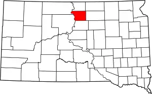 | |
| Towns | ||
| ||

| Authority control |
|---|