Hector, Minnesota
Hector is a city in Renville County, Minnesota, USA. The population was 1,151 at the 2010 census.[7]
Hector | |
|---|---|
| Motto(s): "A great place to live, work and play!"[1] | |
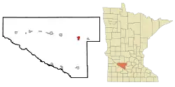 Location of Hector, Minnesota | |
| Coordinates: 44°44′33″N 94°42′52″W | |
| Country | United States |
| State | Minnesota |
| County | Renville |
| Area | |
| • Total | 1.81 sq mi (4.68 km2) |
| • Land | 1.81 sq mi (4.68 km2) |
| • Water | 0.00 sq mi (0.00 km2) |
| Elevation | 1,079 ft (329 m) |
| Population | |
| • Total | 1,151 |
| • Estimate (2019)[4] | 1,050 |
| • Density | 581.40/sq mi (224.44/km2) |
| Time zone | UTC-6 (Central (CST)) |
| • Summer (DST) | UTC-5 (CDT) |
| ZIP code | 55342 |
| Area code(s) | 320 |
| FIPS code | 27-28124[5] |
| GNIS feature ID | 0644825[6] |
| Website | http://hector.govoffice.com/ |
Geography
According to the United States Census Bureau, the city has a total area of 1.56 square miles (4.04 km2), all of it land.[8]
History
Hector was founded in 1878 when the Hastings and Dakota Railway Company constructed the railroad on the north side of the original town site. The ten-block town site survey was completed on September 14, 1878, on land owned by the Hastings and Dakota.[1]
The village was named after the township of Hector, which had been organized in June 1874. It was originally named Milford, but the name was changed when it was learned there was already another Milford in Minnesota. There was heated debate between those who favored the name Plainfield (after the stage stop and post office) and those who favored the name Hector, a township in New York on the east shore of Seneca Lake where many of the early settlers came from. Hector, New York, was named after the bravest of the ancient Trojan warriors whose story is told in Homer's "Iliad".[9][10] (Later research showed the other Milford was actually in South Dakota, so the town could have been named Milford after all.)
Demographics
| Historical population | |||
|---|---|---|---|
| Census | Pop. | %± | |
| 1880 | 196 | — | |
| 1890 | 354 | 80.6% | |
| 1900 | 654 | 84.7% | |
| 1910 | 866 | 32.4% | |
| 1920 | 830 | −4.2% | |
| 1930 | 864 | 4.1% | |
| 1940 | 1,044 | 20.8% | |
| 1950 | 1,196 | 14.6% | |
| 1960 | 1,297 | 8.4% | |
| 1970 | 1,178 | −9.2% | |
| 1980 | 1,252 | 6.3% | |
| 1990 | 1,145 | −8.5% | |
| 2000 | 1,166 | 1.8% | |
| 2010 | 1,151 | −1.3% | |
| 2019 (est.) | 1,050 | [4] | −8.8% |
| U.S. Decennial Census[11] | |||
2010 census
As of the census[3] of 2010, there were 1,151 people, 513 households, and 322 families living in the city. The population density was 737.8 inhabitants per square mile (284.9/km2). There were 573 housing units at an average density of 367.3 per square mile (141.8/km2). The racial makeup of the city was 96.9% White, 0.6% Asian, 2.3% from other races, and 0.3% from two or more races. Hispanic or Latino of any race were 5.7% of the population.
There were 513 households, of which 29.2% had children under the age of 18 living with them, 48.3% were married couples living together, 10.1% had a female householder with no husband present, 4.3% had a male householder with no wife present, and 37.2% were non-families. 31.8% of all households were made up of individuals, and 18.8% had someone living alone who was 65 years of age or older. The average household size was 2.24 and the average family size was 2.78.
The median age in the city was 43.4 years. 23.8% of residents were under the age of 18; 6.5% were between the ages of 18 and 24; 21.5% were from 25 to 44; 27.9% were from 45 to 64; and 20.2% were 65 years of age or older. The gender makeup of the city was 48.9% male and 51.1% female.
2000 census
As of the census[5] of 2000, there were 1,166 people, 509 households, and 320 families living in the city. The population density was 755.7 people per square mile (292.3/km2). There were 532 housing units at an average density of 344.8 per square mile (133.4/km2). The racial makeup of the city was 95.54% White, 4.03% from other races, and 0.43% from two or more races. Hispanic or Latino of any race were 5.23% of the population.
There were 509 households, out of which 28.9% had children under the age of 18 living with them, 50.3% were married couples living together, 9.4% had a female householder with no husband present, and 37.1% were non-families. 33.6% of all households were made up of individuals, and 20.4% had someone living alone who was 65 years of age or older. The average household size was 2.29 and the average family size was 2.90.
In the city, the population was spread out, with 25.5% under the age of 18, 6.4% from 18 to 24, 26.2% from 25 to 44, 21.6% from 45 to 64, and 20.2% who were 65 years of age or older. The median age was 40 years. For every 100 females, there were 85.4 males. For every 100 females age 18 and over, there were 84.9 males.
The median income for a household in the city was $33,000, and the median income for a family was $41,477. Males had a median income of $30,625 versus $22,159 for females. The per capita income for the city was $18,406. About 6.5% of families and 8.4% of the population were below the poverty line, including 11.4% of those under age 18 and 8.4% of those age 65 or over.
Notable people
- Steve Neuman - occasional sports and culture commentator for MinnPost[12] and the Star Tribune RandBall blog, and co-host of The Sportive, Minnesota's leading independent sports podcast
- Dorothy Peterson, film actress, born in Hector
Wayne D. Duehn, Ph.D. [www.waynedduehn.com], Educator, clinician and researcher. Professor of Social Work, The University of Texas at Arlington, Arlington, Texas ; National Association of Social Workers' Pioneer [www.naswfoundation.org/pioneers/d/duehn_wayne.html]; Wall of Witness Recipient, North Central College, Naperville, Illinois and former Research Associate, Masters and Johnson Institute, St. Louis, Missouri.
Infrastructure
Transportation
U.S. Route 212 and Minnesota State Highway 4 are two of the main arterial routes in the city.
Hector Municipal Airport
The town is also served by rail via the Twin Cities and Western railroad's connection to both Minneapolis and St. Paul and points west.[13]
References
- "City of Hector Minnesota". City of Hector Minnesota. Retrieved October 8, 2012.
- "2019 U.S. Gazetteer Files". United States Census Bureau. Retrieved July 26, 2020.
- "American FactFinder". United States Census Bureau. Archived from the original on 2020-02-12. Retrieved 2012-11-13.
- "Population and Housing Unit Estimates". United States Census Bureau. May 24, 2020. Retrieved May 27, 2020.
- "American FactFinder". United States Census Bureau. Archived from the original on 2020-02-12. Retrieved 2008-01-31.
- "US Board on Geographic Names". United States Geological Survey. 2007-10-25. Retrieved 2008-01-31.
- "2010 Census Redistricting Data (Public Law 94-171) Summary File". American FactFinder. United States Census Bureau. Retrieved 27 April 2011.
- "US Gazetteer files 2010". United States Census Bureau. Archived from the original on 2012-01-25. Retrieved 2012-11-13.
- "Profile for Hector, Minnesota, MN". ePodunk. Retrieved October 8, 2012.
- "Profile for Hector, New York, NY". ePodunk. Retrieved October 8, 2012.
- "Census of Population and Housing". Census.gov. Archived from the original on April 26, 2015. Retrieved June 4, 2015.
- "Steve Neuman".
- "TC&W Railroad Map | Largest MN Shortline Rail | MN Rail Map".
External links
Municipalities and communities of Renville County, Minnesota, United States | ||
|---|---|---|
| Cities | 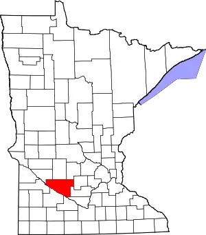 Map of Minnesota highlighting Renville County | |
| Townships | ||
| Unincorporated communities | ||
| Ghost town | ||
| Footnotes | ‡This populated place also has portions in an adjacent county or counties | |
| ||