Renville, Minnesota
Renville is a city in Renville County, Minnesota, United States. The population was 1,287 at the 2010 census.[6]
Renville | |
|---|---|
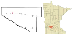 Location of Renville, Minnesota | |
| Coordinates: 44°47′23″N 95°12′46″W | |
| Country | United States |
| State | Minnesota |
| County | Renville |
| Area | |
| • Total | 1.32 sq mi (3.42 km2) |
| • Land | 1.32 sq mi (3.42 km2) |
| • Water | 0.00 sq mi (0.00 km2) |
| Elevation | 1,073 ft (327 m) |
| Population | |
| • Total | 1,287 |
| • Estimate (2019)[3] | 1,189 |
| • Density | 900.08/sq mi (347.46/km2) |
| Time zone | UTC-6 (Central (CST)) |
| • Summer (DST) | UTC-5 (CDT) |
| ZIP code | 56284 |
| Area code(s) | 320 |
| FIPS code | 27-53890[4] |
| GNIS feature ID | 0649934[5] |
| Website | www.ci.renville.mn.us |
U.S. Route 212 and County Highway 6 are two of the main routes in the city.
History
The city and county of Renville were named for Joseph Renville, a man of French and Dakota descent who had extensive knowledge of the wilderness and served as a guide for many expeditions. Renville founded Fort Renville and served as a captain during the War of 1812. He was a courier, interpreter, and founder of the Columbia Fur Company. He earned respect that cut across the racial and ethnic boundaries of that era.
The city of Renville was platted in 1878,[7] when the railroad reached the area. It was incorporated in 1906. It has grown from a population of 250 in 1900 to about 1,200 residents today.
It is situated near the Minnesota River Valley in a fertile agricultural area known for its high productivity. Renville's economy, past and present, is based largely upon agribusiness. Renville serves as an agricultural service and distribution center for the surrounding area, and the city boasts the world's largest sugar beet processing plant.
Geography
According to the United States Census Bureau, the city has a total area of 1.39 square miles (3.60 km2), all of it land.[8]
Demographics
| Historical population | |||
|---|---|---|---|
| Census | Pop. | %± | |
| 1880 | 232 | — | |
| 1890 | 413 | 78.0% | |
| 1900 | 1,075 | 160.3% | |
| 1910 | 1,182 | 10.0% | |
| 1920 | 1,142 | −3.4% | |
| 1930 | 1,064 | −6.8% | |
| 1940 | 1,256 | 18.0% | |
| 1950 | 1,323 | 5.3% | |
| 1960 | 1,373 | 3.8% | |
| 1970 | 1,252 | −8.8% | |
| 1980 | 1,493 | 19.2% | |
| 1990 | 1,315 | −11.9% | |
| 2000 | 1,323 | 0.6% | |
| 2010 | 1,287 | −2.7% | |
| 2019 (est.) | 1,189 | [3] | −7.6% |
| U.S. Decennial Census | |||
2010 census
As of the census[2] of 2010, there were 1,287 people, 538 households, and 316 families residing in the city. The population density was 925.9 inhabitants per square mile (357.5/km2). There were 606 housing units at an average density of 436.0 per square mile (168.3/km2). The racial makeup of the city was 96.8% White, 0.1% African American, 0.2% Native American, 0.3% Asian, 1.9% from other races, and 0.7% from two or more races. Hispanic or Latino of any race were 18.2% of the population.
There were 538 households, of which 27.9% had children under the age of 18 living with them, 46.1% were married couples living together, 8.6% had a female householder with no husband present, 4.1% had a male householder with no wife present, and 41.3% were non-families. 37.5% of all households were made up of individuals, and 23.8% had someone living alone who was 65 years of age or older. The average household size was 2.31 and the average family size was 3.05.
The median age in the city was 41.6 years. 24.9% of residents were under the age of 18; 7% were between the ages of 18 and 24; 21.7% were from 25 to 44; 22.6% were from 45 to 64; and 23.9% were 65 years of age or older. The gender makeup of the city was 49.0% male and 51.0% female.
Economy
Agriculture is the primary business in Renville and agriculture related businesses tend to thrive there. K&M manufacturing is a prime example of an ag-related business in Renville . K&M (which stands for Kleinhuizen and Mulder after founders Nicholas Kleinhuizen and "Muff" Mulder) manufactures tractor seats and ag-related items. Multiple US patent holders either have resided in Renville or have grown up in Renville, including employees of K&M, plus residents Niclas Wolterstorff, Dan Schemel and Richard Fredickson.
References
- "2019 U.S. Gazetteer Files". United States Census Bureau. Retrieved July 26, 2020.
- "U.S. Census website". United States Census Bureau. Retrieved 2012-11-13.
- "Population and Housing Unit Estimates". United States Census Bureau. May 24, 2020. Retrieved May 27, 2020.
- "U.S. Census website". United States Census Bureau. Retrieved 2008-01-31.
- "US Board on Geographic Names". United States Geological Survey. 2007-10-25. Retrieved 2008-01-31.
- "2010 Census Redistricting Data (Public Law 94-171) Summary File". American FactFinder. United States Census Bureau. Retrieved 27 April 2011.
- Upham, Warren (1920). Minnesota Geographic Names: Their Origin and Historic Significance. Minnesota Historical Society. p. 458.
- "US Gazetteer files 2010". United States Census Bureau. Archived from the original on 2011-02-20. Retrieved 2012-11-13.
External links
Municipalities and communities of Renville County, Minnesota, United States | ||
|---|---|---|
| Cities | 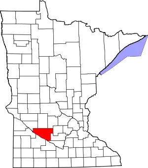 Map of Minnesota highlighting Renville County | |
| Townships | ||
| Unincorporated communities | ||
| Ghost town | ||
| Footnotes | ‡This populated place also has portions in an adjacent county or counties | |
| ||