Heping District, Taichung
Heping District (Chinese: 和平區; pinyin: Hépíng Qū; Wade–Giles: Ho2-p'ing2 Ch'ü1) is a mountain indigenous district in eastern Taichung, Taiwan, and it is the largest district of Taichung City. It is also the largest district in Taiwan by area. It is the demographic center of Taiwan.[1]
Heping
和平區 | |
|---|---|
| Heping District | |
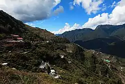 | |
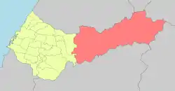 Heping District in Taichung City | |
| Coordinates: 24°16′00″N 121°09′00″E | |
| Country | Taiwan |
| Special municipality | Taichung |
| Boroughs | List
|
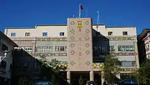
| Government | |
| • Type | District government |
| • District chief | Lin Jian-tang (KMT) |
| Area | |
| • Land | 1,037.82 km2 (400.70 sq mi) |
| Population (January 2016) | |
| • Total | 10,707 |
| Website | www |
History
After the handover of Taiwan from Japan to the Republic of China in 1945, Heping was organized as a Mountain indigenous township of Taichung County. On 7 June 1973, two northeast most villages of the township were separated to form a new county-level division, which was Lishan Constructing Administrative Bureau (Chinese: 梨山建設管理局). However, the bureau was dissolved on 18 February 1982 and the two villages were returned to the township. On 25 December 2010, Taichung County was merged with Taichung City and Heping was upgraded to a district of the city.
Geography
The district covers an area of 1,037.82 square kilometres (400.70 sq mi), making it the largest district in Taichung as well as in Taiwan.[2]
Demographics
As of 2016, the district consists of 10,707 residents, in which around 4,000 of them are Atayal people.[2]
Economy
Native products of Heping District are apple, honey, vegetable, mountain fish, peach and bamboo.
Administrative divisions
Nanshi, Tianlun, Boai, Ziyou, Daguan, Zhongkeng, Lishan and Pingdeng Village.
Infrastructures
Tourist attractions
- Baigu Mountain
- Basianshan National Forest Recreation Area
- Dajian Mountain
- Dajia River
- Dasyueshan National Forest Recreation Area
- Eight Immortals Mountain
- Fushoushan Farm
- Guguan Hot Spring
- Kukuan Dam
- Lishan Culture Museum
- Ma'an Dam
- Mount Nanhu
- Mount Xue
- Qingshan Dam
- Techi Dam
- Tienlun Dam
- Wuling Farm
- Wuling National Forest Recreation Area
Transportation
The Provincial Highway 8 passes through Heping District to the east side of the island. On 21 September 1999, the 921 earthquake caused severe damage to the road, and is unlikely to be repaired. The section east of Guguan is now permanently closed to non-residents. Provincial Highway No. 14A now serves as an alternate route.
Notable natives
- Kao Chin Su-mei, member of Legislative Yuan
See also
References
- "Re: [人口地理] 臺灣人口重心分佈". Ptt 批踢踢實業坊.
- "Heping District - Taichung City".
| Wikimedia Commons has media related to Heping District, Taichung. |
| Highland aboriginal Townships and Districts |
|  | ||||||||||||||||||||||||
|---|---|---|---|---|---|---|---|---|---|---|---|---|---|---|---|---|---|---|---|---|---|---|---|---|---|---|
| Plains aboriginal Townships and County-Administered Cities |
| |||||||||||||||||||||||||
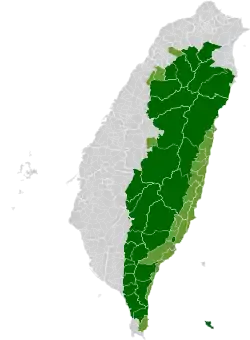
Note: On the map, "Mountain Indigenous Areas" are in dark green and "Plains Indigenous Areas" are in light green. | ||||||||||||||||||||||||||