Hualien City
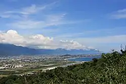
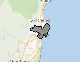
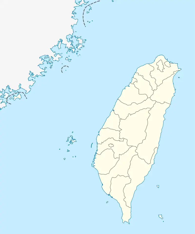
Hualien City (pinyin: Huālián Shì; Wade-Giles: Hua¹-lien² Shih⁴; Hokkien POJ: Hoa-lian-chhī or Hoa-liân-chhī) is a county-administered city and the county seat of Hualien County, Taiwan. It is located on the east coast of Taiwan on the Pacific Ocean, and has a population of 106,368 inhabitants.[3]
Hualien
花蓮市 Karenkō | |
|---|---|
| Hualien City | |
 Hualien City | |
| Nickname(s): Huashi (花市) | |
| |
 Hualien City | |
 Hualien Location in Taiwan | |
| Coordinates: 23°58′20″N 121°36′23″E | |
| Country | Taiwan |
| County | Hualien County |
| Government | |
| • Type | County-administered city |
| • Mayor | Wei Chia-hsien (KMT)[1] |
| Area | |
| • Total | 29.41 km2 (11.36 sq mi) |
| Population (December 2014) | |
| • Total | 106,368 |
| • Density | 3,600/km2 (9,400/sq mi) |
| Time zone | UTC+8 (CST) |
| Post code | 970 |
| Subdivision | 45 Boroughs[2] |
| Website | www.hualien.gov.tw |
| Hualien City | |||||||||||||||||||||||||||||||
|---|---|---|---|---|---|---|---|---|---|---|---|---|---|---|---|---|---|---|---|---|---|---|---|---|---|---|---|---|---|---|---|
| Traditional Chinese | 花蓮市 | ||||||||||||||||||||||||||||||
| |||||||||||||||||||||||||||||||
Name
Hualien County annals (花蓮縣志) record that the city was called "Kiray" (Chinese: 奇萊; Pe̍h-ōe-jī: Kî-lâi) until the early twentieth century. This name refers to the Sakiraya Taiwanese aborigines and their settlement.[4]
After Taiwan came under Japanese rule in 1895 its governors sought to change the name because "Kiray" is pronounced the same as the Japanese word for "dislike" (嫌い, kirai). The name was eventually changed to Karen Harbour (Japanese: 花蓮港, Hepburn: Karenkō). After World War II the incoming Kuomintang-led Republic of China retained the Kanji spelling but shortened the name to just Karen (花蓮), or Hualien via Chinese romanization.
History
The Spaniards built mines for gold in Hualien in 1622. Permanent settlements began in 1851, when 2,200 Han Chinese farmers led by Huang A-fong (黃阿鳳) from Taipei arrived at Fengchuan (now the area near Hualien Rear Station). In 1875, more farmers, led by Lin Cang-an (林蒼安) from Yilan, settled at Fengchuan.
Settlements in the area remained small by the start of Japanese rule. The city was expanded circa 1912 by its Japanese governors to incorporate Guohua (國華) and Guoan (國安) Villages, a region later known as Old New Port (舊新港街). In 1920, Karenkō Town (花蓮港街) was established, and around 1923 it was extended to Riran Port (鯉浪港), today known as "New Port" (新港),[5] including the Guowei and Guoji Villages. In 1940, the town was upgraded to Karenkō City, Karenkō Prefecture.
On 25 October 1945, Taiwan was handed over from Japan to the Republic of China under Kuomintang government. In January 1946, the incoming Kuomintang designated Hualien City a county-administered city of Hualien County and to be the county seat.
Climate
Hualien experiences a tropical rainforest climate (Af) with frequent cyclones, as it borders the Pacific Ocean. It closely borders on a humid subtropical climate. The city experiences significant rainfall year-round and the temperature there averages 23.4 °C (74.1 °F). Precipitation in the city averages 2,177 mm (85.7 in). January is the city's driest month, while September tends to be the wettest.
| Climate data for Hualien (1981−2010) | |||||||||||||
|---|---|---|---|---|---|---|---|---|---|---|---|---|---|
| Month | Jan | Feb | Mar | Apr | May | Jun | Jul | Aug | Sep | Oct | Nov | Dec | Year |
| Record high °C (°F) | 29.6 (85.3) |
30.6 (87.1) |
31.2 (88.2) |
33.6 (92.5) |
34.3 (93.7) |
34.7 (94.5) |
36.3 (97.3) |
37.4 (99.3) |
35.2 (95.4) |
37.0 (98.6) |
32.3 (90.1) |
29.6 (85.3) |
37.4 (99.3) |
| Average high °C (°F) | 21.1 (70.0) |
21.5 (70.7) |
23.4 (74.1) |
26.0 (78.8) |
28.5 (83.3) |
30.4 (86.7) |
32.0 (89.6) |
32.0 (89.6) |
30.4 (86.7) |
28.2 (82.8) |
25.4 (77.7) |
22.5 (72.5) |
26.8 (80.2) |
| Daily mean °C (°F) | 18.0 (64.4) |
18.4 (65.1) |
20.2 (68.4) |
22.7 (72.9) |
25.1 (77.2) |
27.1 (80.8) |
28.5 (83.3) |
28.2 (82.8) |
26.8 (80.2) |
24.8 (76.6) |
22.2 (72.0) |
19.3 (66.7) |
23.4 (74.1) |
| Average low °C (°F) | 15.4 (59.7) |
15.9 (60.6) |
17.5 (63.5) |
20.0 (68.0) |
22.4 (72.3) |
24.3 (75.7) |
25.4 (77.7) |
25.2 (77.4) |
24.0 (75.2) |
22.0 (71.6) |
19.5 (67.1) |
16.7 (62.1) |
20.7 (69.2) |
| Record low °C (°F) | 4.6 (40.3) |
4.4 (39.9) |
8.7 (47.7) |
9.6 (49.3) |
14.6 (58.3) |
16.8 (62.2) |
20.1 (68.2) |
19.8 (67.6) |
16.9 (62.4) |
12.5 (54.5) |
8.1 (46.6) |
6.5 (43.7) |
4.4 (39.9) |
| Average precipitation mm (inches) | 62.2 (2.45) |
94.2 (3.71) |
85.9 (3.38) |
87.0 (3.43) |
195.4 (7.69) |
221.7 (8.73) |
205.2 (8.08) |
242.0 (9.53) |
399.2 (15.72) |
362.7 (14.28) |
152.1 (5.99) |
69.2 (2.72) |
2,176.8 (85.71) |
| Average rainy days | 13.7 | 15.7 | 15.1 | 14.5 | 15.5 | 12.6 | 8.2 | 10.1 | 14.3 | 13.0 | 11.7 | 9.9 | 154.3 |
| Average relative humidity (%) | 76.0 | 78.3 | 78.8 | 79.6 | 80.3 | 81.2 | 77.9 | 78.2 | 79.2 | 76.2 | 74.8 | 73.2 | 77.8 |
| Mean monthly sunshine hours | 70.2 | 64.5 | 82.4 | 92.6 | 119.5 | 162.7 | 246.5 | 224.3 | 152.0 | 120.8 | 90.5 | 77.9 | 1,503.9 |
| Source: Central Weather Bureau | |||||||||||||
Subdivisions
The 45 villages (里) of the city are divided into six village unions (聯合里): (in Hanyu Pinyin)
- The first union: Minyun (民運), Minle (民樂), Minxiang (民享), Minyi (民意), Minxin (民心), Minli (民立), Minde (民德), Minzheng (民政), Minqin (民勤), Minxiao (民孝)
- The second union: Minsheng (民生), Minquan (民權), Minzu (民族), Minyou (民有), Minzhu (民主), Minzhi (民治)
- The third union: Zhuji (主計), Zhuyi (主義), Zhuxin (主信), Zhuqin (主勤), Zhushang (主商), Zhugong (主工)
- The fourth union: Zhuxue (主學), Zhuquan (主權), Zhunong (主農), Zhuhe (主和), Zhuli (主力), Zhu'an (主安), Zhumu (主睦)
- The fifth union: Guofeng (國風), Guofang (國防), Guozhi (國治), Guoguang (國光), Guohun (國魂), Guo'an (國安), Guowei (國威), Guohua (國華), Guolian (國聯), Guosheng (國盛)
- The sixth union: Guofu (國富), Guoyu (國裕), Guoqing (國慶), Guoqiang (國強), Guofu (國福), Guoxing (國興)
The newest villages from 2002 are Guosheng, Guoxing, Minxiao, and Minzhu.
Government institutions
Demographics
Hualien City has 9,000 aboriginal people, making it the city with the largest aboriginal population in Taiwan. The majority of the aborigines that reside in Hualien include the Amis, Atayal, Truku and Bunun.[6] Hualien City is also the most densely populated area in Hualien county.[3]
Education
There are 3 universities, 12 senior high schools, 4 junior high schools, 16 elementary schools.
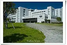
Universities
High schools
Industries
Hualien City is the center of politics, economy and transportation of Hualien County.
Medical care
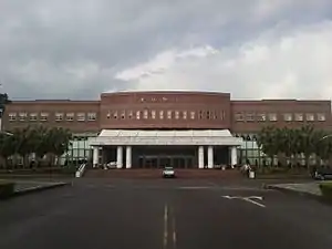
- Hualien Tzu Chi Medical Center (First Medical Center in Eastern Taiwan)
- Mennonite Christian Hospital
- Hualien Hospital, Department of Health, Execusive Yuan
Tourist attractions
- Dongdamen Night Market
- Hualien Al-Falah Mosque
- Hualien Baseball Stadium
- Hualien County Stone Sculptural Museum
- Hualien Cultural and Creative Industries Park
- Hualien Martyrs' Shrine
- Hualien Railway Culture Park
- Pine Garden
- North Beach Park (Beibin Park)
- South Beach Park and Night Market (Nanbin Park)
- Meilun Mountain Park
- Hualien Fish Market
- Old Railroad Cultural Shopping Street
- Rock Street
- Whale Watching
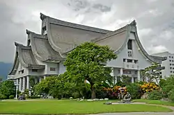
- Jing Si Hall (Meditation Hall) of the Tzu Chi Foundation
- Gong Tian Temple
Transportation
.jpg.webp)
Air
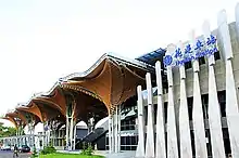
Hualien City is served by Hualien Airport located at the neighboring Xincheng Township of Hualien County. The airport is about 10 minutes drive to the city.
Sea
The Port of Hualien is an international port in the city with liners sailing to Japan, Middle East, South East Asia and South Korea.
Road
- Provincial Highway No. 9
- Provincial Highway No. 11
- County Road No.193
Notable natives
- Hsieh Chia-hsien, baseball player
- Lin Man-ting, football and futsal player
- Yeh Kuang-shih, Deputy Mayor of Kaohsiung (2018–2020)
- Yang Mu, poet, writer
Gallery
 Martyrs' shrine in Hualien
 Formosa Express tourist train
 Residential community
 Yuan Yeh Resort
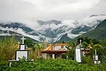 Roadside cemetery
Twin towns – sister cities
Hualien City is twinned with:[7]
 Ulsan, South Korea (1982)
 Yonaguni, Japan (1982)
 Albuquerque, United States (1983)
- Bellevue, United States (1984)
 Oudtshoorn, South Africa (1985)
References
- "KMT's Wei wins Hualien by-election - Taipei Times".
- "Archived copy" 花蓮市公所-英文版-. Archived from the original on 2014-02-22. Retrieved 2014-02-17.CS1 maint: archived copy as title (link)
- "Archived copy" 花蓮市公所-英文版-. Archived from the original on 2013-11-14. Retrieved 2014-02-17.CS1 maint: archived copy as title (link)
- 撒奇萊雅族_認識本族. TAIWAN INDIGENOUS PEOPLES CULTURE PARK (in Chinese). Archived from the original on 11 May 2015. Retrieved 3 December 2014.
- 台灣旅遊景點地圖 - 花蓮縣花蓮市旅遊景點介紹. 旅遊資訊王TravelKing. Retrieved 17 June 2016.
- Stanisław Kałużyński, ed. (1996). Przegląd Orientalistyczny. Warszawa: Polskie Towarzystwo Oreintalistyczne. 177–184: 202. ISSN 0033-2283. Missing or empty
|title=(help) - "Sister Cities". hualien.gov.tw. Hualien City. Retrieved 2020-12-17.
External links
| Wikimedia Commons has media related to Hualien City. |
| Look up Hualien in Wiktionary, the free dictionary. |
 Hualien travel guide from Wikivoyage
 Geographic data related to Hualien City at OpenStreetMap
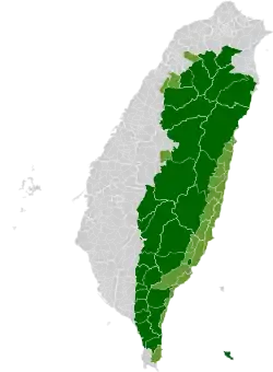
Cities and townships of Hualien County | ||
|---|---|---|
| Cities | 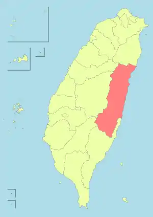 | |
| Urban townships | ||
| Rural townships | ||
| Mountain indigenous townships | ||
| Highland aboriginal Townships and Districts |
|  | ||||||||||||||||||||||||
|---|---|---|---|---|---|---|---|---|---|---|---|---|---|---|---|---|---|---|---|---|---|---|---|---|---|---|
| Plains aboriginal Townships and County-Administered Cities |
| |||||||||||||||||||||||||
Note: On the map, "Mountain Indigenous Areas" are in dark green and "Plains Indigenous Areas" are in light green. | ||||||||||||||||||||||||||
| Authority control |
|---|