Taitung County
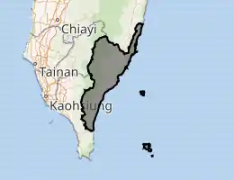
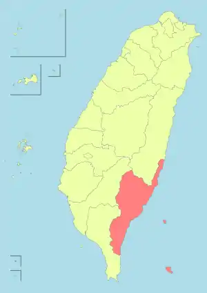
Taitung County (Chinese: 臺東縣; Wade–Giles: Tʻai2-tung1 Hsien4; Mandarin pinyin: Táidōng Xiàn; Hokkien POJ: Tâi-tang-koān; Hakka PFS: Thòi-tûng-yen; Paiwan: Valangaw) is the third largest county in Taiwan, located primarily on the island's southeastern coast and also including Green Island, Orchid Island and Lesser Orchid Island.
Taitung County
臺東縣 | |||||||||||
|---|---|---|---|---|---|---|---|---|---|---|---|
 Top:View of Orchid Island, from Ji-teiwan, Second left:Jiben Spa area, Second right:A view of downtown Taitung, Third left:View of White Sand Bay in Taimali Township, Third right:A memorial for Yami people's boat in Orchild Island, Bottom:A coast of Siaoyeliou | |||||||||||
 Flag  Logo | |||||||||||
| |||||||||||
 | |||||||||||
| Coordinates: 22°56′N 120°56′E | |||||||||||
| Country | Taiwan | ||||||||||
| Region | Eastern Taiwan | ||||||||||
| Seat | Taitung City | ||||||||||
| Largest city | Taitung City | ||||||||||
| Boroughs | 1 cities, 15 (2 urban, 13 rural) townships | ||||||||||
| Government | |||||||||||
| • County Magistrate | Rao Ching-ling (KMT) | ||||||||||
| Area | |||||||||||
| • Total | 3,515.2526 km2 (1,357.2466 sq mi) | ||||||||||
| Area rank | 3 of 22 | ||||||||||
| Population (December 2014) | |||||||||||
| • Total | 224,470 | ||||||||||
| • Rank | 22 of 22 | ||||||||||
| • Density | 64/km2 (170/sq mi) | ||||||||||
| Time zone | UTC+8 (National Standard Time) | ||||||||||
| ISO 3166 code | TW-TTT | ||||||||||
| Website | www.taitung.gov.tw | ||||||||||
| |||||||||||
| Taitung County | |||||||||||||||||||||||||||||||
|---|---|---|---|---|---|---|---|---|---|---|---|---|---|---|---|---|---|---|---|---|---|---|---|---|---|---|---|---|---|---|---|
| Traditional Chinese | 臺東縣 or 台東縣 | ||||||||||||||||||||||||||||||
| |||||||||||||||||||||||||||||||
Name
While its name means "Eastern Taiwan", it is also known as "Houshan" (Chinese: 後山; pinyin: hòushān; Pe̍h-ōe-jī: āu-soaⁿ) by many of the locals, meaning behind the mountains or the back mountains.
History
Qing Dynasty
In 1887, the new Fujian-Taiwan Province included Taitung Prefecture as one of four prefectures.[1]
Empire of Japan
During the Japanese rule of Taiwan, Taitung County was administered as Taitō Prefecture.
Republic of China
After the handover of Taiwan from Japan to the Republic of China on 25 October 1945, Taitung was established as a county of Taiwan Province on 25 December the same year.
Geography
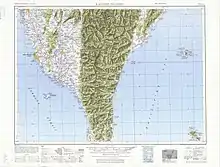
Taitung runs along the south east coast of Taiwan. Taitung county, controlling 3,515 km2 (1,357 sq mi) is the 3rd largest county in Taiwan after Hualien County and Nantou County. Mainland Taitung County's coastline is 166 km (103 mi) long. The Huatung Valley runs along the northern half of the county. Taitung currently has a population of 234,123.[2]
Due in part to its remote location and isolation by mountains from Taiwan's main population centers, Taitung was the last part of the island to be colonized by Han Chinese immigrants (late 19th century). Throughout the 20th century Taitung remained an economic backwater. Sparsely populated even today, this isolation may have been a blessing in disguise, as Taitung mostly escaped the urbanization and pollution that have come to plague much of the island's lowland areas.
In addition to the area on Taiwan proper, the county includes two major islands, Green Island or Isla Verde and Orchid Island. Green Island was home to an infamous penal colony used for political prisoners during the "White Terror" period of Chinese Nationalist (KMT) rule (from 1947 until the end of martial law in 1987). Orchid Island, home of the Tao people (Taiwanese aborigines closely related to the people of the northern Philippines), has become a major tourist attraction despite the government-operated Taiwan Power Company's controversial use of part of the island as a nuclear waste dump.
Government

Administrative divisions
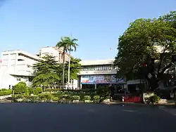
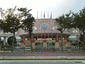
Taitung County is divided into 1 city, 2 urban townships, 8 rural townships and 5 mountain indigenous townships.[3][4][5] Taitung County has the second highest number of mountain indigenous townships in Taiwan after Pingtung County. The seat of the county is located at Taitung City, where it houses the Taitung County Government and Taitung County Council. The current Magistrate of Taitung County is Rao Ching-ling of the Kuomintang.
| Type | Name | Chinese | Taiwanese | Hakka | Formosan | Japanese and other |
|---|---|---|---|---|---|---|
| City | Taitung City | 臺東市 | Tâi-tang | Thòi-tûng | PusungAmis, Paiwan, Puyuma | |
| Urban townships |
Chenggong | 成功鎮 | Sêng-kong | Sṳ̀n-kûng | MadawdawAmis | |
| Guanshan | 關山鎮 | Koan-san | Kûan-sân | KinalaunganBunun | ||
| Rural townships |
Beinan | 卑南鄉 | Pi-lâm | Pî-nàm | PuyumaAmis, Puyuma, PinangRukai | |
| Changbin | 長濱鄉 | Tn̂g-pin | Tshòng-pîn | KakacawanAmis | Nagahama (長浜) | |
| Chishang (Chihshang) | 池上鄉 | Tî-siōng | Tshṳ̀-song | Ikegami (池上) | ||
| Dawu | 大武鄉 | Tāi-bú | Thai-vú | PalangoePaiwan | ||
| Donghe | 東河鄉 | Tong-hô | Tûng-hò | FafukodAmis | ||
| Lyudao[3][4] | 綠島鄉 | Le̍k-tó | Liu̍k-tó | SanasayAmis, JitanaseyYami | Green Island | |
| Luye | 鹿野鄉 | Lo̍k-iá | Lu̍k-yâ | Shikano (鹿野) | ||
| Taimali | 太麻里鄉 | Thài-mâ-lí | Thai-mà-lî | TjavualjiAmis, Paiwan | ||
| Mountain indigenous townships |
Daren | 達仁鄉 | Ta̍t-jîn | Tha̍t-yìn | TadrenPaiwan | |
| Haiduan | 海端鄉 | Hái-toaⁿ | Hói-tôn | HaitutuanBunun | ||
| Jinfeng (Jinfong) | 金峰鄉 | Kim-hong | Kîm-fûng | KinzangPaiwan | ||
| Lanyu | 蘭嶼鄉 | Lân-sū | Làn-yí | Ponso no TaoYami | Orchid Island | |
| Yanping | 延平鄉 | Iân-pêng | Yèn-phìn | InpiingBunun |
Colors indicates the common languages status of Hakka and Formosan languages within each division.
Politics
Taitung County elected one Democratic Progressive Party legislator to the Legislative Yuan during the 2016 Republic of China legislative election.[6]
Demographics
| Year | Pop. | ±% |
|---|---|---|
| 1985 | 276,389 | — |
| 1990 | 256,803 | −7.1% |
| 1995 | 254,375 | −0.9% |
| 2000 | 245,312 | −3.6% |
| 2005 | 235,957 | −3.8% |
| 2010 | 230,673 | −2.2% |
| 2015 | 222,452 | −3.6% |
| Source:"Populations by city and country in Taiwan". Ministry of the Interior Population Census. | ||
Taitung County is home to seven aboriginal ethnics, including Amis, Bunun, Kavalan, Paiwan, Puyuma, Rukai and Yami.[7] Taitung County has the largest aboriginal to overall population of a county or city in Taiwan, at 35.5%.[8]
Education
Education in Taitung County is administered under the Education Department of the Taitung County Government.[9]
Culture
Taitung County possesses a very diverse collection of aboriginal cultures.[10] Because Taitung is probably one of the least affected counties by the settlement of the Han Chinese, most of the aboriginal cultures are still very much a part of everyday society.
Energy
Taitung County houses the Lanyu Power Plant, a 6.5 MW fuel-fired power plant located in Orchid Island.
Tourist attractions
Buildings
Duoliang Station, Lüdao Lighthouse, Moving Castle and Taitung Chinese Association.
Historical sites
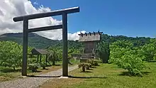
Beinan Cultural Park, Dulan Site and Green Island White Terror Memorial Park.
Museums
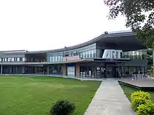
Lanyu Flying Fish Cultural Museum, National Museum of Prehistory, Rice Village Museum, Taitung Art Museum, Taitung County Museum of Natural History, Taitung Story Museum, Wu Tao Chishang Lunch Box Cultural History Museum.
Natures
Baxian Caves, Chulu Ranch, Dapo Pond, Dulan Mountain, East Coast National Scenic Area, East Rift Valley National Scenic Area, Green Island, Jhihben National Forest Recreation Area, Orchid Island, Sanxiantai, Sika Deer Ecological Park, Taitung Forest Park and Zhaori Hot Spring.
Transportation
Air
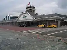
Taitung County houses the international Taitung Airport in the mainland Taitung County of Taitung City and another two airports at the outlying islands, which are Lüdao Airport in Green Island and Lanyu Airport in Orchid Island.
Rail
Taitung County is crossed by two Taiwan Railways Administration lines of South-Link Line and Hualien–Taitung Line. The stations consist of Chishang, Dawu, Guanshan, Guzhuang, Haiduan, Jinlun, Kangle, Longxi, Luye, Ruihe, Ruiyuan, Shanli, Taimali, Taitung and Zhiben Station.
Notable natives
- Yang Chuan-kwang, 1960 Summer Olympics decathlon medalist
- Tank, singer
- A-Mei, singer
Relative location
Places adjacent to Taitung County | ||||||||||
|---|---|---|---|---|---|---|---|---|---|---|
| ||||||||||
References
- Davidson, James W. (1903). The Island of Formosa, Past and Present : history, people, resources, and commercial prospects : tea, camphor, sugar, gold, coal, sulphur, economical plants, and other productions. London and New York: Macmillan & co. p. 244. OL 6931635M. Archived from the original on 8 January 2015. Retrieved 30 November 2014.
- "Archived copy". Archived from the original on 22 July 2018. Retrieved 27 February 2016.CS1 maint: archived copy as title (link)
- "About Taitung". Taitung County Government English. Retrieved 14 April 2019.
Population 234,123, Taitung has 16 townships, categorized as the following: County-Municipal City Taitung City Townships (Jheng) Chenggong Town Guanshan Town Townships (Siang) Beinan Township Luye Township Chishang Township Taimali Township Dawu Township Donghe Township Changbin Township Jinfeng Township Yanping Township Haiduan Township Daren Township Lanyu Township Lyudao Township{...}Lyudao (Green Island), {...}Lyudao (Green Island)
- "Township (City) Offices". Taitung County Government English. Archived from the original on 6 July 2017. Retrieved 14 April 2019.
Lyudao Township Office
- 1.7-鄉鎮市區戶口數 [Population for Township and District]. Ministry of the Interior (in Chinese and English). August 2020. Retrieved 21 September 2020.
臺東縣 Taitung County臺東市 Taitung City成功鎮 Chenggong Township關山鎮 Guanshan Township卑南鄉 Beinan Township大武鄉 Dawu Township太麻里鄉 Taimali Township東河鄉 Donghe Township長濱鄉 Changbin Township鹿野鄉 Luye Township池上鄉 Chihshang Township綠島鄉 Lyudao Township延平鄉 Yanping Township海端鄉 Haiduan Township達仁鄉 Daren Township金峰鄉 Jinfong Township蘭嶼鄉 Lanyu Township
- "2016 The 14th Presidential and Vice Presidential Election and The 9th Legislator Election". Archived from the original on 4 March 2016. Retrieved 17 January 2016.
- "Taitung County Government English". Archived from the original on 16 February 2015. Retrieved 16 February 2015.
- "Amis remains Taiwan's biggest aboriginal tribe at 37.1% of total". Archived from the original on 16 February 2015. Retrieved 16 February 2015.
- 臺東縣政府教育處. www.boe.ttct.edu.tw. Archived from the original on 11 August 2014. Retrieved 24 August 2014.
- "Archived copy". Archived from the original on 11 April 2009. Retrieved 15 September 2009.CS1 maint: archived copy as title (link)
External links
| Wikivoyage has a travel guide for Taitung County. |
| Look up Taitung in Wiktionary, the free dictionary. |
- Taitung County Government Website (in Chinese)
 Geographic data related to Taitung County at OpenStreetMap
| Wikimedia Commons has media related to Taitung County. |
Cities and townships of Taitung County | ||
|---|---|---|
| Cities | | |
| Urban townships | ||
| Rural townships | ||
| Mountain indigenous townships | ||