Highway H07 (Ukraine)
H07 is an important Ukraine national highway (H-highway) in Kyiv, Chernihiv, and Sumy Oblasts, Ukraine, running mainly west-east, and connecting Kyiv (if switching to another highway at Brovary) with Yunakivka in a more or less straight line.[1][2] It begins in Brovary at Highway M01/Highway E95, and passes through Krasylivka, Hoholiv, Rusaniv, Peremoha, Nova Basan, Novyi Bykiv, Pohreby, Rudivka, Pryluky, Okhyrky, Sribne, Kharkove, Lavirkove, Romny, Korovyntsi, Nedryhailiv, Vylshana, Komyshanka, Shtepivka, Sula, Sad, Sumy, Stetskivka, Pysarivka, and Yunakivka, before ending at the Russian border. The road then continues as Russian Highway R200 to Kursk.[3]
| ||||
|---|---|---|---|---|
| Автошлях H07 | ||||
 | ||||
| Route information | ||||
| Length | 334.7 km (208.0 mi) | |||
| Major junctions | ||||
| West end | ||||
| P45 P61 | ||||
| East end | ||||
| Location | ||||
| Regions | Kyiv Oblast, Chernihiv Oblast, Sumy Oblast | |||
| Highway system | ||||
Roads in Ukraine
| ||||

Accessibility
Marshrutkas from Kyiv to Sumy actually prefer to first travel by means of Highway M03, then turning onto Road P60 at Pyryatyn, and pnly then turning onto Highway H07 in Romny. The same stands for marshrutkas from Sumy to Kyiv. The reason is that on this route there are more rest stops for marshrutkas (in Boryspil, Pyryatyn, Lokhvytsya, Romny, and Nedryhailiv) then on Highway H07 (there are none before Romny except in Pryluky but that poses a minor detour).
Main route
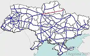
Main route and intersections with other highways in Ukraine.[1]
| Marker | Settlements with intersecting highways | Notes | Highway Interchanges |
|---|---|---|---|
| 0 km | Brovary | ||
| Hoholiv | T1004 | ||
| Novyi Bykiv | T2541 | ||
| Zaizd (near Pryluky) | P67 | ||
| Bileshchyna (near Pryluky) | T2524 | ||
| Sribne | T2530 | ||
| Romny | T1913 P60 | ||
| Nedryhailiv | T1904 | ||
| Shtepivka | T1906 | ||
| Sumy | P44 P45 P61 | ||
| Yunakivka / Border (Russia) |
See also
References
| E-roads in Ukraine | ||
|---|---|---|
| International | ||
| National | ||
| Regional |
| |
| ||
