Honikiwi
Honikiwi is a locality in the Ōtorohanga District and Waikato region of New Zealand. It is northwest of Otorohanga.
Honikiwi | |
|---|---|
Village | |
| |
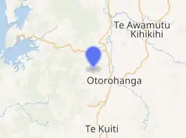
| Coordinates: 38.147°S 175.131°E | |
| Region | Waikato region |
| Territorial authority | Ōtorohanga District |
| Ward | Kāwhia-Tihiroa |
| Electorate | Taranaki-King Country |
| Population (2018 census) | |
| • Territorial | 1,581 |
| Time zone | UTC+12 (NZST) |
| • Summer (DST) | UTC+13 (NZDT) |
Demographics
| Year | Pop. | ±% p.a. |
|---|---|---|
| 2006 | 1,176 | — |
| 2013 | 1,356 | +2.06% |
| 2018 | 1,581 | +3.12% |
| Source: [1] | ||
The Honikiwi statistical area, which at 246 square kilometres is much larger than the locality, had a population of 1,581 at the 2018 New Zealand census, an increase of 225 people (16.6%) since the 2013 census, and an increase of 405 people (34.4%) since the 2006 census. There were 549 households. There were 816 males and 762 females, giving a sex ratio of 1.07 males per female. The median age was 37 years (compared with 37.4 years nationally), with 369 people (23.3%) aged under 15 years, 261 (16.5%) aged 15 to 29, 744 (47.1%) aged 30 to 64, and 204 (12.9%) aged 65 or older.
Ethnicities were 86.9% European/Pākehā, 19.5% Māori, 1.7% Pacific peoples, 2.8% Asian, and 1.7% other ethnicities (totals add to more than 100% since people could identify with multiple ethnicities).
The proportion of people born overseas was 14.6%, compared with 27.1% nationally.
Although some people objected to giving their religion, 57.3% had no religion, 29.8% were Christian, 0.9% were Hindu, 0.2% were Buddhist and 2.5% had other religions.
Of those at least 15 years old, 183 (15.1%) people had a bachelor or higher degree, and 267 (22.0%) people had no formal qualifications. The median income was $35,900, compared with $31,800 nationally. The employment status of those at least 15 was that 672 (55.4%) people were employed full-time, 219 (18.1%) were part-time, and 51 (4.2%) were unemployed.[1]
Education
Honikiwi requested a school in 1906, but the application was rejected.[2] The community offered to build a school if the Board of Education would fund a teacher, but although a site was allocated and material for the school procured, permission to build was denied.[3] The school was allowed to proceed in December 1907, and was built by the end of the year.[4]
The school building was replaced in 1930, with the opening notable for a fight breaking out.[5]
The school was still open in 1973[6] but had closed by 2018.[7]
References
- "Statistical area 1 dataset for 2018 Census". Statistics New Zealand. March 2020. Honikiwi (185300). 2018 Census place summary: Honikiwi
- "Board of Education". New Zealand Herald. 15 November 1906. p. 7.
- "Letters to the Editor - Education in the Back Blocks". New Zealand Herald. 26 November 1907. p. 3.
- "Honikiwi". King Country Chronicle. 10 January 1908. p. 3.
- "Settlers' Free Fight - Country School Gathering". Auckland Star. 22 December 1930. p. 10.
- "Honikiwi School Log Books 1967 - 1973". Archway Series. Retrieved 10 November 2020.
- "Value for Money out West". Harcourts. March 2018.