Te Kawa
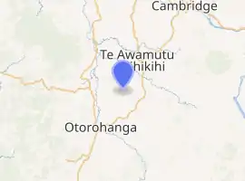
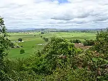
Te Kawa is a rural community in the Otorohanga District and Waikato region of New Zealand's North Island.[1] It lies just to the south of the volcanic hills of Kakepuku and Te Kawa.[2] Until the swamp was drained in the 1900s, Te Kawa was well known for its eels.[3]
Te Kawa | |
|---|---|
Village | |
| |
| Coordinates: | |
| Region | Waikato region |
| Territorial authority | Ōtorohanga District |
| Ward | Kiokio-Korakonui |
| Electorate | Taranaki-King Country |
| Population (2018 census) | |
| • Territorial | 1,209 |
| Time zone | UTC+12 (NZST) |
| • Summer (DST) | UTC+13 (NZDT) |
Te Kawa railway station, a station on the North Island Main Trunk, was located in the area.[4][5] It operated from 9 March 1887 and closed 17 October 1971.[6][7]
A post office was open by 1909[8] and a dairy factory and a school existed in 1913.[9] Te Kawa Bridge over the Waipa opened in 1915.[10] The hill was quarried from 1925.[11] A town hall opened in 1928.[12]
Te Whakaaro Kotahi Marae in Te Kawa is a meeting ground of the Maniapoto hapū of Te Kanawa.[13] It includes a small building.[14]
Demographics
| Year | Pop. | ±% p.a. |
|---|---|---|
| 2006 | 1,068 | — |
| 2013 | 1,074 | +0.08% |
| 2018 | 1,209 | +2.40% |
| Source: [15] | ||
The statistical area of Te Kawa, which at 115 square kilometres is much larger than the locality, had a population of 1,209 at the 2018 New Zealand census, an increase of 135 people (12.6%) since the 2013 census, and an increase of 141 people (13.2%) since the 2006 census. There were 393 households. There were 618 males and 591 females, giving a sex ratio of 1.05 males per female. The median age was 32.9 years (compared with 37.4 years nationally), with 330 people (27.3%) aged under 15 years, 225 (18.6%) aged 15 to 29, 528 (43.7%) aged 30 to 64, and 126 (10.4%) aged 65 or older.
Ethnicities were 88.1% European/Pākehā, 20.1% Māori, 2.2% Pacific peoples, 3.5% Asian, and 1.7% other ethnicities (totals add to more than 100% since people could identify with multiple ethnicities).
The proportion of people born overseas was 10.2%, compared with 27.1% nationally.
Although some people objected to giving their religion, 57.1% had no religion, 30.3% were Christian, 0.5% were Muslim and 2.2% had other religions.
Of those at least 15 years old, 114 (13.0%) people had a bachelor or higher degree, and 165 (18.8%) people had no formal qualifications. The median income was $38,200, compared with $31,800 nationally. The employment status of those at least 15 was that 489 (55.6%) people were employed full-time, 141 (16.0%) were part-time, and 33 (3.8%) were unemployed.[15]
References
- Hariss, Gavin. "Te Kawa, Waikato". topomap.co.nz. NZ Topo Map.
- "Te Kawa, Waikato". NZ Topo Map. Retrieved 7 May 2019.
- "TUNA LAGOONS. AUCKLAND STAR". paperspast.natlib.govt.nz. 10 July 1926. Retrieved 7 May 2019.
- Pierre, Bill (1981). North Island Main Trunk. Wellington: A.H&A.W Reed. pp. 289–290. ISBN 0589013165.
- 1934 photo (top left) in The New Zealand Railways Magazine, Vol 9, Issue 2 (1 May).
- New Zealand Railway and Tramway Atlas (First ed.). Quail Map Co. 1965. pp. 3 & 4.
- Juliet Scoble: Names & Opening & Closing Dates of Railway Stations in New Zealand
- "RECLAIMING THE SWAMPS. NEW ZEALAND HERALD". paperspast.natlib.govt.nz. 20 September 1909. Retrieved 7 May 2019.
- "Te Kawa, New Zealand Herald". paperspast.natlib.govt.nz. 1 July 1913. Retrieved 7 May 2019.
- "OPENING TE KAWA BRIDGE. AUCKLAND STAR". paperspast.natlib.govt.nz. 3 February 1915. Retrieved 7 May 2019.
- "TE KAWA QUARRIES, WAIKATO TIMES". paperspast.natlib.govt.nz. 19 August 1925. Retrieved 7 May 2019.
- "PROGRESS OF TE KAWA. NEW ZEALAND HERALD". paperspast.natlib.govt.nz. 19 July 1928. Retrieved 7 May 2019.
- "Te Kāhui Māngai directory". tkm.govt.nz. Te Puni Kōkiri.
- "Māori Maps". maorimaps.com. Te Potiki National Trust.
- "Statistical area 1 dataset for 2018 Census". Statistics New Zealand. March 2020. Te Kawa (185400). 2018 Census place summary: Te Kawa