Hope, Maine
Hope is a town in Knox County, Maine, United States. The population was 1,536 at the 2010 census.
Hope, Maine | |
|---|---|
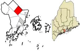 Location in Knox County and the state of Maine. | |
| Coordinates: 44°13′58″N 69°11′33″W | |
| Country | United States |
| State | Maine |
| County | Knox |
| Villages | Hope South Hope |
| Area | |
| • Total | 23.88 sq mi (61.85 km2) |
| • Land | 21.96 sq mi (56.88 km2) |
| • Water | 1.92 sq mi (4.97 km2) |
| Elevation | 469 ft (143 m) |
| Population | |
| • Total | 1,536 |
| • Estimate (2012[3]) | 1,605 |
| • Density | 69.9/sq mi (27.0/km2) |
| Time zone | UTC-5 (Eastern (EST)) |
| • Summer (DST) | UTC-4 (EDT) |
| ZIP code | 04847 |
| Area code(s) | 207 |
| FIPS code | 23-33840 |
| GNIS feature ID | 0582524 |
| Website | hopemaine.org |
Geography
According to the United States Census Bureau, the town has a total area of 23.88 square miles (61.85 km2), of which, 21.96 square miles (56.88 km2) of it is land and 1.92 square miles (4.97 km2) is water.[1] Principle bodies of water include: Part of Megunticook Lake, Alford Lake (595), Hobbs Pond (266 acres), Lermond Pond (173 acres), Fish Pond (112 acres), Mansfield Pond (41 acres) and Lily Pond (29 acres).
The town is crossed by Maine State Routes 17, 105 and 235. It is bordered by Searsmont on the north, Lincolnville on the east, Camden and Rockport on the southeast, Union on the west and Appleton on the northwest.
Demographics
| Historical population | |||
|---|---|---|---|
| Census | Pop. | %± | |
| 1810 | 787 | — | |
| 1820 | 1,179 | 49.8% | |
| 1830 | 1,541 | 30.7% | |
| 1840 | 1,770 | 14.9% | |
| 1850 | 1,108 | −37.4% | |
| 1860 | 1,064 | −4.0% | |
| 1870 | 907 | −14.8% | |
| 1880 | 830 | −8.5% | |
| 1890 | 641 | −22.8% | |
| 1900 | 599 | −6.6% | |
| 1910 | 497 | −17.0% | |
| 1920 | 424 | −14.7% | |
| 1930 | 464 | 9.4% | |
| 1940 | 524 | 12.9% | |
| 1950 | 504 | −3.8% | |
| 1960 | 525 | 4.2% | |
| 1970 | 500 | −4.8% | |
| 1980 | 730 | 46.0% | |
| 1990 | 1,017 | 39.3% | |
| 2000 | 1,310 | 28.8% | |
| 2010 | 1,536 | 17.3% | |
| 2014 (est.) | 1,659 | [4] | 8.0% |
| U.S. Decennial Census | |||
2010 census
As of the census[2] of 2010, there were 1,536 people, 603 households, and 444 families residing in the town. The population density was 69.9 inhabitants per square mile (27.0/km2). There were 805 housing units at an average density of 36.7 per square mile (14.2/km2). The racial makeup of the town was 96.8% White, 0.1% African American, 0.8% Native American, 0.7% Asian, 0.1% from other races, and 1.6% from two or more races. Hispanic or Latino of any race were 1.0% of the population.
There were 603 households, of which 34.3% had children under the age of 18 living with them, 61.0% were married couples living together, 9.6% had a female householder with no husband present, 3.0% had a male householder with no wife present, and 26.4% were non-families. 18.6% of all households were made up of individuals, and 5.3% had someone living alone who was 65 years of age or older. The average household size was 2.54 and the average family size was 2.91.
The median age in the town was 43.2 years. 23.8% of residents were under the age of 18; 5.1% were between the ages of 18 and 24; 24.2% were from 25 to 44; 34% were from 45 to 64; and 12.9% were 65 years of age or older. The gender makeup of the town was 48.9% male and 51.1% female.
2000 census
As of the census[5] of 2000, there were 1,310 people, 513 households, and 380 families residing in the town. The population density was 60.0 people per square mile (23.2/km2). There were 687 housing units at an average density of 31.5 per square mile (12.1/km2). The racial makeup of the town was 98.63% White, 0.15% African American, 0.31% Native American, 0.23% Asian, 0.15% from other races, and 0.53% from two or more races. Hispanic or Latino of any race were 0.84% of the population.
There were 513 households, out of which 35.5% had children under the age of 18 living with them, 62.8% were married couples living together, 7.8% had a female householder with no husband present, and 25.9% were non-families. 21.1% of all households were made up of individuals, and 6.2% had someone living alone who was 65 years of age or older. The average household size was 2.54 and the average family size was 2.94.
In the town, the population was spread out, with 26.9% under the age of 18, 4.2% from 18 to 24, 32.8% from 25 to 44, 27.1% from 45 to 64, and 9.0% who were 65 years of age or older. The median age was 38 years. For every 100 females, there were 97.3 males. For every 100 females age 18 and over, there were 91.2 males.
The median income for a household in the town was $42,273, and the median income for a family was $45,781. Males had a median income of $33,125 versus $26,850 for females. The per capita income for the town was $24,385. About 4.7% of families and 6.5% of the population were below the poverty line, including 6.6% of those under age 18 and 8.4% of those age 65 or over.
Education
For grades Kindergarten to 8, Hope is part of School Union 69. Danielle Fagonde is the principal and Dianne Helprin is the superintendent. Hope Elementary School was one of two schools in the state of Maine to receive the title of National Blue Ribbon School in 2012.
For grades 9 to grades 12, Hope is part of the Five Town Community School District, which operates Camden Hills Regional High School. Maria Libby is the Superintendent.[6]
References
- "US Gazetteer files 2010". United States Census Bureau. Archived from the original on 2012-12-20. Retrieved 2012-12-16.
- "U.S. Census website". United States Census Bureau. Retrieved 2012-12-16.
- "Population Estimates". United States Census Bureau. Archived from the original on 2013-06-11. Retrieved 2013-07-06.
- "Annual Estimates of the Resident Population for Incorporated Places: April 1, 2010 to July 1, 2014". Archived from the original on May 23, 2015. Retrieved June 4, 2015.
- "U.S. Census website". United States Census Bureau. Retrieved 2008-01-31.
- http://www.fivetowns.net/contact.cfm. Missing or empty
|title=(help)
Further reading
- Wright, Virginia M. "Hope is Hip". Down East: The Magazine of Maine (May 2009).
External links
Municipalities and communities of Knox County, Maine, United States | ||
|---|---|---|
| City | 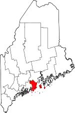 Knox County map | |
| Towns | ||
| Plantation | ||
| Unorganized territories | ||
| CDPs | ||
| Other villages | ||
| ||
| Authority control |
|---|