Hornick, Iowa
Hornick is a city in Woodbury County, Iowa, United States. It is part of the Sioux City, IA–NE–SD metropolitan statistical area. The population was 225 at the 2010 census.
Hornick, Iowa | |
|---|---|
 | |
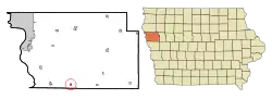 Location of Hornick, Iowa | |
| Coordinates: 42°13′51″N 96°5′48″W | |
| Country | |
| State | |
| County | Woodbury |
| Incorporated | June 23, 1896 [1] |
| Area | |
| • Total | 0.26 sq mi (0.67 km2) |
| • Land | 0.25 sq mi (0.65 km2) |
| • Water | 0.01 sq mi (0.01 km2) |
| Elevation | 1,063 ft (324 m) |
| Population | |
| • Total | 225 |
| • Estimate (2019)[4] | 218 |
| • Density | 861.66/sq mi (332.88/km2) |
| Time zone | UTC-6 (Central (CST)) |
| • Summer (DST) | UTC-5 (CDT) |
| ZIP code | 51026 |
| Area code(s) | 712 |
| FIPS code | 19-37200 |
| GNIS feature ID | 0457662 |
Geography
Hornick is located at 42°13′51″N 96°5′48″W (42.230972, -96.096610).[5]
According to the United States Census Bureau, the city has a total area of 0.26 square miles (0.67 km2), of which 0.25 square miles (0.65 km2) is land and 0.01 square mile (0.03 km2) is water.[6] The town is located on the floodplain of the Missouri River, near the edge of the Loess Hills, adjacent to the old (meandered) channel of the West Fork of the Little Sioux River.
History
Hornick was impacted the 2019 floods.[7] The town was under 2 feet of water. Funding has been allocated for the construction of a berm, similar to the temporary berm which prevented flooding in 1996.[8]
Demographics
| Year | Pop. | ±% |
|---|---|---|
| 1900 | 284 | — |
| 1910 | 245 | −13.7% |
| 1920 | 296 | +20.8% |
| 1930 | 309 | +4.4% |
| 1940 | 291 | −5.8% |
| 1950 | 310 | +6.5% |
| 1960 | 275 | −11.3% |
| 1970 | 250 | −9.1% |
| 1980 | 239 | −4.4% |
| 1990 | 222 | −7.1% |
| 2000 | 253 | +14.0% |
| 2010 | 225 | −11.1% |
| 2019 | 218 | −3.1% |
| Source:"U.S. Census website". United States Census Bureau. Retrieved 2020-03-29. and Iowa Data Center Source: | ||
2010 census
As of the census of 2010,[3] there were 225 people, 102 households, and 65 families living in the city. The population density was 900.0 inhabitants per square mile (347.5/km2). There were 113 housing units at an average density of 452.0 per square mile (174.5/km2). The racial makeup of the city was 98.2% White, 0.4% African American, 0.4% Asian, 0.4% from other races, and 0.4% from two or more races. Hispanic or Latino of any race were 0.9% of the population.
There were 102 households, of which 33.3% had children under the age of 18 living with them, 47.1% were married couples living together, 12.7% had a female householder with no husband present, 3.9% had a male householder with no wife present, and 36.3% were non-families. 35.3% of all households were made up of individuals, and 13.7% had someone living alone who was 65 years of age or older. The average household size was 2.21 and the average family size was 2.82.
The median age in the city was 38.3 years. 26.7% of residents were under the age of 18; 5.2% were between the ages of 18 and 24; 24.8% were from 25 to 44; 25.3% were from 45 to 64; and 17.8% were 65 years of age or older. The gender makeup of the city was 48.0% male and 52.0% female.
2000 census
As of the census of 2000,[10] there were 253 people, 101 households, and 68 families living in the city. The population density was 984.4 people per square mile (375.7/km2). There were 113 housing units at an average density of 439.7 per square mile (167.8/km2). The racial makeup of the city was 98.42% White, 0.79% African American, and 0.79% from two or more races.
There were 101 households, out of which 34.7% had children under the age of 18 living with them, 56.4% were married couples living together, 8.9% had a female householder with no husband present, and 31.7% were non-families. 27.7% of all households were made up of individuals, and 17.8% had someone living alone who was 65 years of age or older. The average household size was 2.50 and the average family size was 3.10.
Age spread: 24.1% under the age of 18, 8.3% from 18 to 24, 30.0% from 25 to 44, 21.3% from 45 to 64, and 16.2% who were 65 years of age or older. The median age was 38 years. For every 100 females, there were 90.2 males. For every 100 females age 18 and over, there were 88.2 males.
The median income for a household in the city was $28,958, and the median income for a family was $37,083. Males had a median income of $26,750 versus $20,781 for females. The per capita income for the city was $15,246. About 8.5% of families and 8.9% of the population were below the poverty line, including 8.9% of those under the age of eighteen and 10.9% of those 65 or over.
References
- "Hornick, Iowa". City-Data. Retrieved January 23, 2011.
- "2019 U.S. Gazetteer Files". United States Census Bureau. Retrieved July 17, 2020.
- "U.S. Census website". United States Census Bureau. Retrieved 2012-05-11.
- "Population and Housing Unit Estimates". United States Census Bureau. May 24, 2020. Retrieved May 27, 2020.
- "US Gazetteer files: 2010, 2000, and 1990". United States Census Bureau. 2011-02-12. Retrieved 2011-04-23.
- "US Gazetteer files 2010". United States Census Bureau. Archived from the original on 2012-01-25. Retrieved 2012-05-11.
- Peikes, Katie (Mar 28, 2019). "After Flooding, People In Hornick Return To A Different Normal". Iowa Public Radio. Retrieved 2019-09-22.
- Norvell, Kim (October 9, 2019). "205 days and counting: For western Iowa, recovery from historic flooding remains a long way off". Des Moines Register. Retrieved 2019-12-08.
- "Census of Population and Housing". Census.gov. Retrieved June 4, 2015.
- "U.S. Census website". United States Census Bureau. Retrieved 2008-01-31.
External links
- City-Data Comprehensive Statistical Data and more about Hornick
Municipalities and communities of Woodbury County, Iowa, United States | ||
|---|---|---|
| Cities | Map of Iowa highlighting Woodbury County | |
| CDP | ||
| Other communities |
| |
| Indian reservations | ||
| Ghost towns |
| |
| Civil townships | ||
| Footnotes | ‡This populated place also has portions in an adjacent county or counties | |
| ||