Woodbury County, Iowa
Woodbury County is a county located in the U.S. state of Iowa. As of the 2010 census, the population was 102,172.[2] The county seat is Sioux City.[3]
Woodbury County | |
|---|---|
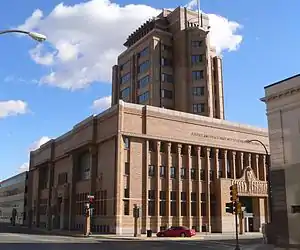 Woodbury County Courthouse in Sioux City | |
 Seal | |
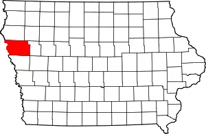 Location within the U.S. state of Iowa | |
 Iowa's location within the U.S. | |
| Coordinates: 42°23′29″N 96°03′03″W | |
| Country | |
| State | |
| Founded | 1851 |
| Named for | Levi Woodbury[1] |
| Seat | Sioux City |
| Largest city | Sioux City |
| Area | |
| • Total | 878 sq mi (2,270 km2) |
| • Land | 872.59 sq mi (2,260.0 km2) |
| • Water | 4.79 sq mi (12.4 km2) 0.55% |
| Population (2010) | |
| • Total | 102,172 |
| • Estimate (2018) | 102,539 |
| • Density | 120/sq mi (45/km2) |
| Time zone | UTC−6 (Central) |
| • Summer (DST) | UTC−5 (CDT) |
| Congressional district | 4th |
| Website | www |
Woodbury County is included in the Sioux City, IA-NE-SD Metropolitan Statistical Area.[4]
History
Originally established in 1851 as Wahkaw County, the Iowa Legislature in 1853 changed the name to Woodbury County in honor of Levi Woodbury (1789–1851), a senator and Governor of New Hampshire who served as a Supreme Court justice from 1844 until his death.
The first county seat of Wahkaw County was the now-extinct village of Thompsonville; when the Legislature changed the county name to Woodbury, the new county seat became Sergeant's Bluff (now Sergeant Bluff). The county seat was moved to Sioux City in 1856.
The Winnebago Tribe of Nebraska (Ho-Chunk) owns reservation land in Woodbury County.
Geography
The county is on the western edge of Iowa, with its western border being the Missouri River.
According to the U.S. Census Bureau, the county has a total area of 878 square miles (2,270 km2), of which 873 square miles (2,260 km2) is land and 4.9 square miles (13 km2) (0.6%) is water.[5] It is the third-largest county by area in Iowa.
Major highways
.svg.png.webp) Interstate 29
Interstate 29.svg.png.webp) Interstate 129
Interstate 129 U.S. Highway 20
 U.S. Highway 75
 U.S. Highway 77
 Iowa Highway 12
 Iowa Highway 31
 Iowa Highway 140
 Iowa Highway 141
 Iowa Highway 175
Adjacent counties
- Plymouth County (north)
- Cherokee County (northeast)
- Ida County (east)
- Monona County (south)
- Thurston County, Nebraska (southwest)
- Dakota County, Nebraska (west)
- Union County, South Dakota (northwest)
Demographics
| Historical population | |||
|---|---|---|---|
| Census | Pop. | %± | |
| 1860 | 1,119 | — | |
| 1870 | 6,172 | 451.6% | |
| 1880 | 14,996 | 143.0% | |
| 1890 | 55,632 | 271.0% | |
| 1900 | 54,610 | −1.8% | |
| 1910 | 67,616 | 23.8% | |
| 1920 | 92,171 | 36.3% | |
| 1930 | 101,669 | 10.3% | |
| 1940 | 103,627 | 1.9% | |
| 1950 | 103,917 | 0.3% | |
| 1960 | 107,849 | 3.8% | |
| 1970 | 103,052 | −4.4% | |
| 1980 | 100,884 | −2.1% | |
| 1990 | 98,276 | −2.6% | |
| 2000 | 103,877 | 5.7% | |
| 2010 | 102,172 | −1.6% | |
| 2018 (est.) | 102,539 | [6] | 0.4% |
| U.S. Decennial Census[7] 1790-1960[8] 1900-1990[9] 1990-2000[10] 2010-2018[2] | |||
2010 census
The 2010 census recorded a population of 102,172 in the county, with a population density of 117.062/sq mi (45.1980/km2). There were 41,454 housing units, of which 39,052 were occupied.[11]
2000 census
As of the census[12] of 2000, there were 103,877 people, 39,151 households, and 26,426 families residing in the county. The population density was 119 people per square mile (46/km2). There were 41,394 housing units at an average density of 47 per square mile (18/km2). The racial makeup of the county was 87.48% White, 2.02% Black or African American, 1.69% Native American, 2.41% Asian, 0.04% Pacific Islander, 4.37% from other races, and 1.99% from two or more races. 9.11% of the population were Hispanic or Latino of any race.
Of the 39,151 households 34.00% had children under the age of 18 living with them, 51.90% were married couples living together, 11.30% had a female householder with no husband present, and 32.50% were non-families. 26.60% of households were one person and 11.20% were one person aged 65 or older. The average household size was 2.58 and the average family size was 3.13.
The age distribution was 27.30% under the age of 18, 10.20% from 18 to 24, 28.30% from 25 to 44, 20.80% from 45 to 64, and 13.40% 65 or older. The median age was 34 years. For every 100 females, there were 96.10 males. For every 100 females age 18 and over, there were 92.80 males.
The median household income was $38,509 and the median family income was $46,499. Males had a median income of $31,664 versus $22,599 for females. The per capita income for the county was $18,771. About 7.20% of families and 10.30% of the population were below the poverty line, including 13.60% of those under age 18 and 7.40% of those age 65 or over.
Politics
For much of the second half of the 20th century, Woodbury County tilted Republican, albeit not as overwhelmingly as most of western Iowa. Between 1988 and 2012 Woodbury County was the quintessential swing county in Iowa. No candidate won it by more than 3.5% over that quarter century. This was the only county in Iowa that Barack Obama won in 2012 that he failed to carry in 2008. However, in 2016, Woodbury County swung over dramatically to Donald Trump, who carried it by a 22 percent margin, the largest margin of victory since Lyndon Johnson's landslide election in 1964.
| Year | Republican | Democratic | Third Parties |
|---|---|---|---|
| 2020 | 56.7% 25,736 | 41.2% 18,704 | 2.0% 922 |
| 2016 | 56.6% 24,727 | 37.1% 16,210 | 6.4% 2,781 |
| 2012 | 48.5% 21,841 | 49.5% 22,302 | 2.0% 876 |
| 2008 | 49.6% 22,219 | 49.1% 21,983 | 1.4% 613 |
| 2004 | 50.8% 22,451 | 48.6% 21,455 | 0.7% 289 |
| 2000 | 49.8% 18,864 | 46.7% 17,691 | 3.5% 1,341 |
| 1996 | 43.7% 16,368 | 46.0% 17,224 | 10.3% 3,872 |
| 1992 | 42.3% 18,148 | 40.6% 17,398 | 17.1% 7,318 |
| 1988 | 47.9% 18,790 | 51.4% 20,153 | 0.7% 282 |
| 1984 | 54.3% 23,002 | 44.8% 18,951 | 0.9% 397 |
| 1980 | 54.4% 23,553 | 36.8% 15,930 | 8.8% 3,792 |
| 1976 | 52.8% 22,853 | 45.4% 19,664 | 1.8% 770 |
| 1972 | 57.3% 23,757 | 41.0% 16,974 | 1.7% 699 |
| 1968 | 50.6% 21,159 | 43.7% 18,281 | 5.7% 2,363 |
| 1964 | 39.2% 17,347 | 60.7% 26,841 | 0.1% 30 |
| 1960 | 55.1% 26,832 | 44.9% 21,906 | 0.0% 6 |
| 1956 | 55.9% 25,399 | 44.0% 19,997 | 0.1% 49 |
| 1952 | 58.4% 27,518 | 41.3% 19,474 | 0.3% 159 |
| 1948 | 42.6% 16,655 | 56.4% 22,056 | 1.0% 373 |
| 1944 | 47.4% 18,544 | 52.3% 20,448 | 0.3% 104 |
| 1940 | 48.2% 22,832 | 51.6% 24,457 | 0.2% 89 |
| 1936 | 32.9% 14,157 | 62.4% 26,847 | 4.7% 1,998 |
| 1932 | 32.0% 12,764 | 66.1% 26,397 | 1.9% 761 |
| 1928 | 54.8% 20,587 | 44.8% 16,831 | 0.4% 166 |
| 1924 | 47.4% 16,639 | 16.2% 5,676 | 36.5% 12,804 |
| 1920 | 62.1% 17,603 | 34.6% 9,815 | 3.3% 944 |
| 1916 | 38.6% 5,735 | 59.4% 8,819 | 2.0% 299 |
| 1912 | 18.7% 2,441 | 34.9% 4,564 | 46.5% 6,077 |
| 1908 | 53.5% 6,587 | 42.4% 5,222 | 4.1% 498 |
| 1904 | 66.9% 7,597 | 24.7% 2,809 | 8.4% 958 |
| 1900 | 57.5% 7,045 | 39.2% 4,796 | 3.3% 402 |
| 1896 | 54.9% 6,204 | 43.1% 4,876 | 2.0% 229 |
| 1892 | 47.1% 4,620 | 42.3% 4,156 | 10.6% 1,040 |
| 1888 | 52.9% 4,169 | 45.5% 3,588 | 1.6% 129 |
| 1884 | 53.8% 2,789 | 45.9% 2,380 | 0.3% 17 |
| 1880 | 56.3% 1,453 | 38.5% 995 | 5.2% 135 |
Communities

Cities
Unincorporated communities
- Climbing Hill (a census-designated place)
- Discord
- Holly Springs
- Midway
- Owego[15]
Townships
Population ranking
The population ranking of the following table is based on the 2010 census of Woodbury County.[16]
† county seat
| Rank | City/Town/etc. | Municipal type | Population (2010 Census) |
|---|---|---|---|
| 1 | † Sioux City (partially in Plymouth County) | City | 82,678 (82,684 total) |
| 2 | Sergeant Bluff | City | 4,227 |
| 3 | Moville | City | 1,618 |
| 4 | Sloan | City | 973 |
| 5 | Lawton | City | 908 |
| 6 | Correctionville | City | 821 |
| 7 | Anthon | City | 565 |
| 8 | Pierson | City | 366 |
| 9 | Salix | City | 363 |
| 10 | Danbury | City | 348 |
| 11 | Bronson | City | 322 |
| 12 | Hornick | City | 225 |
| 13 | Smithland | City | 224 |
| 14 | Cushing | City | 220 |
| 15 | Oto | City | 108 |
| 16 | Climbing Hill | CDP | 97 |
References
- Chicago and North Western Railway Company (1908). A History of the Origin of the Place Names Connected with the Chicago & North Western and Chicago, St. Paul, Minneapolis & Omaha Railways. p. 165.
- "State & County QuickFacts". United States Census Bureau. Retrieved July 20, 2014.
- "Find a County". National Association of Counties. Retrieved June 7, 2011.
- United States Office of Management and Budget. "Update of Statistical Area Definitions and Guidance on Their Uses" (PDF). pp. 5, 36. Archived from the original (PDF) on May 14, 2006. Retrieved July 21, 2006.
- "US Gazetteer files: 2010, 2000, and 1990". United States Census Bureau. February 12, 2011. Retrieved April 23, 2011.
- "Population and Housing Unit Estimates". Retrieved June 6, 2019.
- "U.S. Decennial Census". United States Census Bureau. Retrieved July 20, 2014.
- "Historical Census Browser". University of Virginia Library. Retrieved July 20, 2014.
- "Population of Counties by Decennial Census: 1900 to 1990". United States Census Bureau. Retrieved July 20, 2014.
- "Census 2000 PHC-T-4. Ranking Tables for Counties: 1990 and 2000" (PDF). United States Census Bureau. Retrieved July 20, 2014.
- "Population & Housing Occupancy Status 2010". United States Census Bureau American FactFinder. Retrieved May 9, 2011.
- "U.S. Census website". United States Census Bureau. Retrieved January 31, 2008.
- Leip, David. "Dave Leip's Atlas of U.S. Presidential Elections". uselectionatlas.org. Retrieved April 28, 2018.
- "Our Campaigns - U.S. President". Retrieved January 22, 2021.
- Owego - google maps
- 2010 Census
Further reading
- Lensch, R.A. (2006). Soil survey of Woodbury County, Iowa. Washington, D.C.: U.S. Department of Agriculture, Natural Resources Conservation Service
External links
| Wikimedia Commons has media related to Woodbury County, Iowa. |
Places adjacent to Woodbury County, Iowa | |
|---|---|
Municipalities and communities of Woodbury County, Iowa, United States | ||
|---|---|---|
| Cities | Map of Iowa highlighting Woodbury County | |
| CDP | ||
| Other communities |
| |
| Indian reservations | ||
| Ghost towns |
| |
| Civil townships | ||
| Footnotes | ‡This populated place also has portions in an adjacent county or counties | |
| ||

| Authority control |
|---|