Pierson, Iowa
Pierson is a city in Woodbury County, Iowa, United States. It is part of the Sioux City, IA–NE–SD Metropolitan Statistical Area. The population was 366 at the 2010 census.
Pierson, Iowa | |
|---|---|
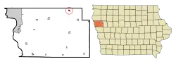 Location of Pierson, Iowa | |
| Coordinates: 42°32′41″N 95°52′7″W | |
| Country | |
| State | |
| County | Woodbury |
| Area | |
| • Total | 0.62 sq mi (1.60 km2) |
| • Land | 0.62 sq mi (1.60 km2) |
| • Water | 0.00 sq mi (0.00 km2) |
| Elevation | 1,280 ft (390 m) |
| Population | |
| • Total | 366 |
| • Estimate (2019)[3] | 354 |
| • Density | 573.74/sq mi (221.58/km2) |
| Time zone | UTC-6 (Central (CST)) |
| • Summer (DST) | UTC-5 (CDT) |
| ZIP code | 51048 |
| Area code(s) | 712 |
| FIPS code | 19-62760 |
| GNIS feature ID | 0460129 |
History
A post office called Pierson has been in operation since 1884.[4] The city was named for Andrew Pierson, a pioneer settler.[5]
Geography
Pierson is located at 42°32′41″N 95°52′7″W (42.544627, -95.868617).[6]
According to the United States Census Bureau, the city has a total area of 0.62 square miles (1.61 km2), all land.[7]
Pierson is east of Sioux City and is located north of U.S. Route 20.
Demographics
| Year | Pop. | ±% |
|---|---|---|
| 1900 | 358 | — |
| 1910 | 416 | +16.2% |
| 1920 | 554 | +33.2% |
| 1930 | 551 | −0.5% |
| 1940 | 531 | −3.6% |
| 1950 | 453 | −14.7% |
| 1960 | 425 | −6.2% |
| 1970 | 421 | −0.9% |
| 1980 | 408 | −3.1% |
| 1990 | 341 | −16.4% |
| 2000 | 371 | +8.8% |
| 2010 | 366 | −1.3% |
| 2019 | 354 | −3.3% |
| Source:"U.S. Census website". United States Census Bureau. Retrieved 2020-03-29. and Iowa Data Center Source: | ||
Website:www.pierson.mysite.com
2010 census
As of the census[2] of 2010, there were 366 people, 147 households, and 102 families living in the city. The population density was 590.3 inhabitants per square mile (227.9/km2). There were 170 housing units at an average density of 274.2 per square mile (105.9/km2). The racial makeup of the city was 94.5% White, 0.8% African American, 1.9% Native American, 0.5% Asian, 0.3% from other races, and 1.9% from two or more races. Hispanic or Latino of any race were 1.1% of the population.
There were 147 households, of which 35.4% had children under the age of 18 living with them, 51.7% were married couples living together, 11.6% had a female householder with no husband present, 6.1% had a male householder with no wife present, and 30.6% were non-families. 23.8% of all households were made up of individuals, and 12.9% had someone living alone who was 65 years of age or older. The average household size was 2.49 and the average family size was 2.97.
The median age in the city was 36.7 years. 30.1% of residents were under the age of 18; 6.3% were between the ages of 18 and 24; 21.9% were from 25 to 44; 23.8% were from 45 to 64; and 18% were 65 years of age or older. The gender makeup of the city was 51.1% male and 48.9% female.
2000 census
As of the census[9] of 2000, there were 371 people, 148 households, and 105 families living in the city. The population density was 757.3 people per square mile (292.3/km2). There were 166 housing units at an average density of 338.9 per square mile (130.8/km2). The racial makeup of the city was 98.38% White, 0.27% Asian, 0.27% from other races, and 1.08% from two or more races. Hispanic or Latino of any race were 0.54% of the population.
There were 148 households, out of which 31.8% had children under the age of 18 living with them, 58.8% were married couples living together, 6.1% had a female householder with no husband present, and 28.4% were non-families. 25.7% of all households were made up of individuals, and 14.2% had someone living alone who was 65 years of age or older. The average household size was 2.51 and the average family size was 2.95.
Age spread: 27.5% under the age of 18, 6.2% from 18 to 24, 25.6% from 25 to 44, 18.9% from 45 to 64, and 21.8% who were 65 years of age or older. The median age was 38 years. For every 100 females, there were 100.5 males. For every 100 females age 18 and over, there were 97.8 males.
The median income for a household in the city was $35,278, and the median income for a family was $40,833. Males had a median income of $30,083 versus $25,556 for females. The per capita income for the city was $15,945. About 4.8% of families and 6.3% of the population were below the poverty line, including 6.5% of those under age 18 and 4.9% of those age 65 or over.
Education
The Kingsley-Pierson Community School District operates local area public schools.[10]
References
- "2019 U.S. Gazetteer Files". United States Census Bureau. Retrieved July 17, 2020.
- "U.S. Census website". United States Census Bureau. Retrieved 2012-05-11.
- "Population and Housing Unit Estimates". United States Census Bureau. May 24, 2020. Retrieved May 27, 2020.
- "Woodbury County". Jim Forte Postal History. Retrieved 24 March 2015.
- Chicago and North Western Railway Company (1908). A History of the Origin of the Place Names Connected with the Chicago & North Western and Chicago, St. Paul, Minneapolis & Omaha Railways. p. 113.
- "US Gazetteer files: 2010, 2000, and 1990". United States Census Bureau. 2011-02-12. Retrieved 2011-04-23.
- "US Gazetteer files 2010". United States Census Bureau. Archived from the original on 2012-01-25. Retrieved 2012-05-11.
- "Census of Population and Housing". Census.gov. Retrieved June 4, 2015.
- "U.S. Census website". United States Census Bureau. Retrieved 2008-01-31.
- "KINGSLEY-PIERSON" (PDF). Iowa Department of Education. Retrieved 2019-09-01.
External links
Municipalities and communities of Woodbury County, Iowa, United States | ||
|---|---|---|
| Cities | Map of Iowa highlighting Woodbury County | |
| CDP | ||
| Other communities |
| |
| Indian reservations | ||
| Ghost towns |
| |
| Civil townships | ||
| Footnotes | ‡This populated place also has portions in an adjacent county or counties | |
| ||