Oto, Iowa
Oto is a city in Woodbury County, Iowa, United States. It is part of the Sioux City, IA–NE–SD Metropolitan Statistical Area. The population was 108 at the 2010 census.
Oto, Iowa | |
|---|---|
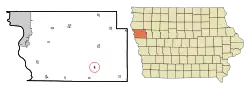 Location of Oto, Iowa | |
| Coordinates: 42°17′1″N 95°53′39″W | |
| Country | |
| State | |
| County | Woodbury |
| Area | |
| • Total | 0.27 sq mi (0.69 km2) |
| • Land | 0.27 sq mi (0.69 km2) |
| • Water | 0.00 sq mi (0.00 km2) |
| Elevation | 1,096 ft (334 m) |
| Population | |
| • Total | 108 |
| • Estimate (2019)[3] | 103 |
| • Density | 388.68/sq mi (150.17/km2) |
| Time zone | UTC-6 (Central (CST)) |
| • Summer (DST) | UTC-5 (CDT) |
| ZIP code | 51044 |
| Area code(s) | 712 |
| FIPS code | 19-60240 |
| GNIS feature ID | 0459918 |
Geography
Oto is located at 42°17′1″N 95°53′39″W (42.283676, -95.894047).[4] It is situated near the Little Sioux River.
According to the United States Census Bureau, the city has a total area of 0.27 square miles (0.70 km2), all land.[5]
Demographics
| Year | Pop. | ±% |
|---|---|---|
| 1890 | 247 | — |
| 1900 | 396 | +60.3% |
| 1910 | 268 | −32.3% |
| 1920 | 333 | +24.3% |
| 1930 | 370 | +11.1% |
| 1940 | 410 | +10.8% |
| 1950 | 302 | −26.3% |
| 1960 | 221 | −26.8% |
| 1970 | 203 | −8.1% |
| 1980 | 172 | −15.3% |
| 1990 | 118 | −31.4% |
| 2000 | 145 | +22.9% |
| 2010 | 108 | −25.5% |
| 2019 | 103 | −4.6% |
| Source:"U.S. Census website". United States Census Bureau. Retrieved 2020-03-29. and Iowa Data Center Source: | ||
2010 census
As of the census[2] of 2010, there were 108 people, 46 households, and 27 families living in the city. The population density was 400.0 inhabitants per square mile (154.4/km2). There were 60 housing units at an average density of 222.2 per square mile (85.8/km2). The racial makeup of the city was 96.3% White, 0.9% Native American, 0.9% Asian, 0.9% from other races, and 0.9% from two or more races. Hispanic or Latino of any race were 9.3% of the population.
There were 46 households, of which 28.3% had children under the age of 18 living with them, 39.1% were married couples living together, 15.2% had a female householder with no husband present, 4.3% had a male householder with no wife present, and 41.3% were non-families. 39.1% of all households were made up of individuals, and 26.1% had someone living alone who was 65 years of age or older. The average household size was 2.35 and the average family size was 3.07.
The median age in the city was 38.5 years. 22.2% of residents were under the age of 18; 8.3% were between the ages of 18 and 24; 25.9% were from 25 to 44; 26.9% were from 45 to 64; and 16.7% were 65 years of age or older. The gender makeup of the city was 50.9% male and 49.1% female.
2000 census
As of the census[7] of 2000, there were 145 people, 54 households, and 40 families living in the city. The population density was 552.7 people per square mile (215.3/km2). There were 67 housing units at an average density of 255.4 per square mile (99.5/km2). The racial makeup of the city was 96.55% White, 2.76% Native American, and 0.69% from two or more races. Hispanic or Latino of any race were 0.69% of the population.
There were 54 households, out of which 29.6% had children under the age of 18 living with them, 50.0% were married couples living together, 14.8% had a female householder with no husband present, and 25.9% were non-families. 24.1% of all households were made up of individuals, and 14.8% had someone living alone who was 65 years of age or older. The average household size was 2.69 and the average family size was 3.05.
In the city, the population was spread out, with 29.7% under the age of 18, 6.2% from 18 to 24, 35.9% from 25 to 44, 14.5% from 45 to 64, and 13.8% who were 65 years of age or older. The median age was 34 years. For every 100 females, there were 101.4 males. For every 100 females age 18 and over, there were 96.2 males.
The median income for a household in the city was $22,857, and the median income for a family was $24,500. Males had a median income of $21,500 versus $16,563 for females. The per capita income for the city was $9,237. There were 11.1% of families and 21.3% of the population living below the poverty line, including 23.6% of under eighteens and none of those over 64.
Education
The city is served by the Maple Valley–Anthon–Oto Community School District.[8]
The Oto and Anthon school districts consolidated in 1959 to form the Anthon–Oto Community School District.[9] The Anthon–Oto district began grade-sharing with the Maple Valley Community School District circa 1993, and as part of that arrangement all high school students from both districts attended high school in Mapleton.[10] On July 1, 2012, Anthon–Oto merged with Maple Valley to form the Maple Valley–Anthon–Oto district.[11]
References
- "2019 U.S. Gazetteer Files". United States Census Bureau. Retrieved July 17, 2020.
- "U.S. Census website". United States Census Bureau. Retrieved 2012-05-11.
- "Population and Housing Unit Estimates". United States Census Bureau. May 24, 2020. Retrieved May 27, 2020.
- "US Gazetteer files: 2010, 2000, and 1990". United States Census Bureau. 2011-02-12. Retrieved 2011-04-23.
- "US Gazetteer files 2010". United States Census Bureau. Archived from the original on 2012-01-25. Retrieved 2012-05-11.
- "Census of Population and Housing". Census.gov. Retrieved June 4, 2015.
- "U.S. Census website". United States Census Bureau. Retrieved 2008-01-31.
- "Maple Valley Anthon-Oto." Iowa Department of Education. Retrieved on July 16, 2018.
- Anthon history page 2. Maple Valley Community School District. March 5, 2001. Retrieved on July 16, 2018.
- Linck, Michele (2010-11-28). "School consolidation". Sioux City Journal. Retrieved 2018-07-16.
- "REORGANIZATION & DISSOLUTION ACTIONS SINCE 1965-66 Archived 2019-02-09 at the Wayback Machine." Iowa Department of Education. Retrieved on July 20, 2018.
Municipalities and communities of Woodbury County, Iowa, United States | ||
|---|---|---|
| Cities | Map of Iowa highlighting Woodbury County | |
| CDP | ||
| Other communities |
| |
| Indian reservations | ||
| Ghost towns |
| |
| Civil townships | ||
| Footnotes | ‡This populated place also has portions in an adjacent county or counties | |
| ||
| Authority control |
|
|---|
