Huai Phueng District
Huai Phueng (Thai: ห้วยผึ้ง, pronounced [hûa̯j pʰɯ̂ŋ]) is a district (amphoe) in the eastern part of Kalasin Province, northeastern Thailand.
Huai Phueng
ห้วยผึ้ง | |
|---|---|
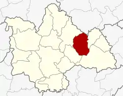 District location in Kalasin Province | |
| Coordinates: 16°38′45″N 103°54′32″E | |
| Country | Thailand |
| Province | Kalasin |
| Seat | Nikhom Huai Phueng |
| Area | |
| • Total | 256.832 km2 (99.163 sq mi) |
| Population (2005) | |
| • Total | 30,343 |
| • Density | 118.1/km2 (306/sq mi) |
| Time zone | UTC+7 (ICT) |
| Postal code | 46170 |
| Geocode | 4614 |
Geography
Neighboring districts are (from the east clockwise): Na Khu, Kuchinarai, Na Mon, and Somdet of Kalasin Province, and Phu Phan of Sakon Nakhon Province.
History
On 5 May 1981 the minor district (king amphoe) Huai Phueng was created by splitting off the three tambons Nikhom Huai Phueng, Kham Bong, and Khai Nun from Khao Wong District.[1] It was upgraded to a full district on 21 May 1990.[2]
Administration
The district is divided into four sub-districts (tambons), which are further subdivided into 52 villages (mubans). Huai Phueng is a township (thesaban tambon) which covers parts of tambon Nikhom Huai Phueng. There are a further four tambon administrative organizations (TAO).
| No. | Name | Thai name | Villages | Pop. | |
|---|---|---|---|---|---|
| 1. | Kham Bong | คำบง | 15 | 10,367 | |
| 2. | Khai Nun | ไค้นุ่น | 13 | 6,444 | |
| 3. | Nikhom Huai Phueng | นิคมห้วยผึ้ง | 16 | 9,070 | |
| 4. | Nong I But | หนองอีบุตร | 8 | 4,462 |
References
- ประกาศกระทรวงมหาดไทย แบ่งท้องที่อำเภอกุฉินารายน์ จังหวัดกาฬสินธุ์ ตั้งเป็นกิ่งอำเภอห้วยผึ้ง (PDF). Royal Gazette (in Thai). 98 (90 ง): 1732. 9 June 1981.
- พระราชกฤษฎีกาตั้งอำเภอห้วยผึ้ง อำเภอวังวิเศษ อำเภอคลองหาด อำเภอป่าบอน อำเภอหนองหญ้าปล้อง อำเภอวังโป่ง อำเภอควนเนียง อำเภอหนองหญ้าไซ อำเภอบ้านนาเดิม อำเภอทุ่งฝน อำเภอสร้างคอม และอำเภอทองแสนขัน พ.ศ. ๒๕๓๓ (PDF). Royal Gazette (in Thai). 107 (83 ก special): 1–4. 21 May 1994.