Somdet District
Somdet (Thai: สมเด็จ, pronounced [sǒm.dèt]) is a district (amphoe) in the northeastern part of Kalasin Province, northeastern Thailand.
Somdet
สมเด็จ | |
|---|---|
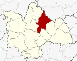 District location in Kalasin Province | |
| Coordinates: 16°42′16″N 103°45′0″E | |
| Country | Thailand |
| Province | Kalasin |
| Seat | Somdet |
| Area | |
| • Total | 454.1 km2 (175.3 sq mi) |
| Population (2005) | |
| • Total | 61,380 |
| • Density | 135.2/km2 (350/sq mi) |
| Time zone | UTC+7 (ICT) |
| Postal code | 46150 |
| Geocode | 4613 |
Geography
Neighboring districts are (from the southeast clockwise): Huai Phueng, Na Mon, Mueang Kalasin, Sahatsakhan, and Kham Muang of Kalasin Province and Phu Phan of Sakon Nakhon Province.
History
The minor district (king amphoe) Somdet was created on 16 August 1964, when the three tambons Somdet, Mu Mon, and Saeng Badan were split-off from Sahatsakhan District.[1] It was upgraded to a full district on 25 February 1969.[2]
Administration
The district is divided into eight sub-districts (tambons), which are further subdivided into 91 villages (mubans). Somdet is a township (thesaban tambon) which covers parts of the tambon Somdet. There are a further eight tambon administrative organizations (TAO).
| No. | Name | Thai name | Villages | Pop. | |
|---|---|---|---|---|---|
| 1. | Somdet | สมเด็จ | 10 | 13,505 | |
| 2. | Nong Waeng | หนองแวง | 16 | 9,774 | |
| 3. | Saeng Badan | แซงบาดาล | 15 | 7,407 | |
| 4. | Maha Chai | มหาไชย | 10 | 4,551 | |
| 5. | Mu Mon | หมูม่น | 11 | 7,103 | |
| 6. | Pha Sawoei | ผาเสวย | 11 | 7,555 | |
| 7. | Si Somdet | ศรีสมเด็จ | 8 | 5,236 | |
| 8. | Lam Huai Lua | ลำห้วยหลัว | 10 | 6,249 |
References
- ประกาศกระทรวงมหาดไทย เรื่อง แบ่งท้องที่การปกครองอำเภอสหัสขันธ์ตั้งเป็นกิ่งอำเภอ (PDF). Royal Gazette (in Thai). 81 (74 ง): 2102. 11 Aug 1964.
- พระราชกฤษฎีกาจัดตั้งอำเภอสมเด็จ อำเภอสีชมพู อำเภอหนองบัวแดง อำเภอบ้านแท่น อำเภอดอนตูม อำเภอนากลาง อำเภอศรีบุญเรือง และอำเภอป่าติ้ว พ.ศ. ๒๕๑๒ (PDF). Royal Gazette (in Thai). 86 (16 ก): 225–229. 25 Feb 1969.