Yang Talat District
Yang Talat (Thai: ยางตลาด, pronounced [jāːŋ tā.làːt]) is a district (amphoe) in the western part of Kalasin Province, northeastern Thailand.
Yang Talat
ยางตลาด | |
|---|---|
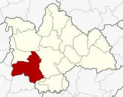 District location in Kalasin Province | |
| Coordinates: 16°24′8″N 103°22′23″E | |
| Country | Thailand |
| Province | Kalasin |
| Area | |
| • Total | 621.084 km2 (239.802 sq mi) |
| Population (2008) | |
| • Total | 129,022 |
| • Density | 207.2/km2 (537/sq mi) |
| Time zone | UTC+7 (ICT) |
| Postal code | 46120 |
| Geocode | 4607 |
Geography
Neighboring districts are (from the northwest clockwise): Huai Mek, Nong Kung Si, Mueang Kalasin, and Khong Chai of Kalasin Province; Kantharawichai and Chiang Yuen of Maha Sarakham Province.
History
Originally named Pachim Kalasin (ปจิมกาฬสินธุ์), the district was renamed Phu Len Chang (ภูแล่นช้าง) in 1913.[1] In 1917, it received its current name Yang Talat.[2]
Administration
The district is divided into 15 sub-districts (tambons), which are further subdivided into 207 villages (mubans). There are six sub-district municipalities (thesaban tambons): Yang Talat covers parts of tambon Yang Talat and Dok Si covers parts of tambons Dok Sombun and Um Mao. Bua Ban, Itue, Hua Na Kham, and Khao Phra Non are further sub-district municipalities which cover the whole same-named sub-district. There are a further 11 tambon administrative organizations (TAO).
| No. | Name | Thai | Villages | Pop.[3] |
|---|---|---|---|---|
| 1. | Yang Talat | ยางตลาด | 20 | 16,226 |
| 2. | Hua Ngua | หัวงัว | 13 | 7,796 |
| 3. | Um Mao | อุ่มเม่า | 12 | 7,443 |
| 4. | Bua Ban | บัวบาน | 22 | 13,157 |
| 5. | Woe | เว่อ | 11 | 4,414 |
| 6. | Itue | อิตื้อ | 12 | 9,105 |
| 7. | Hua Na Kham | หัวนาคำ | 19 | 13,090 |
| 8. | Nong I Thao | หนองอิเฒ่า | 11 | 4,836 |
| 9. | Don Sombun | ดอนสมบูรณ์ | 14 | 8,324 |
| 10. | Na Chueak | นาเชือก | 14 | 7,319 |
| 11. | Khlong Kham | คลองขาม | 19 | 14,224 |
| 12. | Khao Phra Non | เขาพระนอน | 9 | 5,866 |
| 13. | Na Di | นาดี | 9 | 5,702 |
| 14. | Non Sung | โนนสูง | 12 | 7,796 |
| 15. | Nong Tok Paen | หนองตอกแป้น | 10 | 3,724 |
References
- แจ้งความกระทรวงมหาดไทย เรื่อง เปลี่ยนนามอำเภอ (PDF). Royal Gazette (in Thai). 30 (0 ง): 1619–1620. 16 October 1913.
- ประกาศกระทรวงมหาดไทย เรื่อง เปลี่ยนชื่ออำเภอ (PDF). Royal Gazette (in Thai). 34 (0 ก): 40–68. 29 April 1917.
- "Population statistics 2008". Department of Provincial Administration.