Idaho State Highway 36
State Highway 36 (SH-36) is a 73.313-mile-long (117.986 km) east-west state highway located in the southeast part of the U.S. state of Idaho. SH-36 runs from Interstate 15 (I-15) near Malad City to U.S. Route 89 (US-89) near Montpelier. The highway is maintained by the Idaho Transportation Department.
| ||||
|---|---|---|---|---|
| Route information | ||||
| Maintained by ITD | ||||
| Length | 73.313 mi[1][2][3] (117.986 km) | |||
| Major junctions | ||||
| West end | ||||
| East end | ||||
| Location | ||||
| Counties | Oneida, Franklin, Bear Lake | |||
| Highway system | ||||
| ||||

Route description
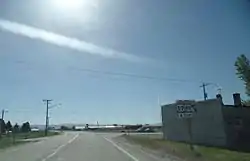
SH-36 begins at a diamond interchange with I-15. As Deep Creek Road, the highway travels east before turning southeast, passing through the forest and just west of Old Baldy Peak before entering the town of Weston. There, SH-36 turns north, entering Dayton before turning east. Crossing the Bear River, the highway continues into the city of Preston, running concurrently with US-91 due north along State Street before turning northeast along a roadway with SH-34. After crossing the Bear River again, SH-36 continues northeast, passing through the community of Mink Creek before passing through fields and forests. SH-36 passes through Liberty before ending in the town of Ovid just west of Montpelier.[1][2][3][4]
Major intersections
| County | Location | mi[1][2][3] | km | Destinations | Notes |
|---|---|---|---|---|---|
| Oneida | | 0.000 | 0.000 | I-15 exit 17; western terminus. | |
| Franklin | Preston | 33.075 | 53.229 | Western end of concurrency with US 91 | |
| 33.905 | 54.565 | Eastern end of concurrency with US 91; western end of concurrency with SH-34 | |||
| | 39.387 | 63.387 | Eastern end of concurrency with SH-34 | ||
| Bear Lake | Ovid | 73.313 | 117.986 | Eastern terminus of SH-36 | |
1.000 mi = 1.609 km; 1.000 km = 0.621 mi
| |||||
References
- "State Highway 36 Milepoint Log" (PDF). Idaho Transportation Department. Archived from the original (PDF) on April 8, 2016. Retrieved July 4, 2016.
- "U.S. 89 Milepoint Log" (PDF). Idaho Transportation Department. Archived from the original (PDF) on April 8, 2016. Retrieved July 4, 2016.
- "State Highway 34 Milepoint Log" (PDF). Idaho Transportation Department. Archived from the original (PDF) on September 13, 2014. Retrieved July 4, 2016.
- Google (July 4, 2016). "Overview map of State Highway 36" (Map). Google Maps. Google. Retrieved July 4, 2016.
External links
![]() Media related to Idaho State Highway 36 at Wikimedia Commons
Media related to Idaho State Highway 36 at Wikimedia Commons
