Montpelier, Idaho
Montpelier is a city in Bear Lake County, Idaho, United States. The population was 2,597 at the 2010 census, down from 2,785 in 2000. The city is the largest community in the Bear Lake Valley, a farming region north of Bear Lake in southeastern Idaho along the Utah border. It was settled in 1863 by Pioneers of The Church Of Jesus Christ on the route of the Oregon Trail. Nearby to the east is the border with Wyoming.
Montpelier, Idaho | |
|---|---|
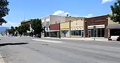 Montpelier, Idaho, downtown view. | |
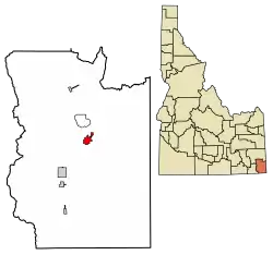 Location of Montpelier in Bear Lake County, Idaho. | |
| Coordinates: 42°19′13″N 111°18′13″W | |
| Country | United States |
| State | Idaho |
| County | Bear Lake |
| Named for | Montpelier, Vermont |
| Government | |
| • Type | Mayor–council[1] |
| • Mayor | Jared Sharp[2] |
| Area | |
| • Total | 2.32 sq mi (6.00 km2) |
| • Land | 2.32 sq mi (6.00 km2) |
| • Water | 0.00 sq mi (0.00 km2) |
| Elevation | 5,981 ft (1,823 m) |
| Population | |
| • Total | 2,597 |
| • Estimate (2019)[5] | 2,538 |
| • Density | 1,094.91/sq mi (422.70/km2) |
| Time zone | UTC-7 (Mountain (MST)) |
| • Summer (DST) | UTC-6 (MDT) |
| ZIP codes | 83220, 83254 |
| Area code(s) | 208, 986 |
| FIPS code | 16-53920 |
| GNIS feature ID | 0396914 |
| Website | montpelier |
History
As happened for many western towns, the name has been changed numerous times. First it was known as Clover Creek by Oregon Trail travelers, later it became Belmont and finally was given the name Montpelier by Brigham Young, one of the early leaders of The Church of Jesus Christ of Latter-day Saints (LDS Church), after the capital of his birth state of Vermont. The city was first settled in 1864.[6]
In 1892, the railroad was extended to Montpelier, with a terminal being located here until 1972. The railroad brought a population that made Montpelier the county's "Gentile Town" as opposed to nearby Mormon-run Paris that was the county seat. Both cities would have tabernacles built in their city limits.
U.S. Routes 89 and 30 intersect in Montpelier.
In 1896, Montpelier was the site of a bank heist by Butch Cassidy and members of Butch Cassidy's Wild Bunch, Elzy Lay and Henry "Bub" Meeks, who were supposedly trying to get enough money to bail out fellow gang member Matt Warner. This historical footnote has become a notable component of the town's identity and is commemorated by a plaque on Washington Street (Highway 89).
The Montpelier Historic District is listed on the National Register of Historic Places. It includes four buildings: the city hall, a high school, the high school's gymnasium, and an LDS church.
Geography
Montpelier is located at 42°19′13″N 111°18′13″W (42.320416, -111.303703),[7] at an elevation of 5,981 feet (1,823 m) above sea level.
According to the United States Census Bureau, the city has a total area of 2.33 square miles (6.03 km2), all of it land.[8]
Demographics
| Historical population | |||
|---|---|---|---|
| Census | Pop. | %± | |
| 1870 | 120 | — | |
| 1880 | 546 | 355.0% | |
| 1890 | 1,174 | 115.0% | |
| 1900 | 1,444 | 23.0% | |
| 1910 | 1,924 | 33.2% | |
| 1920 | 2,984 | 55.1% | |
| 1930 | 2,436 | −18.4% | |
| 1940 | 2,824 | 15.9% | |
| 1950 | 2,682 | −5.0% | |
| 1960 | 3,146 | 17.3% | |
| 1970 | 2,604 | −17.2% | |
| 1980 | 3,107 | 19.3% | |
| 1990 | 2,656 | −14.5% | |
| 2000 | 2,785 | 4.9% | |
| 2010 | 2,597 | −6.8% | |
| 2019 (est.) | 2,538 | [5] | −2.3% |
| U.S. Decennial Census[9] | |||
2010 census
As of the census[4] of 2010, there were 2,597 people, 1,006 households, and 680 families living in the city. The population density was 1,114.6 inhabitants per square mile (430.3/km2). There were 1,234 housing units at an average density of 529.6 per square mile (204.5/km2). The racial makeup of the city was 96.2% White, 0.4% Native American, 0.2% Asian, 2.0% from other races, and 1.2% from two or more races. Hispanic or Latino of any race were 4.9% of the population.
There were 1,006 households, of which 35.0% had children under the age of 18 living with them, 55.6% were married couples living together, 8.1% had a female householder with no husband present, 4.0% had a male householder with no wife present, and 32.4% were non-families. 28.5% of all households were made up of individuals, and 13.1% had someone living alone who was 65 years of age or older. The average household size was 2.55 and the average family size was 3.17.
The median age in the city was 36.4 years. 29.1% of residents were under the age of 18; 6.5% were between the ages of 18 and 24; 23.4% were from 25 to 44; 23.9% were from 45 to 64; and 17.1% were 65 years of age or older. The gender makeup of the city was 48.2% male and 51.8% female.
2000 census
As of the census[10] of 2000, there were 2,785 people, 1,012 households, and 715 families living in the city. The population density was 1,512.3 people per square mile (584.4/km2). There were 1,171 housing units at an average density of 635.9 per square mile (245.7/km2). The racial makeup of the city was 96.70% White, 0.61% Native American, 0.04% Pacific Islander, 1.97% from other races, and 0.68% from two or more races. Hispanic or Latino of any race were 3.81% of the population.
There were 1,012 households, out of which 38.4% had children under the age of 18 living with them, 58.7% were married couples living together, 8.8% had a female householder with no husband present, and 29.3% were non-families. 26.6% of all households were made up of individuals, and 13.9% had someone living alone who was 65 years of age or older. The average household size was 2.70 and the average family size was 3.31.
In the city, the population was spread out, with 32.3% under the age of 18, 8.3% from 18 to 24, 23.6% from 25 to 44, 19.4% from 45 to 64, and 16.6% who were 65 years of age or older. The median age was 34 years. For every 100 females, there were 96.3 males. For every 100 females age 18 and over, there were 93.4 males.
The median income for a household in the city was $29,693, and the median income for a family was $33,639. Males had a median income of $32,218 versus $15,227 for females. The per capita income for the city was $12,364. About 9.2% of families and 12.9% of the population were below the poverty line, including 17.6% of those under age 18 and 9.2% of those age 65 or over.
References
- "City Government - Montpelier, Idaho". montpelier.id.gov. Retrieved January 4, 2020.
- "Mayor and Council - Montpelier, Idaho". montpelier.id.gov. Retrieved January 4, 2020.
- "2019 U.S. Gazetteer Files". United States Census Bureau. Retrieved July 9, 2020.
- "U.S. Census website". United States Census Bureau. Retrieved 2012-12-18.
- "Population and Housing Unit Estimates". United States Census Bureau. May 24, 2020. Retrieved May 27, 2020.
- Leonard J. Arrington. History of Idaho. Vol. 1, p. 273
- "US Gazetteer files: 2010, 2000, and 1990". United States Census Bureau. 2011-02-12. Retrieved 2011-04-23.
- "US Gazetteer files 2010". United States Census Bureau. Archived from the original on 2012-07-02. Retrieved 2012-12-18.
- "Census of Population and Housing". Census.gov. Retrieved June 4, 2015.
- "U.S. Census website". United States Census Bureau. Retrieved 2008-01-31.
External links
| Wikimedia Commons has media related to Montpelier, Idaho. |
Municipalities and communities of Bear Lake County, Idaho, United States | ||
|---|---|---|
| Cities | Map of Idaho highlighting Bear Lake County | |
| CDP | ||
| Unincorporated communities | ||
| ||
| Authority control |
|---|