Ina, Saitama
Ina (伊奈町, Ina-machi) is a town in Saitama Prefecture, Japan. As of 1 February 2016, the town had an estimated population of 44,532, and a population density of 3010 persons per km². Its total area is 14.79 square kilometres (5.71 sq mi).
Ina
伊奈町 | |
|---|---|
 Ina Town Hall | |
 Flag  Seal | |
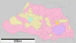 Location of Ina in Saitama Prefecture | |
 Ina | |
| Coordinates: 36°0′0.3″N 139°37′27″E | |
| Country | Japan |
| Region | Kantō |
| Prefecture | Saitama Prefecture |
| District | Kitaadachi |
| Area | |
| • Total | 14.79 km2 (5.71 sq mi) |
| Population (February 2016) | |
| • Total | 44,532 |
| • Density | 3,010/km2 (7,800/sq mi) |
| Time zone | UTC+9 (Japan Standard Time) |
| - Tree | Osmanthus fragrans |
| - Flower | Rose |
| Phone number | 048-721-2111 |
| Address | 9493 Komuro, Ina-machi, Kitaadachi-gun, Saitama-ken 362-8517 |
| Website | http://www.town.saitama-ina.lg.jp/ |
Geography
Located in central-east Saitama Prefecture, Ina is in the flatlands of the Kantō plains.
Surrounding municipalities
History
During the early Edo period, Ina was home to the short-lived (1590-1619) Komuro Domainfounded by Ina Tadatsugu under the Tokugawa shogunate. It was afterward ruled as hatamoto territory.
The villages of Komuro and Kobari were created in Kitaadachi District, Saitama with the establishment of the municipalities system on April 1, 1889. They were merged on July 15, 1943 to form the village of Ina.
Ina was elevated to town status on November 1, 1970.
Economy
The economy of Ina is primarily agricultural.
Education
- Nihon Pharmaceutical University
- Ina has four elementary schools, three middle schools, two combined middle/high schools and one high school.
Transportation
Highway
Ina is not served by any expressways or public highways
Local attractions
- Saitama Cancer Center
- Saitama Prefectural Mental Health Center
External links
| Wikimedia Commons has media related to Ina, Saitama. |
- Official website (in Japanese)
| Saitama |
| |||
|---|---|---|---|---|
| Core cities | ||||
| Special cities |
| |||
| Cities | ||||
| Districts | ||||
| Authority control |
|---|