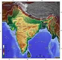
Indian Himalayan Region
The Indian Himalayan Region'(IHR) is the section of the Himalayas within India, spanning 11 Indian states and union territories namely UTs of Jammu and Kashmir and Ladakh, and States of Himachal Pradesh, Uttarakhand, Sikkim,[1] Arunachal Pradesh, Nagaland, Manipur, Mizoram, Tripura, Meghalaya, Assam and West Bengal.[2][3] The region is responsible for providing water to a large part of the Indian subcontinent and contains various flora and fauna.[4]
The IHR physiographically, starting from the foothills of south (Shivaliks), this mountain range extends up to Tibetan plateau on the north (Trans-Himalaya). Three major geographical entities, the Himadri (greater Himalaya), Himanchal (lesser Himalaya) and the Shiwaliks (outer Himalaya) extending almost uninterrupted throughout its length, are separated by major geological fault lines. Mighty but older streams like the Indus, Sutlej, Kali, Kosi and Brahmaputra have cut through steep gorges to escape into the Great Plains and have established their antecedence.
The northernmost range of mountains are the Karakoram Mountains that continue into Pakistan and China. To the south of the Karakoram Range lies Parallel to the Zanskar Ranges and parallel to Pir Panjal Ranges. These three mountain ranges lie parallel to each other in the north-western part of India, most of its area lying in the state of Jammu and Kashmir as its capital Srinagar, too.
Some of the highest mountains on earth are found in the region. Many rivers considered holy like the Ganga and supplying 13th to draw a flow from the Himalayas.
Trans-Himalaya
Trans himalaya is created due to the collision with the Eurasian plate. This Zone is the northernmost area in the country in the states of Jammu and Kashmir and Himachal Pradesh. It is an extension of Tibetan plateau around the Himalayas. The Main Himalayan Ranges are as follows:
- Pir Panjal Range (part of middle Himalayas)
- Dhauladhar Range madya himalaya
- Zanskar Range
- Ladakh Range
- East Karakoram Range
- Mahabharata range (middle Himalayas in Nepal)
Pir Panjal Range
To the south of the main Himalayas lies the Pir Panjal Range at an average height of 5,000 metres (16,000 ft). From Gulmarg in the northwest it follows the southern rim of the Kashmir valley to the Banihal Pass. Here the Pir Panjal meets the ridgeline that separates the Kashmir valley from the Warvan Valley. The major passes here in Pir Panjal are the Pir Panjal Pass due west of Srinagar, the Banihal Pass which lies at the top of the Jhelum River at the southern end of the Kashmir valley, and the Sythan Pass linking Kashmir with Kishtwar and Salooni.
Dhauladhar Range
To the south of the Pir Panjal lies the Dhauladhar range. Both ranges are visible from Salooni of Chamba. It is easily visible because of its distinct feature of the snow-capped ridge, which forms the division between the Ravi and the Beas valleys. In the west it divides the Chenab valley and the Tawi Valley. Towards the east it extends across Himachal Pradesh forming the high ridges of the Large gorge and extending towards the south of the Pin Parvati Valley before it forms the ridgeline east of the Sutlej River. The rivers flow from it.
Zanskar Range
The Zanskar Range lies to the north of the main Himalaya. It acts as a backbone of Ladakh south of the Indus River, extending from the ridges beyond Lamayuru in the west across the Zanskar region; there it is divided from the main Himalaya by the Stod and Tsarap valleys, the Zanskar valley. On the east of the Zanskar region the range continues through the Lahaul and Spiti district and Pangi of the Chamba. While in the north it continues across the Kinnaur before extending towards west across Uttarakhand. Some of the main passes are the Fatu La, on the Leh-Srinagar road, while the main trekking passes into the Zanskar valley are Singge La, the Cha Cha La and the Rubrang La.
Ladakh Range
To the north of the Leh lies the Ladakh Range and it is an important part of the Trans-Himalayan range that merges with the Kailash Range in Tibet. Here the important passes are the famous Khardung La, and Digar La, which lie to the northeast of Leh.
East Karakoram Range
The Karakoram is a giant range, which geographically divides India and Central Asia. The range consists of high mountain peaks like Saltoro Kangri, Rimo and Teram Kargri. The Korakoram Pass acts as the main connector between the markets of Yarkand, Leh and Kashgar.
Shiwalik Hills
The Shivalik Hills lie to the south of the Dhaula Dhar, with an average height of 1,500 to 2,000 m. It includes the Jammu hills and Vaishno Devi, and extends to Kangra and further east to the range south of Mandi. In Uttarakhand it stretches from Dehradun to Almora (covers almost the entire Kumaon and Garhwal region) and across the southern borders of India. The hills are in the foothills of Himalayas.
References
- O'Neill, Alexander; et al. (25 February 2020). "Establishing Ecological Baselines Around a Temperate Himalayan Peatland". Wetlands Ecology & Management. doi:10.1007/s11273-020-09710-7.
- http://gbpihedenvis.nic.in/indian_him_reg.htm
- https://www.globalsecurity.org/military/world/india/ihr.htm
- Sustainable development of the Indian Himalayan region : Linking ecological and economic concerns
External links
 Himalayan North travel guide from Wikivoyage
- Resource Information Database of Indian Himalaya