Kishtwar
Kishtwar is a municipality in the Kishtwar District of the Jammu region in the Indian union territory of Jammu and Kashmir.[1] District Kishtwar was carved out in the year 2007 and it started functioning as an independent administrative unit on 01-04-2007. Kishtwar town, the headquarter of District Kishtwar is situated at a distance of 235 km (146 mi) from the winter capital of Jammu. The altitude of the district varies from 3,000–15,000 ft (910–4,570 m) above mean sea level. Commonly known as the "Land of Sapphire and Saffron", it is also very rich in forests and wildlife. Kishtwar is surrounded by the districts Anantnag and Doda and also touches the boundaries of state Himachal Pradesh.
Kishtwar | |
|---|---|
City | |
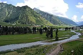 Warwan valley | |
 Kishtwar Location in Jammu and Kashmir, India  Kishtwar Kishtwar (India) | |
| Coordinates: 33.32°N 75.77°E | |
| Country | |
| Union Territory | Jammu and Kashmir |
| District | Kishtwar |
| Elevation | 1,638 m (5,374 ft) |
| Population (2011) | |
| • Total | 14,865 |
| Languages | |
| • Official | Urdu |
| • Spoken | Kashmiri is spoken by Muslims. Kishtwari, an ancient language with its roots in Sanskrit, is spoken by Hindus Bhoti is another local dialect |
| Time zone | UTC+5:30 (IST) |
| PIN | 182204 |
| Vehicle registration | JK17 |
| Website | www |
History
Kishtwar is first referred to in the Rajatarangini by the ancient name Kashthavata[2][3] during the reign of Raja Kalsa of Kashmir (1063–1089), when "Uttamaraja", the ruler of Kashthavata visited the court of the Kashmir King in company with several other hill chiefs to pay their respects to the Raja. This place, as said by people, is also mentioned in the epic Mahabharata.
Kishtwar merged with the State of Jammu and Kashmir when Maharaja Ranjit Singh annexed it in 1821, A.D. With the passage of time Kishtwar became a Tehsil of the Udhampur district and remained so until 1948, when it became part of the newly created District Doda in the wake of first re-organization of the state during the post-independence period.
Demographics
As of 2011 India census Kishtwar had a population of 14,865. Males constitute 63% of the population and females 37%. Kishtwar has an average literacy rate of 78%, higher than the Indian national average: male literacy is 82%, and female literacy is 42%. In Kishtwar, 11% of the population is under six years of age. The main language spoken here by the Muslims is Kashmiri and local Hindus of Kishtwar speak a local dialect of Kashmiri language called Kashtwari.[5] The dominant religion in Kishtwar is Islam with 69.21% population Muslims following Hinduism with second-largest religion with 29.59% as Hindus.
Transport
Air
Kishtwar does not have its own airport as of now, though, there is a helipad in Kishtwar which is located just 3 kilometres north of the city of Kishtwar. The government had started a project in which Kishtwar is to get its own airstrip of 1200–1300 meters long in upcoming years. The government is upgrading it into a full-fledged airstrip.[6][7] The nearest airports to Kishtwar are Jammu Airport and Srinagar International Airport located 219 and 211 kilometres respectively.
Rail
There is no rail-connectivity to Kishtwar yet. The nearest railway station to Kishtwar is Banihal railway station located 174 kilometres from Kishtwar. The nearest major railway station is Jammu Tawi railway station, located at a distance of 221 kilometres.
Road
Kishtwar is well-connected by roads to other places in Jammu and Kashmir and India as several highways and roads pass through Kishtwar including NH 244.
References
- "District Kishtwar".
- "Kishtewar".
- Development Institute, MSME. "Brief Industrial Profile of Kishatwar District" (PDF).
- "Kishtwar District Religion Census 2011". 1 January 2011.
- Kashmiri, Ethnologue, retrieved 14 July 2018.
- "Construction works of airstrip at Kishtwar to begin soon". The Dispatch. 30 May 2020. Retrieved 2 June 2020.
- "Kishtwar in J&K to get full-fledged Airport". Press Information Bureau (Govt. of India). Retrieved 16 January 2018.