Indian Lake, Pennsylvania
Indian Lake is a borough in Somerset County, Pennsylvania. It is part of the Johnstown, Pennsylvania Metropolitan Statistical Area. The population was 394 at the 2010 census, down from 450 in 2000. Indian Lake is home to Indian Lake Golf Club, which opened in 1974, and was the first to be designed by Arnold Palmer,[3] Northwinds Golf Course (public), Indian Lake Resort (fine dining, banquet, and lodging), Indian Lake Marina, and the James W. McIntyre Hiking and Biking Trail.
Indian Lake, Pennsylvania | |
|---|---|
Borough | |
 Location of Indian Lake in Somerset County, Pennsylvania. | |
 Location of Indian Lake in Somerset County, Pennsylvania. | |
| Coordinates: 40°02′51″N 78°51′33″W | |
| Country | United States |
| State | Pennsylvania |
| County | Somerset |
| Established | 1966 |
| Government | |
| • Type | Borough Council |
| • Mayor | Michael Miscoe |
| Area | |
| • Total | 4.35 sq mi (11.26 km2) |
| • Land | 3.56 sq mi (9.23 km2) |
| • Water | 0.79 sq mi (2.04 km2) |
| Elevation | 2,281 ft (695 m) |
| Population (2010) | |
| • Total | 394 |
| • Estimate (2019)[2] | 378 |
| • Density | 106.09/sq mi (40.96/km2) |
| Time zone | UTC-5 (Eastern (EST)) |
| • Summer (DST) | UTC-4 (EDT) |
| Area code(s) | 814 |
| FIPS code | 42-36888 |
| Website | Indian Lake Home Page |
While the crash of United Airlines Flight 93 is often reported as Shanksville, it is actually closer to Indian Lake, about 1.5 versus 2 miles away. The actual location of the crash was in a field in Stonycreek Township.
Geography
Indian Lake is located at 40°2′51″N 78°51′33″W (40.047616, -78.859198).[4]
According to the United States Census Bureau, the borough has a total area of 4.5 square miles (12 km2), of which, 3.7 square miles (9.6 km2) of it is land and 0.8 square miles (2.1 km2) of it (17.26%) is water.
Indian Lake has the fourth-highest elevation of towns in Pennsylvania, at 2281 feet.[5] This is the Lake water level, homes at Indian Lake range from 2300 to 2550 feet in base elevation.
Demographics
| Historical population | |||
|---|---|---|---|
| Census | Pop. | %± | |
| 1970 | 129 | — | |
| 1980 | 306 | 137.2% | |
| 1990 | 388 | 26.8% | |
| 2000 | 450 | 16.0% | |
| 2010 | 394 | −12.4% | |
| 2019 (est.) | 378 | [2] | −4.1% |
| Sources:[6][7][8] | |||
As of the census[7] of 2000, there were 450 people, 206 households, and 146 families residing in the borough. The population density was 122.0 people per square mile (47.1/km2). There were 548 housing units at an average density of 148.5 per square mile (57.3/km2). The racial makeup of the borough was 99.33% White, 0.22% from other races, and 0.44% from two or more races. Hispanic or Latino of any race were 0.44% of the population.
In 2000 there were 206 households, of which 16.5% had children under the age of 18 living with them, 66.0% were married couples living together, 1.9% had a female householder with no husband present, and 29.1% were non-families. 22.3% of all households were made up of individuals, and 9.7% had someone living alone who was 65 years of age or older. The average household size was 2.18 and the average family size was 2.53.
In the borough the population has 14.2% under the age of 18, 4.4% from 18 to 24, 27.3% from 25 to 44, 34.7% from 45 to 64, and 19.3% who were 65 years of age or older. The median age was 47 years. For every 100 females there were 110.3 males. For every 100 females aged 18 and over, there were 113.3 males.
The median income for a household in the borough was $53,750, and the median income for a family was $58,214. Males had a median income of $44,792 versus $28,750 for females. The per capita income for the borough was $27,630. About 1.4% of families and 2.9% of the population were below the poverty line, including none of those under age 18 and 2.8% of those age 65 or over.
References
- "2019 U.S. Gazetteer Files". United States Census Bureau. Retrieved July 28, 2020.
- "Population and Housing Unit Estimates". United States Census Bureau. May 24, 2020. Retrieved May 27, 2020.
- "Indian Lake Golf Club". golflink.com.
- "US Gazetteer files: 2010, 2000, and 1990". United States Census Bureau. 2011-02-12. Retrieved 2011-04-23.
- Highest Elevation of Towns in Pennsylvania
- "Census of Population and Housing". U.S. Census Bureau. Retrieved 11 December 2013.
- "U.S. Census website". United States Census Bureau. Retrieved 2008-01-31.
- "Incorporated Places and Minor Civil Divisions Datasets: Subcounty Resident Population Estimates: April 1, 2010 to July 1, 2012". Population Estimates. U.S. Census Bureau. Archived from the original on 17 June 2013. Retrieved 11 December 2013.
Municipalities and communities of Somerset County, Pennsylvania, United States | ||
|---|---|---|
| Boroughs | 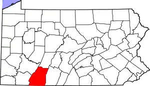 | |
| Townships | ||
| CDPs | ||
| Unincorporated communities | ||
| Footnotes | ‡This populated place also has portions in an adjacent county or counties | |
| ||