Isogo-ku, Yokohama
Isogo-ku (磯子区) is one of the 18 wards of the city of Yokohama in Kanagawa Prefecture, Japan. As of 2010, the ward has an estimated population of 163,406 and a population density of 8,520 persons per km². The total area is 19.17 km².
Isogo
磯子区 | |
|---|---|
| Isogo Ward | |
Flag | |

| |
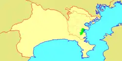 Location of Isogo in Kanagawa | |
 Isogo | |
| Coordinates: 35°24′8″N 139°37′8″E | |
| Country | Japan |
| Region | Kantō |
| Prefecture | Kanagawa |
| City | Yokohama |
| Area | |
| • Total | 19.17 km2 (7.40 sq mi) |
| Population (February 2010) | |
| • Total | 163,406 |
| • Density | 8,520/km2 (22,100/sq mi) |
| Time zone | UTC+9 (Japan Standard Time) |
| - Tree | Prunus mume |
| - Flower | Cosmos |
| Address | 3-5-1 Isogo, Isogo-ku Yokohama-shi, Kanagawa-ken 235-0016 |
| Website | Isogo Ward Office |

Geography
Isogo is located in eastern Kanagawa Prefecture, and in the southeast corner of the city of Yokohama. The area is largely flatland, with scattered small hills. The Ward is bordered to the east by Tokyo Bay.
Surrounding municipalities
History
During the Edo period, area around present-day Isogo Ward was formerly part of the tenryō territory in Sagami Province controlled directly by the Tokugawa shogunate, but administered through various hatamoto. The area consisted of small fishing villages, noted primarily for their catch of Sea cucumber. After the Meiji Restoration, the area became part of Kuraki District in the new Kanagawa Prefecture. In the cadastral reform of April 1, 1889, the area was divided into numerous villages. On April 1, 1901, Negishi village was annexed by neighboring Yokohama. The remaining northern portions of the district were annexed in 1911 and 1927. On October 10, 1927, the 14 former towns and villages were re-organized as Isogo Ward within the city of Yokohama.
Isogo Ward annexed the remaining southern portions of Kuraki District (Kanazawa Town and Mutsuuraso Village) in October 1936. During World War II, Isogo was bombed twice: once on April 15, 1945, and again during the devastating Yokohama Air Raid of May 29, 1945, during which 692 houses were burned down. On May 15, 1948, Kanazawa Ward was separated from Isogo Ward. During the 1960s, the coastal areas of Isogo were converted into a massive chemical and petrochemical industrial zone through the extensive use of landfill, and the population of the area increased dramatically. The Isogo Ward offices relocated to their present location in June 1967.
Economy
Isogo is largely a regional commercial center and bedroom community for central Yokohama, Kawasaki and Tokyo. The coastal area is part of the Keihin heavy industrial zone, and has numerous chemical and petrochemical plants.
Transportation
Railroads
- East Japan Railway Company - Negishi Line
- Negishi- Isogo - Shin-Sugita - Yōkōdai
- Keihin Electric Express Railway-Keikyū Main Line
- Yokohama New Transit Co., Ltd - Kanazawa Seaside Line
Highways
- Bayshore Route
- National Route 16
- National Route 357
- Kanagawa Prefectural Road 22
Education
Secondary school:
- Yokohama Gakuen
Senior high schools:
- Hitorizawa High School
- Isogo High School
- Isogo Technical High School
- Yokohama Commercial High School(Barber and beautician)
- Kashima Gakuen High School(Isogo Serendip campus)
Junior high schools:
- Hama
- Mori
- Negishi
- Okamura
- Shiomidai
- Yōkōdai-Dai-ichi
- Yōkōdai-Daini
Primary schools:
|
|
|
|
The South Korean government maintains the Korea Education Institution in Kanagawa (Korean: 가나가와한국종합교육원, Japanese: 神奈川韓国綜合教育院) in this ward.[1]
Notable people
- Hibari Misora, singer and actress
- Nobuhiko Takada, professional wrestler
References
- Kato, Yuzo. Yokohama Past and Present. Yokohama City University (1990).
- "Home". Korea Education Institution in Kanagawa. Retrieved 2020-05-16.
Isogo 3-10-28, Isogo-ku, Yokohama-shi, Kanagawa-ken, 235-0016, Japan
External links
| Wikimedia Commons has media related to Isogo-ku, Yokohama. |
- Isogo Ward Office
 Geographic data related to Isogo-ku, Yokohama at OpenStreetMap
| Yokohama |
| |||
|---|---|---|---|---|
| Kawasaki |
| |||
| Sagamihara |
| |||
| Core city | ||||
| Special cities | ||||
| Cities | ||||
| Districts | ||||
| Authority control |
|---|