Ebina, Kanagawa
Ebina (海老名市, Ebina-shi) is a city located in Kanagawa Prefecture, Japan.[1]
Ebina
海老名市 | |
|---|---|
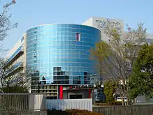
 Ebina City Hall | |
 Flag  Seal | |
 Location of Ebina in Kanagawa Prefecture | |
 Ebina | |
| Coordinates: 35°26′47″N 139°23′27″E | |
| Country | Japan |
| Region | Kantō |
| Prefecture | Kanagawa Prefecture |
| Government | |
| • Mayor | Masaharu Uchino |
| Area | |
| • Total | 26.59 km2 (10.27 sq mi) |
| Population (April 1, 2017) | |
| • Total | 130,860 |
| • Density | 4,900/km2 (13,000/sq mi) |
| Time zone | UTC+9 (Japan Standard Time) |
| - Tree | Box tree |
| - Flower | Azalea |
| - Bird | Greenfinch |
| Phone number | 046-231-2111 |
| Address | 175-1 Katase, Ebina-shi, Kanagawa-ken 243-0492 |
| Website | http://www.city.ebina.kanagawa.jp/ |
As of April 1, 2017, the city had an estimated population of 130,860, with 54,509 households,[2] and a population density of 4,900 persons per km². The total area is 26.69 km².
Geography
Ebina is located in the middle of the Sagami Plain, part of western Kantō Plain. The city sits on the eastern bank of the Sagami River, and the Hikiji River flows through part of the city. The Tōmei Expressway cuts across the southern end of the city.[1]
Climate
| Climate data for Ebina (1981 - 2010) | |||||||||||||
|---|---|---|---|---|---|---|---|---|---|---|---|---|---|
| Month | Jan | Feb | Mar | Apr | May | Jun | Jul | Aug | Sep | Oct | Nov | Dec | Year |
| Record high °C (°F) | 19.2 (66.6) |
25.3 (77.5) |
25.1 (77.2) |
31.0 (87.8) |
33.4 (92.1) |
37.6 (99.7) |
37.9 (100.2) |
37.6 (99.7) |
37.6 (99.7) |
32.6 (90.7) |
26.1 (79.0) |
24.2 (75.6) |
37.9 (100.2) |
| Average high °C (°F) | 10.6 (51.1) |
11.0 (51.8) |
13.8 (56.8) |
19.2 (66.6) |
23.2 (73.8) |
25.8 (78.4) |
29.6 (85.3) |
31.2 (88.2) |
27.5 (81.5) |
22.3 (72.1) |
17.4 (63.3) |
13.1 (55.6) |
20.4 (68.7) |
| Daily mean °C (°F) | 4.6 (40.3) |
5.3 (41.5) |
8.6 (47.5) |
13.8 (56.8) |
18.2 (64.8) |
21.5 (70.7) |
25.1 (77.2) |
26.5 (79.7) |
23.0 (73.4) |
17.4 (63.3) |
11.9 (53.4) |
7.0 (44.6) |
15.3 (59.5) |
| Average low °C (°F) | −0.7 (30.7) |
0.0 (32.0) |
3.4 (38.1) |
8.6 (47.5) |
13.5 (56.3) |
17.8 (64.0) |
21.7 (71.1) |
22.9 (73.2) |
19.4 (66.9) |
13.3 (55.9) |
7.2 (45.0) |
1.6 (34.9) |
10.7 (51.3) |
| Record low °C (°F) | −7.2 (19.0) |
−8.6 (16.5) |
−5.6 (21.9) |
−2.7 (27.1) |
4.7 (40.5) |
10.7 (51.3) |
14.2 (57.6) |
17.5 (63.5) |
10.6 (51.1) |
2.0 (35.6) |
−1.5 (29.3) |
−7.3 (18.9) |
−8.6 (16.5) |
| Average precipitation mm (inches) | 61.2 (2.41) |
68.4 (2.69) |
141.3 (5.56) |
152.3 (6.00) |
150.7 (5.93) |
189.1 (7.44) |
180.6 (7.11) |
193.2 (7.61) |
243.6 (9.59) |
205.2 (8.08) |
108.6 (4.28) |
58.3 (2.30) |
1,729.9 (68.11) |
| Average precipitation days (≥ 1.0 mm) | 5.6 | 6.2 | 11.2 | 10.5 | 10.5 | 12.6 | 11.6 | 9.2 | 12.6 | 10.4 | 7.5 | 4.8 | 112.7 |
| Mean monthly sunshine hours | 174.3 | 158.4 | 154.7 | 170.0 | 163.8 | 121.9 | 150.6 | 183.2 | 125.6 | 129.3 | 142.9 | 172.0 | 1,848.5 |
| Source 1: Japan Meteorological Agency | |||||||||||||
| Source 2: 観測史上1〜10位の値(年間を通じての値) | |||||||||||||
History
The area of modern Ebina has been settled since prehistoric times, and has a number of remains from the Kofun period. Ebina became the provincial capital of Sagami Province in the Nara period, and was the location of the kokubunji, or provincial temple.[1] It was home to the Yokoyama clan, one of the seven warrior clans of the Musashi region during the early Kamakura period. During the Edo period, the lands around Ebina were tenryō territory theoretically administered directly by the Tokugawa Shogunate in Edo; however, in reality, the area was a patchwork of small fiefs held by various hatamoto, as well as exclaves under the control of Sakura Domain and Karasuyama Domain.
After the Meiji Restoration, the area became part of Kōza District, Kanagawa Prefecture and was administratively divided into Ebina Village and Arima Village on April 1, 1889. The area was connected by rail in 1926 via the Sagami Railway and in 1927 by the Odakyu Electric Railway, leading to an increase in population and a change in status of Ebina from village to town in 1940. In 1955, Arima Village merged into Ebina Town. Ebina was elevated to city status on November 1, 1971. Urban development projects in the 1980s and 1990s have modernized the city center.[1]
Economy
Ebina is home to over 150 factories. The town is a center of the production of electrical appliances, metal products, and machinery. The Taito Corporation operates the Ebina Development Center in Ebina. The city was once known for its broad rice paddies, but agriculture now centers on the cultivation of strawberries, tomatoes, and ornamental plants. Ebina serves as a bedroom community to the greater Tokyo and Yokohama area.[1][3]
Transportation
Railway
Highway
.png.webp) Tōmei Expressway - Ebina Service Area - Ebina Junction
Tōmei Expressway - Ebina Service Area - Ebina Junction.png.webp) Shin-Tōmei Expressway - Ebina-minami Junction
Shin-Tōmei Expressway - Ebina-minami Junction.png.webp) Ken-Ō Expressway - Ebina-minami Junction - Ebina Interchange - Ebina Junction
Ken-Ō Expressway - Ebina-minami Junction - Ebina Interchange - Ebina Junction National Route 246
Local attractions
- Sagami Kokubun-ji, provincial temple of Sagami Province and national historic landmark
- Ebina Premium Film Festival (held annually in autumn)
Notable people from Ebina
- Akiko Kijimuta - Japanese former professional tennis player
- Haruma Saikyo - Japanese kickboxer
- Kensuke Kitahama - Japanese professional shogi player, ranked 8-dan
- Miyu Nagasaki - Japanese table tennis player
- Naoko Kijimuta - Japanese former professional tennis player
- Riko Gunji - Japanese badminton player
- Syuri Kondo - Japanese professional wrestler, shoot boxer, kickboxer and mixed martial artist
- Takashi Kamoshida - Japanese football player (Fukushima United FC, J3 League)
- Yukiya Yokoyama - Japanese former Nippon Professional Baseball pitcher
References
- "Ebina". Encyclopedia of Japan. Tokyo: Shogakukan. 2012. OCLC 56431036. Archived from the original on 2007-08-25. Retrieved 2012-07-27.
- "Official website of Ebina City" (in Japanese). Japan: Ebina City. Retrieved 7 May 2017.
- "Company Overview Archived 2011-07-16 at the Wayback Machine." Taito Corporation. Retrieved on January 30, 2011. "Ebina Development Center 3-11-1, Shimoimaizumi, Ebina-shi, Kanagawa 243-0498, JAPAN"
External links
| Wikimedia Commons has media related to Ebina, Kanagawa. |
- Official Website (in Japanese)
| Yokohama |
| |||
|---|---|---|---|---|
| Kawasaki |
| |||
| Sagamihara |
| |||
| Core city | ||||
| Special cities | ||||
| Cities | ||||
| Districts | ||||
| Authority control |
|---|
