Jackrabbit, Arizona
Jackrabbit was an early 20th century mining community in Pinal County, Arizona, just north of the border of Pima County.[2] It has an estimated elevation of 1,542 feet (470 m) above sea level.[1]
Jackrabbit, Arizona | |
|---|---|
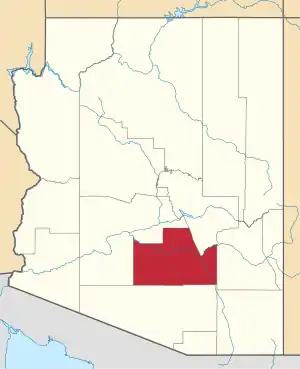
 Jackrabbit Location within the state of Arizona  Jackrabbit Jackrabbit (the United States) | |
| Coordinates: 32°36′19″N 111°53′45″W | |
| Country | United States |
| State | Arizona |
| County | Pinal |
| Elevation | 1,542 ft (470 m) |
| Time zone | UTC-7 (Mountain (MST)) |
| • Summer (DST) | UTC-7 (MST) |
| Area code(s) | 928 |
| FIPS code | 04-35690 |
| GNIS feature ID | 24472 |
The Jackrabbit area is located at the northern end of the Slate Mountains and includes the Jackrabbit, Turning Point, and the Desert Queen Mines. Mining activity peaked in 1910 and at that time, human settlement in the area was concentrated in the community of Jackrabbit. By 1960, there was no active mining in the area, few remains of any building or equipment, and no human habitation.[3]
References
- "Feature Detail Report for: Jackrabbit House". Geographic Names Information System. United States Geological Survey.
- "Jackrabbit House (in Pinal County, AZ) Populated Place Profile". AZ Hometown Locator. Retrieved November 29, 2016.
- Hammer, Donald F. (1961). Geology and Ore Deposits of the Jackrabbit Area, Pinal County, Arizona (PDF) (Master's). University of Arizona. Retrieved April 23, 2020.
This article is issued from Wikipedia. The text is licensed under Creative Commons - Attribution - Sharealike. Additional terms may apply for the media files.