Jamaterek
Jamaterek (Uighur: جامالتېرەك يېزىسى,[4] from Mandarin Chinese Jiamatiereke Chinese: 加马铁热克乡; pinyin: Jiāmǎtiěrèkè Xiāng) is a township of Akto County in Xinjiang Uygur Autonomous Region, China. Located in the northeastern part of the county, the township covers an area of 44 square kilometers with a population of 11,398 (as of 2017). It has 7 administrative villages under its jurisdiction. Its seat is at Bagla Village (巴格拉村).[1]
Jamaterek
جامالتېرەك يېزىسى 加马铁热克乡 Jiamatiereke | |
|---|---|
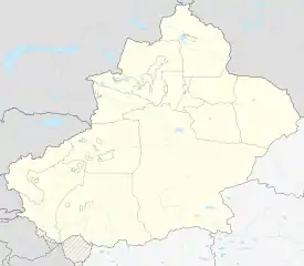
 Jamaterek Location of the township | |
| Coordinates: 39.2066895254°N 76.1073172178°E | |
| Country | People's Republic of China |
| Autonomous region | Xinjiang |
| Prefecture | Kizilsu |
| County | Akto (Aketao) |
| Area | |
| • Total | 44 km2 (17 sq mi) |
| Population (2017) | |
| • Total | 11,398 |
| [1] | |
| Ethnic groups | |
| • Major ethnic groups | Uyghur[2][3] |
| Time zone | UTC+8 (China Standard Time) |
| postal code | 845554 |
| Area code(s) | 653022 204 |
| Website | www.xjakt.gov.cn |
Name
The name of Jamal terek or Jamalterak[3] is from Uyghur language, Jamal is a personal name, and terek means "poplar tree" (杨树). It is said that 250 years ago (about 1770s), there was a tall poplar tree in Tairegeilikehuoyila (台热给力克霍伊拉), near which lived a capable woman named Jamal Han (加馬汗), so the land was named after it.[5][6]
History
In 1955, Jamalterak was transferred to Akto County from Yengisar.[3]
In 1962, a commune was founded (加马铁热克公社).[2]
In 1967, the commune was renamed Shuguang Commune (曙光公社).[2]
In 1984, the commune was renamed and made into a township.[2]
Geography
Jamaterek Township is located between the east longitude 76°36′- 76°41′ and the north latitude 39°04′- 39°29′, to the northeast of the county seat. It is bordered by Shufu County to the east and south, by Pilal Township and Tortayi Farm to the west, by the 41st Regiment (41团) of the XPCC across Yuepuhu River (岳普湖河) to the north. Its maximum distance is 10 kilometers from west to east and 6 kilometers from north to south, with a total area of 44 square kilometers, arable land area of 2,240 hectares. The seat of the township is 15 kilometers away from the county seat, with a road mileage of 20 kilometers.
The average elevation of Jamaterek Township is 1,302 meters. The terrain is flat, the groundwater level is high, the climate is mild, the precipitation is scarce, the annual average temperature is 17.5℃, and the frost-free period is 180 – 220 days. It is a agriculture-oriented, animal husbandry, forest fruit industry coordinated development of agricultural township, mainly planting wheat, corn, cotton and other crops.[7]
Administrative divisions
The township has 7 villages under its jurisdiction.[8][2]
- 7 villages
- Bagla Village (Bagela, Bagelacun;[9] 巴格拉村) 39°12′11″N 076°04′36″E
- Kashboy Village (قاشبويى كەنت / Kashiboyi; 喀什博依村)
- Konahoyla Village (Kuonahuoyila; 阔纳霍伊拉村/阔纳霍依拉村)
- Koshterek Village (Kuoshitiereke; 阔什铁热克村)
- Sakkizerik Village (Saikezi'airike; 赛克孜艾日克村)
- Turtay Village (Tuo'ertayi; 托尔塔依村)
- Wukamaili Village (乌卡买里村)
Demographics
| Year | Pop. | ±% p.a. |
|---|---|---|
| 2000 | 9,591 | — |
| 2010 | 10,311 | +0.73% |
| [10] | ||
As of 1997, the population of Barin Township was 99.7% Uyghur.[2]
Economy
Livestock raised in Jamalterak include cattle, donkeys, and sheep.[3]
References
- 加马铁热克乡(概况). xjakt.gov.cn. 2018-06-04. Retrieved 2019-07-08.
- 1997年阿克陶县行政区划 [1997 Akto County Administrative Divisions] (in Chinese). XZQH.org. 31 December 2010. Retrieved 11 September 2020.
加马铁热克乡 1962年成立加马铁热克公社,1967年更名曙光公社,1984年改设加马铁热克乡。位于县城东北20千米。面积43平方千米,人口0.2万,其中维吾尔族占99.7%。喀(什)和(田)公路从辖区旁边通过,辖巴格拉、赛克孜艾日克、阔纳霍伊拉、乌科、喀什博依、库什铁热克6个行政村。
- Xie Yuzhong 解玉忠 (2003). 地名中的新疆 (in Chinese). Ürümqi: 新疆人民出版社. p. 192. ISBN 7-228-08004-1.
- Amangul Abdurrahman ئامانگۈل ئابدۇراخمان, ed. (18 August 2020). ئامباردا ھەقسىز ساقلاشتىن نەپكە ئېرىشىش ئېلېكتىرونلۇق سودا ياردەم تولۇقلىمىسىدىن بەھرىلىنىش. Xinjiang Daily (in Uyghur). Retrieved 12 September 2020.
ئاقتۇ ناھىيەسىنىڭ جامالتېرەك يېزىسى
- 阿克陶县行政区划和居民地名称. xjkz.gov.cn. 2018-05-04. Retrieved 2019-11-08.
- 加马铁热克乡简介. GOVERNMENT OF AKETAO. Archived from the original on 3 April 2015. Retrieved 13 September 2020 – via Internet Archive.
- 阿克陶县加马铁热克乡特色林果业建设项目可行性报告. wodefanwen.com. 2012-07-01. Retrieved 2019-11-08.; jinchutou.com
- 2019年加马铁热克乡行政区划代码. National Bureau of Statistics of China. 2019. Retrieved 11 September 2020.
- Bagelacun (Approved - N) at GEOnet Names Server, United States National Geospatial-Intelligence Agency
- 阿克陶县历史沿革. XZQH.org (in Chinese). 29 January 2019. Archived from the original on 19 August 2019. Retrieved 7 September 2020 – via Internet Archive.
2000年第五次人口普查,阿克陶县常住总人口163024人,其中:{...}加马铁力克乡 9591人、{...}2010年第六次人口普查,阿克陶县常住总人口199065人,其中:{...}加马铁力克乡10311人,{...
}