Jarbidge Wilderness
The Jarbidge Wilderness is a wilderness area located in the Jarbidge Mountains of northern Elko County in northeastern Nevada, United States. It is contained within the Jarbidge Ranger District of the Humboldt-Toiyabe National Forest.[1][2]
| Jarbidge Wilderness | |
|---|---|
IUCN category Ib (wilderness area) | |
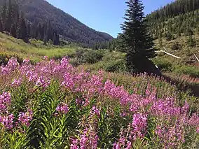 Wildflowers in the upper Jarbidge River Canyon | |
 | |
| Location | Elko County, Nevada, USA |
| Nearest city | Jarbidge, NV |
| Coordinates | 41°45′41″N 115°19′13″W |
| Area | 113,167 acres (457.97 km2) |
| Established | January 1, 1964 |
| Governing body | U.S. Forest Service |
"Jarbidge" is a name derived from the Shoshone language meaning "devil".[3] Indians believed the hills in the area were haunted.[4]
Geography
The original Jarbidge Wilderness was established by the 1964 Wilderness Act, and was the first wilderness area protected in Nevada. Expanded in 1989 by the Nevada Wilderness Act, this wilderness is now over 113,000 acres (46,000 ha).
The wilderness area contains the headwaters of both the Marys and Jarbidge Rivers, and of Salmon Falls Creek. Emerald and Jarbidge Lakes are also within its boundaries. Nearly ten mountain peaks of greater than 10,000 feet (3,000 m) are located within the wilderness.[5]
Native habitats include Subalpine Fir, Whitebark Pine, and Quaking Aspen forests, riparian woodlands, and sagebrush steppe.

References
- "Jarbidge Ranger District - Humboldt-Toiyabe National Forest". Retrieved August 11, 2013.
- "Jarbidge Wilderness - Humboldt-Toiyabe National Forest". Retrieved August 11, 2013.
- Nestor, Sandy (29 November 2004). Indian Placenames in America. McFarland. p. 104. ISBN 978-0-7864-7167-6.
- Federal Writers' Project (1941). Origin of Place Names: Nevada (PDF). W.P.A. p. 25.
- "Jarbidge Wilderness map - Wilderness.net". Retrieved August 11, 2013.
External links
 Media related to Jarbidge Wilderness at Wikimedia Commons
- Humboldt-Toiyabe National Forest.gov: official Jarbidge Wilderness webpage
- Wilderness.net: Jarbidge Wilderness
- IdahoSummits.com: Jarbidge Wilderness