Jethagram
Jethagram (Bengali: জেঠাগ্রাম) is a village of Gokarna Union in Nasirnagar Upazila at Brahmanbaria District under Chittagong Division of eastern Bangladesh. This village is surrounded by paddy fields, ponds, deghees and jungles. Most of the people are engaged in agriculture and fisheries. Important institutions are available here such as schools, Mosque, School of Islamic science, Temple etc. Hindus and Muslims are living together in this village from log ago.
Jethagram
জেঠাগ্রাম | |
|---|---|
Village | |
 Walk ways or Gopath | |
 Jethagram Location in Bangladesh | |
| Coordinates: 24°08′31.7″N 91°12′19.3″E | |
| Country | |
| Division | Chittagong Division |
| District | Brahmanbaria District |
| Time zone | UTC+6 (BST) |
| Website | bangladesh |
Demographics
According to the 2011 Bangladesh census, Jathagram had 822 households and a population of 4,427.[1]
Education
'Jethagram High School' is at the middle of the village following education standard under Comilla Board. 'Jethagram Primary School' and 'Jethagram Hafizia Madrasha' is at the east and educating the villagers. There are a lot of mosques helping by the common roll of Islamic education.
Etymology
Jethagram derived from 'Jetha'(Bengali: জেঠা) means uncle and 'gram'(Bengali: গ্রাম) means village in English. This village is well known for a lot of ponds. Earlier it was well known for betel leaf. Greater Jethagram included other villages - Jethagram, Shochiura, Deghar and Choarkuri.
Gallery
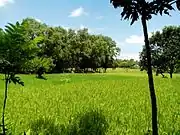 Beauty of nature
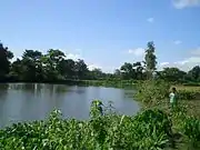 Choudhory Bari Pond

Kontor Deghee 
Paddy Seedlings 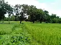
Mango orchard besides paddy field 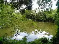
Shaheb Bari Pond 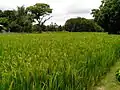
Golden paddy field 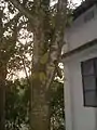
Jack-fruit 
House structure of villagers
References
- "Population Census 2011: Brahmanbaria Table C-01" (PDF). Bangladesh Bureau of Statistics. Archived from the original (PDF) on September 23, 2015. Retrieved July 11, 2014.
Capital: Brahmanbaria | ||
| Upazilas | ||
| Constituencies | ||
| Attractions and sites | ||
| History | ||
| Inhabited areas | ||
| Rivers | ||
| Educational institutions | ||
| Organisations | ||
| Transport | ||
| See also | ||
