Brahmanbaria Sadar Upazila
Brahmanbaria Sadar (Bengali: ব্রাহ্মণবাড়িয়া সদর) is an upazila of Brahmanbaria District in the Division of Chittagong, Bangladesh. Brahmanbaria Sadar is located at 23.9528°N 91.1167°E.
Brahmanbaria Sadar
ব্রাহ্মণবাড়িয়া সদর | |
|---|---|
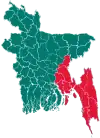
 Brahmanbaria Sadar Location in Bangladesh | |
| Coordinates: 23°57.2′N 91°7′E | |
| Country | Bangladesh |
| Division | Chittagong Division |
| District | Brahmanbaria District |
| Area | |
| • Total | 495.85 km2 (191.45 sq mi) |
| Population (1991) | |
| • Total | 659,449 |
| • Density | 1,330/km2 (3,400/sq mi) |
| Time zone | UTC+6 (BST) |
| Website | Official Map of Brahmanbaria Sadar |
History
The historic name of Brahmanbaria was Rang (রং). During the Sena period of Bengal, King Ballala Sena invited a Brahmin family to come and live in Rang as there was a deficiency of Hindu priests. In the 14th century, a Qadi by the name of Syed Mahmud came to Rang to propagate the religion of Islam to its inhabitants. The Brahman family willingly accepted Islam. They decided gave up their position as the Priests of Rang, and migrated to Nabinagar to start a new life. Rang was named as Brahmanbaria (lit. Brahmins leaving in the local dialect of the district) after this incident.[1] The area Mahmud resided in was named Kazipara (Kazi being a variant of Qadi) after him, and his mazar (mausoleum) remains there.[2]
Brahmanbaria Thana was converted into an upazila in 1984.[3]
Demographics
According to the 1991 Bangladesh census, Brahmanbaria Sadar had a population of 659,449. Males constituted 51.38% of the population, and females 48.62%. The population aged 18 or over was 312,696. Brahmanbaria Sadar had an average literacy rate of 30.1% (7+ years), against the national average of 32.4%.[4]
Administration
Brahmanbaria Sadar Upazila is divided into Brahmanbaria Municipality and 11 union parishads: Basudeb, Bodhal, Dakshin Natai, Machihata, Majlishpur, Ramrail, Sadekpur, Shuhilpur, Sultanpur, Talsahar, and Uttar Natai. The union parishads are subdivided into 103 mauzas and 146 villages.[5]
Brahmanbaria Municipality is subdivided into 12 wards and 34 mahallas.[5]
References
- ব্রাহ্মণবাড়িয়া সদর উপজেলার পটভূমি. Brahmanbaria Sadar Upazila (in Bengali).
- কাজী মাহমুদ শাহ (রহ) মাজার. Brahmanbaria Sadar Upazila (in Bengali).
- Md. Mahabubur Rahman (2012). "Brahmanbaria Sadar Upazila". In Islam, Sirajul; Miah, Sajahan; Khanam, Mahfuza; Ahmed, Sabbir (eds.). Banglapedia: the National Encyclopedia of Bangladesh (Online ed.). Dhaka, Bangladesh: Banglapedia Trust, Asiatic Society of Bangladesh. ISBN 984-32-0576-6. OCLC 52727562. Retrieved 28 January 2021.
- "Population Census Wing, BBS". Archived from the original on 2005-03-27. Retrieved November 10, 2006.
- "District Statistics 2011: Brahmanbaria" (PDF). Bangladesh Bureau of Statistics. Archived from the original (PDF) on 13 November 2014. Retrieved 14 July 2014.
