Kafr Kila, Lebanon
KafarKila (Arabic: كفركلا, also, Kfarkila, Kfarkela, Kafarkela) is a village in Southern Lebanon.
Kafar Kila
كفركلا | |
|---|---|
Village | |
.jpg.webp) Kafr Kila | |
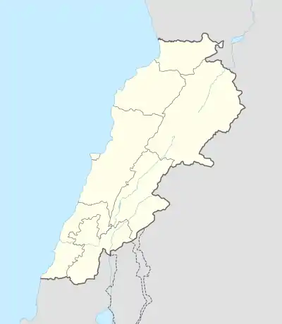 Kafar Kila Location within Lebanon | |
| Coordinates: 33°17′N 35°33′E | |
| Grid position | 201/298 PAL |
| Country | |
| Governorate | Nabatieh Governorate |
| District | Marjeyoun District |
| Elevation | 400 m (1,300 ft) |
| Time zone | UTC+2 (EET) |
| • Summer (DST) | UTC+3 (EEST) |
| Dialing code | +961 |
Kafarkila name means "The village of the pasturage".[1]
History
Al-Maqdisi (c. 945/946 – 991) noted that Kafr Kila (called Kafar Kila) was "A place lying a day's march from Tabariyyah".[2]
Ottoman era
In the 1596 tax records, it was named as a village, Kafr Kuk, in the Ottoman nahiya (subdistrict) of Tibnin, part of Safad Sanjak, with a population of 31 households and 2 bachelors, all Muslim. The villagers paid taxes on agricultural products, such as wheat, barley, olive trees, goats, beehives and winter pastures; a total of 4,700 akçe.[3][4]
In 1838, Eli Smith noted Kafr Kila's population as Metawileh.[5]
In 1875 Victor Guérin visited and noted that the village had about 1,000 Metawileh inhabitants.[6] He further noted: "The mosque and several of the houses are built of old materials. The spring is partly ancient."[7]
In 1881, the PEF's Survey of Western Palestine (SWP) described it as "a village, built of stone and mud, containing about 150 Moslems, situated on sloping ground, with figs, olives, and arable land around. A good spring near."[8]
Modern era
The total population of the village is about 14,500. The occupants' number increases dramatically during summer. Its altitude is around 700 m from sea level.[9] Kafarkila is well known for its high quality olive oil, grapes, and bee honey in addition to many other farming activities.
Many developments are currently taking place due to the efforts and the determination of the municipality side by side with the people in order to mitigate the problems that accumulated over the years from central government indifference, civil war, occupation and border wars.
Kafr Kela is home to a Hezbollah military base complete with fighters, about 20 arms depots, fighting positions and observation posts. The first Hezbollah tunnel the Israel Defense Forces (IDF) found near Metula came out of Kafr Kela. Dozens of Hezbollah members live in the village among the civilian population.[10]
References
- Palmer, 1881, p. 23
- Le Strange, 1890, p. 470
- Hütteroth and Abdulfattah, 1977, p. 184
- Note that Rhode, 1979, p. 6 writes that the register that Hütteroth and Abdulfattah studied was not from 1595/6, but from 1548/9
- Robinson and Smith, 1841, vol 3, 2nd appendix, p. 137
- Guérin, 1880, p. 277
- Guérin, 1880, pp. 277-278; as given in Conder and Kitchener, 1881, SWP I, pp. 117
- Conder and Kitchener, 1881, SWP I, pp. 87-88
- "Map of Kfar Kila". Archived from the original on 2013-06-28. Retrieved 28 May 2013.
- https://www.ynetnews.com/articles/0,7340,L-5422241,00.html
Bibliography
- Conder, C.R.; Kitchener, H.H. (1881). The Survey of Western Palestine: Memoirs of the Topography, Orography, Hydrography, and Archaeology. 1. London: Committee of the Palestine Exploration Fund.
- Guérin, V. (1880). Description Géographique Historique et Archéologique de la Palestine (in French). 3: Galilee, pt. 2. Paris: L'Imprimerie Nationale.
- Hütteroth, Wolf-Dieter; Abdulfattah, Kamal (1977). Historical Geography of Palestine, Transjordan and Southern Syria in the Late 16th Century. Erlanger Geographische Arbeiten, Sonderband 5. Erlangen, Germany: Vorstand der Fränkischen Geographischen Gesellschaft. ISBN 978-3-920405-41-4.
- Le Strange, G. (1890). Palestine Under the Moslems: A Description of Syria and the Holy Land from A.D. 650 to 1500. London: Committee of the Palestine Exploration Fund.
- Palmer, E.H. (1881). The Survey of Western Palestine: Arabic and English Name Lists Collected During the Survey by Lieutenants Conder and Kitchener, R. E. Transliterated and Explained by E.H. Palmer. Committee of the Palestine Exploration Fund.
- Rhode, H. (1979). Administration and Population of the Sancak of Safed in the Sixteenth Century (PhD). Columbia University.
- Robinson, E.; Smith, E. (1841). Biblical Researches in Palestine, Mount Sinai and Arabia Petraea: A Journal of Travels in the year 1838. 3. Boston: Crocker & Brewster.
External links
- Survey of Western Palestine, Map 2: IAA, Wikimedia commons
- Kfar Kila, Localiban
- www.kafarkila.net
| Capital | 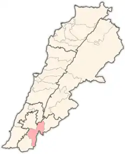 | |
|---|---|---|
| Towns and villages | ||
| Other | ||
