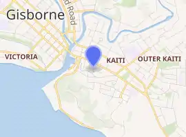
Kaiti, New Zealand
Kaiti (Māori: Kaitī) is a suburb of the New Zealand city of Gisborne. It is located immediately to the east of the city centre, on the opposing bank of the Waimata River.
Kaiti | |
|---|---|
Suburb | |
| |
| Country | New Zealand |
| Local authority | Gisborne |
| Electoral ward | Gisborne |
| Population (2018)[1] | |
| • Total | 7,803 |
| Gisborne Central | Whataupoko | |
| Victoria |
|
|
| (Poverty Bay) | Tamarau |
Kaiti Hill or Titirangi overlooks Poverty Bay with Young Nick's Head (Te Kurī-a-Pāoa) across the Bay.[2] Titirangi also overlooks the city. The Turanganui River is below it, and separates Kaiti from the Gisborne Central Business District.[3]
Kaiti Beach is one of New Zealand's most historic spots, being the landing site of the Horouta waka.[3] It brought ancestors of the tangata whenua to the region. In 1769 Captain James Cook, the first European to have set foot on New Zealand soil, also landed here. The Cook Landing Site is protected as a national reserve.
The name kaiti comes from Māori words meaning "to eat the edible parts of cabbage trees".
Demographics
| Year | Pop. | ±% p.a. |
|---|---|---|
| 2006 | 7,524 | — |
| 2013 | 6,891 | −1.25% |
| 2018 | 7,803 | +2.52% |
| Source: [1] | ||
Kaiti, comprising the statistical areas of Kaiti North, Kaiti South and Outer Kaiti, had a population of 7,803 at the 2018 New Zealand census, an increase of 912 people (13.2%) since the 2013 census, and an increase of 279 people (3.7%) since the 2006 census. There were 2,397 households. There were 3,762 males and 4,050 females, giving a sex ratio of 0.93 males per female, with 2,121 people (27.2%) aged under 15 years, 1,680 (21.5%) aged 15 to 29, 3,018 (38.7%) aged 30 to 64, and 987 (12.6%) aged 65 or older.
Ethnicities were 43.5% European/Pākehā, 67.7% Māori, 7.5% Pacific peoples, 2.7% Asian, and 0.8% other ethnicities (totals add to more than 100% since people could identify with multiple ethnicities).
The proportion of people born overseas was 9.1%, compared with 27.1% nationally.
Although some people objected to giving their religion, 46.9% had no religion, 35.3% were Christian, 0.3% were Hindu, 0.3% were Muslim, 0.3% were Buddhist and 8.2% had other religions.
Of those at least 15 years old, 756 (13.3%) people had a bachelor or higher degree, and 1,284 (22.6%) people had no formal qualifications. The employment status of those at least 15 was that 2,481 (43.7%) people were employed full-time, 783 (13.8%) were part-time, and 447 (7.9%) were unemployed.[1]
| Name | Population | Households | Median age | Median income |
|---|---|---|---|---|
| Kaiti North | 2,178 | 738 | 40.9 years | $29,300[4] |
| Kaiti South | 3,060 | 948 | 30.3 years | $22,400[5] |
| Outer Kaiti | 2,565 | 711 | 25.9 years | $19,700[6] |
| New Zealand | 37.4 years | $31,800 |
Geography
Titirangi Hill
Titirangi Hill is a reserve with a dog walking area, fitness trail, picnic area, playground and lookout spot.[7]
The Kaiti Beach reserve, at the south-west base of the hill, is a beach, local park and dog walking area.[7]
Other parks
Anzac Park includes a barbecue area, boat ramp, football fields, picnic area and playground.[7]
Waikirikiri Reserve is a sports ground, dog walking area and picnic area.[7]
London Street Reserve is a local park and dog walking area.[7]
Marae
Te Poho-o-Rawiri Marae is located in Kaiti. It is a tribal meeting ground of the Ngāti Porou hapū of Ngāti Konohi and Ngāti Oneone,[8] and includes Te Poho o Rawiri meeting house.[9]
In October 2020, the Government committed $1,686,254 from the Provincial Growth Fund to upgrade Te Poho-o-Rawiri Marae and 5 other Rongowhakaata marae, creating an estimated 41 jobs.[10]
Education
Kaiti School is a Year 1–6 state primary school[11] with a roll of 350.[12][13]
Te Wharau School is a Year 1–6 primary school[14] with a roll of 442.[15][16]
Ilminster Intermediate is a Year 7–8 state intermediate school[17] with a roll of 406.[18]
Waikirikiri School is a Year 1–8 state primary school[19] with a roll of 192.[20]
All these schools are co-educational. Rolls are as of March 2020.[21]
References
- "Statistical area 1 dataset for 2018 Census". Statistics New Zealand. March 2020. Kaiti North (206900), Kaiti South (207000) and Outer Kaiti (207100).
- Hariss, Gavin. "Kaiti, Gisborne". topomap.co.nz. NZ Topo Map.
- Jackman, Gordon Heathcote (2002) – Archaeology, Annales and the Port of Gisborne, Aotearoa New Zealand. Thesis, submitted for the degree of Master of Arts in Anthropology at Univ. of Auckland, New Zealand.
- 2018 Census place summary: Kaiti North
- 2018 Census place summary: Kaiti South
- 2018 Census place summary: Outer Kaiti
- "Gisborne Parks and Reserves". gdc.govt.nz. Gisborne District Council.
- "Te Kāhui Māngai directory". tkm.govt.nz. Te Puni Kōkiri.
- "Māori Maps". maorimaps.com. Te Potiki National Trust.
- "Marae Announcements" (Excel). growregions.govt.nz. Provincial Growth Fund. 9 October 2020.
- "Official School Website". kaiti.school.nz.
- "Ministry of Education School Profile". educationcounts.govt.nz. Ministry of Education.
- "Education Review Office Report". ero.govt.nz. Education Review Office.
- "Official School Website". tewharau.school.nz.
- "Ministry of Education School Profile". educationcounts.govt.nz. Ministry of Education.
- "Education Review Office Report". ero.govt.nz. Education Review Office.
- "Education Review Office Report". ero.govt.nz. Education Review Office.
- "Ministry of Education School Profile". educationcounts.govt.nz. Ministry of Education.
- "Education Review Office Report". ero.govt.nz. Education Review Office.
- "Ministry of Education School Profile". educationcounts.govt.nz. Ministry of Education.
- "New Zealand Schools Directory". New Zealand Ministry of Education. Retrieved 26 April 2020.
