Kaliro District
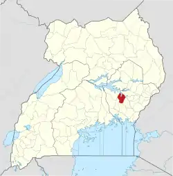
Kaliro District is a district in the Eastern Region of Uganda. It was created out of the eastern part of Kamuli District in 2006. Kaliro is the site of the district headquarters.
Kaliro District | |
|---|---|
 District location in Uganda | |
| Coordinates: 00°54′N 33°30′E | |
| Country | |
| Region | Eastern Region of Uganda |
| Sub-region | Busoga sub-region |
| Capital | Kaliro |
| Area | |
| • Total | 1,062.7 km2 (410.3 sq mi) |
| • Land | 868.7 km2 (335.4 sq mi) |
| • Water | 194 km2 (75 sq mi) |
| Elevation | 1,100 m (3,600 ft) |
| Population (2012 Estimate) | |
| • Total | 216,500 |
| • Density | 249.2/km2 (645/sq mi) |
| Time zone | UTC+3 (EAT) |
| Website | www |
Location
Kaliro District borders Serere District to the north, across Lake Nakuwa, one, of the lakes that comprise the Lake Kyoga water complex. Pallisa District lies to the northeast, Namutumba District to the southeast, Iganga District to the south, Luuka District to the southwest, and Buyende District to the northwest. The town of Kaliro is approximately 40 kilometres (25 mi), by road, north of Iganga, the nearest large town.[1]
Population
In 1991, the national population census estimated the population of the district at 105,100. The 2002 Uganda national census put the population at approximately 154,700, of whom 49.5 percent were males and 50.5 percent were females. The annual population growth rate was calculated at 3.5%. In 2012, the population of Kaliro District was estimated at 216,500.[2]
See also
References
- "Road Distance Between Kaliro And Iganga With Map". Globefeed.com. Retrieved 18 May 2014.
- "Estimated Population of Kaliro District In 1991, 2002 & 2012". Citypopulation.de. Retrieved 18 May 2014.