Kalu Ganga
Kalu Ganga (Sinhala: කළු ගඟ; literally: Black River) is a river in Sri Lanka. Measuring 129 km (80 mi) in length, the river originates from Sri Padhaya and reach the sea at Kalutara. The Black River flows through the Ratnapura and the Kalutara District and pass the city Ratnapura. The mountainous forests in the Central Province and the Sinharaja Forest Reserve are the main sources of water for the river.[1]
| Kalu Ganga | |
|---|---|
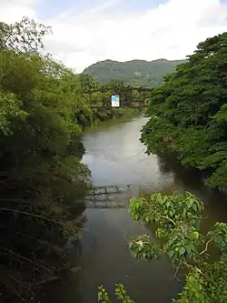 Kalu Ganga in Ratnapura | |
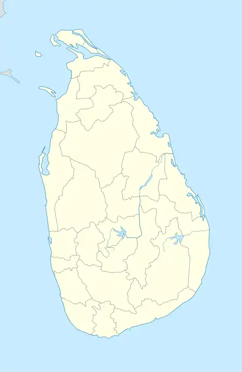 Kalu Ganga (Sri Lanka) | |
| Native name | කළු ගඟ (Kalu Ganga) |
| Location | |
| Country | Sri Lanka |
| Physical characteristics | |
| Source | Sri Padaya |
| • elevation | 2,400 m (7,874 ft) |
| Mouth | Indian Ocean |
• location | Kalutara |
• elevation | 1m |
| Length | 129 km (80 mi) |
| Basin size | 2,766 km2 (1,068 sq mi) |
| Basin features | |
| Tributaries | |
| • left | Kukule River |
Kalu Ganga basin is one of the most important river basins in Sri Lanka which receives very high rainfalls and has higher discharges. Due to its hydrological and topographical characteristics, the lower flood plain suffers from frequent floods and it affects socio-economic profile greatly. During the past several years, many researchers have investigated climatic changes of main river basins of the country, but no studies have been done on climatic changes in Kalu Ganga basin. Therefore, the objective of this study was to investigate precipitation trends in Kalu Ganga basin. Annual and monthly precipitation trends were detected with Mann-Kendall statistical test. Negative trends of annual precipitation were found in all the analyzed rainfall gauging stations. As an average, -0.98 trend with the annual rainfall reduction of 12.03 mm/year was found. April and August were observed to have strong decreasing trends. July and November displayed strong increasing trends. In conclusion, whole the Kalu Ganga basin has a decreasing trend of annual precipitation and it is clear that slight climatic changes may have affected the magnitude and timing of the precipitation within the study area
Introduction

Kalu Ganga basin is the second largest river basin in Sri Lanka covering 2766 km2 and much of the catchment is located in the highest rainfall area of the country, which reflects the high annual rainfall. The annual rainfall in the basin is averaged to 4000mm and leads to 4000 million m3 of annual flow.The Kalu Ganga originates from the central hills of wet zone at an altitude of 2250 m and garners rainfall on the western slopes and falls out to the sea at Kalutara after traversing about 129 km. The basin has steep gradients in upper part and mild gradients in lower part. Due to these hydrological and topographical characteristics of the river basin, its lower flood plain suffers from frequent floods during the Southwest monsoon season. Therefore, the damages to the socio-economic profile are significantly high since the lower flood plain of Kalu Ganga is densely populated and it is a potential area for rice production. During the past several years, attention has been paid to study on precipitation changes of main river basins of Sri Lanka. El Niño-southern oscillation influences on stream flow in Kelani River.[2] In studied 2005 hydrology and environmental flows in the Walawe River basin. However, we couldn’t find any academic literature regarding climatic changes in Kalu Ganga basin, which is one of the four main rivers in Sri Lanka. The major possible effects of climate change may include variability in water resources, increase desertification, loss of biodiversity and changes in agricultural productivity. One of the most significant consequences resulting from climate change may be the alteration of regional hydrological cycles and subsequent changes in stream flow regimes. Studies of general circulation model (GCM) reveals that increased global temperature could lead to increase the amount and intensity of regional precipitation. Precipitation is a good indication of the impacts from climate change on water resources. Changes in precipitation patterns are very important for water resources managers to deal with the water resources planning and management. Variations in precipitation over daily, seasonal, annual, and decadal timescales influencewater resource systems. In addition to the studies on short-term variability of precipitation, long-term detection of precipitation is essential for understanding the potential impacts on water resources resulting from climate change. Therefore, the objective of this study was to investigate long-term precipitation trends, which is one of the crucial parameters in climatic change, in Kalu Ganga basin.[3]
See also
References
- Development of a Flood Forecasting Model For Kalu River and Kelani River Basins in Sri Lanka using Radial Basis Function Neural Networks
- Lareef, Z. (2003). Sensitivity of Kelani streamflow in Sri Lnaka. Sri Lanka.
- Dharmasena, G.T. (2006). Integrated water resources management and sound information system-Sri Lankan experience. Sri Lanka.
