Kamimine, Saga
Kamimine (上峰町, Kamimine-chō) is a town located in Miyaki District, Saga Prefecture, Japan.
Kamimine
上峰町 | |||||||||||
|---|---|---|---|---|---|---|---|---|---|---|---|
Town | |||||||||||
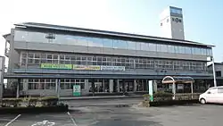 Kamimine town hall | |||||||||||
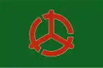 Flag  Emblem | |||||||||||
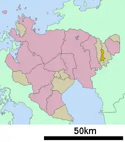 Location of Kamimine in Saga Prefecture | |||||||||||
 Kamimine Location in Japan | |||||||||||
| Coordinates: 33°19′N 130°26′E | |||||||||||
| Country | Japan | ||||||||||
| Region | Kyushu | ||||||||||
| Prefecture | Saga Prefecture | ||||||||||
| District | Miyaki | ||||||||||
| Area | |||||||||||
| • Total | 12.79 km2 (4.94 sq mi) | ||||||||||
| Population (March 1, 2017) | |||||||||||
| • Total | 9,589 | ||||||||||
| • Density | 750/km2 (1,900/sq mi) | ||||||||||
| Time zone | UTC+09:00 (JST) | ||||||||||
| City hall address | 383-1 Ōaza Bōsho, Kamimine-chō, Miyaki-gun, Saga-ken 849-0123 | ||||||||||
| Website | www | ||||||||||
| |||||||||||
Geography
Kamimine is located in the eastern part of Saga Prefecture about 15 kilometres (9.3 mi) east of central Saga, the capital city. It is also about 15 kilometres (9.3 mi) west of Kurume, a major city in Fukuoka Prefecture. There is a lot of flat land in Kamimine as the town area consists largely of the Saga Plains. However, the northern part of town contains Mt. Chinzei.
Adjoining municipalities
History
- April 1, 1889 – The modern municipal system is established. The villages of Bōsho, Emukai, Maemuta and Tsutsumi merge to form Kamimine.
- November 1, 1989 – Kamimine gains town status.
Industry
The main industry in Kamimine is agriculture, particularly rice.
Education
Public schools
- Kamimine Junior High School (上峰中学校)
- Kamimine Elementary School (上峰小学校)
Private schools
- Kamimine Kindergarten (上峰幼稚園)
Transportation
Air
The closest airports are Saga Airport and Fukuoka Airport.
Rail
The Nagasaki Main Line runs through Kamimine, but there are no stations within the town borders. The closest station is Yoshinogari-kōen Station in neighboring Yoshinogari.
Road
- Expressways: The Nagasaki Expressway runs through Kamimine, but there are no interchanges within the town borders. The closest interchange is the Higashisefuri Interchange in neighboring Yoshinogari.
- National highways: Route 34
- Main prefectural roads: Kitashigeyasu-Mitagawa Route 22
External links
 Media related to Kamimine, Saga at Wikimedia Commons
- Kamimine official website
| Special city | ||
|---|---|---|
| Cities | ||
| Districts | ||
| Authority control |
|---|