Kepi, Indonesia
Kepi is a town in Mappi Regency, Papua, Indonesia. Following the formation of Mappi Regency in 2002, the town became its administrative seat.
Kepi | |
|---|---|
Town | |
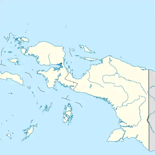 Kepi Location in Western New Guinea and Indonesia  Kepi Kepi (Indonesia) | |
| Coordinates: 6°32′S 139°19′E | |
| Country | |
| Province | |
| Regency | Mappi Regency |
| Founded | 1946 |
| Government | |
| • Mayor | Kristosimus Agawemu |
| • Vice Mayor | ? |
| Area | |
| • Total | 25,443 km2 (9,824 sq mi) |
| Population (2018 est.) | |
| • Total | 5,647[1] |
| • Density | 2,219/km2 (5,750/sq mi) |
| Languages | |
| • Main languages | Indonesian, Papuan Malay, Awyu, Yaqay, Kayagar |
| Time zone | UTC+9 (IEST) |
| Area code | (+62) 832 |
| Climate | Af |
| Website | kepi |
History
At the time of the Dutch arrival, the region was inhabited by various tribes speaking Trans–New Guinea languages, such as the Awyu, the Yaqay, or the Kayagar.[2] The inhabitant of the area were mostly left alone by the outside world until the first half of the 20th century, when the Dutch started taking an interest in the region. In 1926, a penitential colony for political prisoners was established further inland at Tanahmerah, although it would take ten more years for the first Dutch government post to be established in the Mappi area. In 1936 a military post known as Mappi Post was set up on an hill named Tamao, at the confluence of the Digoel and Kawarga River, to prevent Headhunting raids which were creating unrest and migrations, and assert Dutch control over the area.[3] Following the Japanese invasion of New Guinea in 1942 and the subsequent bombing of the post by Japanese aircraft in 1943,[4] the post was essentially abandoned and only manned by a coastwatcher. In 1944, the Australian Army moved in, installing a radar station which had been previously operating in Bupul, with the goal of spotting Japanese airplanes coming from the west to attack Merauke.[5] However, as the Japanese airfields were wiped out by allied aerial bombardments, the radar station became useless and the Australian army departed in 1945.[6]
Shortly after the war in 1946, the administrative center of the Mappi district was moved from the Mappi Post to the village of Kepi,[3][7] a protestant mission with a church was established there, and catholic religious orders soon followed, such as the Daughters of Our Lady of the Sacred Heart or Our Lady of the Seven Dolours in 1948.[8] The Dutch were also successful in eradicating the Headhunting raids in the area, the last one occurring in 1949.[9] The brothers of Our Lady of the Seven Dolours introduced a regional project with an agricultural centre in Mappi. This Welfare Plan Mappi and the Regional Plan, which encouraged the cultivation of cocoa and rubber, were joint ventures of the mission and the Dutch government.[10] The christian missionaries carried on their work after the withdrawal of the Dutch from the area in 1962, and the subsequent transfer of Western New Guinea to Indonesia.
in 2002, following the separation of Mappi Regency from the Merauke Regency, the town became its administrative seat.
Geography
Kepi is located along the Obaa river, and is surrounded by swamps. During the rainy monsoon, the rivers in the region regularly overflow their banks and often flood large areas for several months.
Climate
Kepi has a tropical rainforest climate (Af) with heavy rainfall year-round.
| Climate data for Kepi | |||||||||||||
|---|---|---|---|---|---|---|---|---|---|---|---|---|---|
| Month | Jan | Feb | Mar | Apr | May | Jun | Jul | Aug | Sep | Oct | Nov | Dec | Year |
| Average high °C (°F) | 31.6 (88.9) |
31.5 (88.7) |
31.6 (88.9) |
31.4 (88.5) |
30.7 (87.3) |
29.6 (85.3) |
28.9 (84.0) |
29.3 (84.7) |
30.3 (86.5) |
31.5 (88.7) |
32.1 (89.8) |
31.9 (89.4) |
30.9 (87.6) |
| Daily mean °C (°F) | 27.2 (81.0) |
27.1 (80.8) |
27.2 (81.0) |
27.2 (81.0) |
26.7 (80.1) |
25.8 (78.4) |
25.3 (77.5) |
25.3 (77.5) |
25.9 (78.6) |
26.8 (80.2) |
27.4 (81.3) |
27.5 (81.5) |
26.6 (79.9) |
| Average low °C (°F) | 22.9 (73.2) |
22.8 (73.0) |
22.9 (73.2) |
23.0 (73.4) |
22.8 (73.0) |
22.1 (71.8) |
21.7 (71.1) |
21.4 (70.5) |
21.6 (70.9) |
22.1 (71.8) |
22.7 (72.9) |
23.2 (73.8) |
22.4 (72.4) |
| Average precipitation mm (inches) | 313 (12.3) |
312 (12.3) |
372 (14.6) |
337 (13.3) |
312 (12.3) |
211 (8.3) |
216 (8.5) |
201 (7.9) |
217 (8.5) |
233 (9.2) |
268 (10.6) |
305 (12.0) |
3,297 (129.8) |
| Source: Climate-Data.org[11] | |||||||||||||
Demographics
As per 2018 the population was 5,647, according to the Indonesian Government estimates.[1]
Transport
Kepi is served by regular flights from Merauke and Mimika through the nearby Kepi Airport. The town can also be reached by boats going up the Oba river, itself connected to the Digul and the Odamun rivers through the Mappi river.
Notes
- Indonesian statistics. (2019). p.28.
- Gerrit J. van Enk & Lourens de Vries (1997). p.14.
- Boelaars, Jan H. M. C. (1981). pp.4–5.
- Donald F. Thomson. (1953). p.3.
- Simmonds, Ed (2002). pp.26–30
- Arnold, Anthony Peter (2013), p. 328.
- Steenbrink, Karel. (2008). p.549.
- Steenbrink, Karel (2015). pp.342–343.
- Steenbrink, Karel (2015). pp.343–344
- Ipenburg, A. N. (2004)
- "Climate: Kepi". Climate-Data.org. Retrieved July 25, 2020.
References
- Gerrit J. van Enk & Lourens de Vries (1997). The Korowai of Irian Jaya: Their Language in Its Cultural Context. New York, Oxford: Oxford University Press. ISBN 978-0-1951-0551-3.CS1 maint: uses authors parameter (link)
- Boelaars, Jan H. M. C. (1981). Head-Hunters About Themselves: An Ethnographic Report from Irian Jaya, Indonesia. B. V.: Springer Science Business Media. ISBN 9-4011-6808-3.
- Boelaars, Jan H. M. C. (1981). "Head-Hunters About Themselves: An Ethnographic Report from Irian Jaya, Indonesia – Notes" (PDF).
- Thomson, Donald F (1953). War-Time Exploration in Dutch New Guinea. The Geographical Journal Vol. 119, No. 1. The Royal Geographical Society (with the Institute of British Geographers).
- Steenbrink, Karel (2008). Catholics in Indonesia, 1808-1942: A Documented History. Volume 2: The Spectacular Growth of a Self Confident Minority, 1903–1942. Leiden, Netherlands: KITLV Press. ISBN 9-0671-8260-5.
- Steenbrink, Karel (2015). Catholics in Independent Indonesia: 1945-2010. Volume 298: Verhandelingen van het Koninklijk Instituut voor Taal-, Land- en Volkenkunde. Leiden, Boston: Brill; Lam edition. ISBN 9-0042-8513-X.
- Statistics Indonesia. "Distrik Obaa Dalam Angka 2019 (Obaa Subdistrict in Numbers, 2019)" (in Indonesian).
- Simmonds, Ed (2002). "Radar Returns". World War, 1939-1945 -- Australia -- Radar defense networks.
- Arnold, Anthony Peter (2013). "A Slim Barrier: The Defence of Mainland Australia 1939-1945".
- Ipenburg, A. N. (2004). "A Church History of West Papua".