Kerkhoven, Minnesota
Kerkhoven is a city in Swift County, Minnesota, United States, located roughly 100 miles (160 km) west of the Twin Cities region of Minneapolis/St. Paul along U.S. Route 12. The population was 759 at the 2010 census.[6]
Kerkhoven | |
|---|---|
| Nickname(s): Kerk | |
| Motto(s): "A Small Town with Big Possibilities." | |
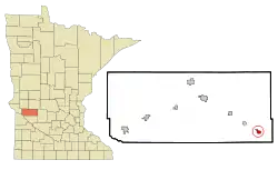 Location of Kerkhoven, Minnesota | |
| Coordinates: 45°11′30″N 95°19′0″W | |
| Country | United States |
| State | Minnesota |
| County | Swift |
| Government | |
| • Mayor | Kordell Van Heuveln |
| Area | |
| • Total | 0.83 sq mi (2.15 km2) |
| • Land | 0.83 sq mi (2.15 km2) |
| • Water | 0.00 sq mi (0.00 km2) |
| Elevation | 1,099 ft (335 m) |
| Population | |
| • Total | 759 |
| • Estimate (2019)[3] | 706 |
| • Density | 850.60/sq mi (328.28/km2) |
| Time zone | UTC-6 (Central (CST)) |
| • Summer (DST) | UTC-5 (CDT) |
| ZIP code | 56252 |
| Area code(s) | 320 |
| FIPS code | 27-32876 [4] |
| GNIS feature ID | 0646118 [5] |
| Website | http://www.cityofkerk.com/ |
History
Kerkhoven was platted in 1870, and named for a railroad promoter.[7] A post office has been in operation at Kerkhoven since 1871.[8] Kerkhoven was incorporated in 1881.[7]
Geography
Kerkhoven is located at 45°11′30″N 95°19′0″W.
According to the United States Census Bureau, the city has a total area of 0.82 square miles (2.12 km2), all land.[9]
Demographics
| Historical population | |||
|---|---|---|---|
| Census | Pop. | %± | |
| 1880 | 94 | — | |
| 1890 | 299 | 218.1% | |
| 1900 | 411 | 37.5% | |
| 1910 | 432 | 5.1% | |
| 1920 | 568 | 31.5% | |
| 1930 | 553 | −2.6% | |
| 1940 | 607 | 9.8% | |
| 1950 | 664 | 9.4% | |
| 1960 | 645 | −2.9% | |
| 1970 | 641 | −0.6% | |
| 1980 | 761 | 18.7% | |
| 1990 | 735 | −3.4% | |
| 2000 | 759 | 3.3% | |
| 2010 | 759 | 0.0% | |
| 2019 (est.) | 706 | [3] | −7.0% |
| U.S. Decennial Census | |||
2010 census
As of the census[2] of 2010, there were 759 people, 329 households, and 206 families residing in the city. The population density was 925.6 inhabitants per square mile (357.4/km2). There were 352 housing units at an average density of 429.3 per square mile (165.8/km2). The racial makeup of the city was 97.1% White, 0.3% Native American, 2.5% from other races, and 0.1% from two or more races. Hispanic or Latino of any race were 12.3% of the population.
There were 329 households, of which 31.0% had children under the age of 18 living with them, 49.5% were married couples living together, 9.7% had a female householder with no husband present, 3.3% had a male householder with no wife present, and 37.4% were non-families. 34.7% of all households were made up of individuals, and 16.2% had someone living alone who was 65 years of age or older. The average household size was 2.31 and the average family size was 2.97.
The median age in the city was 40.1 years. 26% of residents were under the age of 18; 8.6% were between the ages of 18 and 24; 21.1% were from 25 to 44; 26.4% were from 45 to 64; and 17.8% were 65 years of age or older. The gender makeup of the city was 49.7% male and 50.3% female.
2000 census
As of the census[4] of 2000, there were 759 people, 313 households, and 210 families residing in the city. The population density was 1,023.5 people per square mile (396.0/km2). There were 338 housing units at an average density of 455.8 per square mile (176.4/km2). The racial makeup of the city was 94.99% White, 0.13% African American, 0.40% Native American, 4.22% from other races, and 0.26% from two or more races. Hispanic or Latino of any race were 4.74% of the population.
There were 313 households, out of which 31.0% had children under the age of 18 living with them, 56.5% were married couples living together, 8.0% had a female householder with no husband present, and 32.6% were non-families. 30.0% of all households were made up of individuals, and 16.9% had someone living alone who was 65 years of age or older. The average household size was 2.42 and the average family size was 3.00.
In the city, the population was spread out, with 27.3% under the age of 18, 7.0% from 18 to 24, 26.9% from 25 to 44, 18.2% from 45 to 64, and 20.7% who were 65 years of age or older. The median age was 38 years. For every 100 females there were 88.8 males. For every 100 females age 18 and over, there were 85.9 males.
The median income for a household in the city was $32,375, and the median income for a family was $40,179. Males had a median income of $27,262 versus $22,656 for females. The per capita income for the city was $16,435. About 8.4% of families and 9.3% of the population were below the poverty line, including 15.0% of those under age 18 and 7.8% of those age 65 or over.
Education
Kerkhoven is home to Kerkhoven-Murdock-Sunburg Junior Senior High School on the western side of the community. The current building (which replaced the 1904 McKinley Building complex) was constructed in 1994 during the 1993-1994, adjacent to the old one. The original structure was demolished in the summer of 1994. The new and current building started during the 1994-1995 school year. The local high school (Kerkhoven-Murdock-Sunburg Fighting Saints) claimed the 2008 Minnesota High School Football Class A Championship by defeating Royalton, and reigned as 2009 Minnesota Class A Wrestling Champions.
References
- "2019 U.S. Gazetteer Files". United States Census Bureau. Retrieved July 26, 2020.
- "U.S. Census website". United States Census Bureau. Retrieved 2012-11-13.
- "Population and Housing Unit Estimates". United States Census Bureau. May 24, 2020. Retrieved May 27, 2020.
- "U.S. Census website". United States Census Bureau. Retrieved 2008-01-31.
- "Kerkhoven". Geographic Names Information System. United States Geological Survey. Retrieved 2009-05-03.
- "2010 Census Redistricting Data (Public Law 94-171) Summary File". American FactFinder. U.S. Census Bureau, 2010 Census. Retrieved 23 April 2011.
- Upham, Warren (1920). Minnesota Geographic Names: Their Origin and Historic Significance. Minnesota Historical Society. p. 541.
- "Swift County". Jim Forte Postal History. Retrieved 9 August 2015.
- "US Gazetteer files 2010". United States Census Bureau. Archived from the original on 2012-01-25. Retrieved 2012-11-13.
Municipalities and communities of Swift County, Minnesota, United States | ||
|---|---|---|
| Cities | 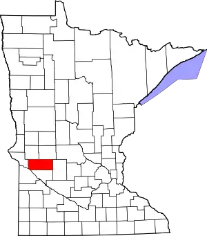 Map of Minnesota highlighting Swift County | |
| Townships | ||
| Unincorporated communities | ||
| ||
| Authority control |
|
|---|