Khandadevi
Khandadevi is a populated place and a ward (ward no. 7) of Khandadevi Rural Municipality. It was a village development committee before 10 March 2017. At the time of the 1991 Nepal census it had a population of 3751 people living in 650 individual households.[1]
Khandadevi
खाँडादेवी | |
|---|---|
 Khandadevi Location in Nepal | |
| Coordinates: 27.4622°N 85.9277°E | |
| Country | |
| Province | Bagmati Province |
| District | Ramechhap District |
| Rural Municipality | Khandadevi Rural Municipality |
| Ward No. | 7 |
| Established as a VDC | 1990 |
| Established as a ward | 2017 |
| Government | |
| • Type | Ward council |
| • Ward Chairperson | Mr. Asal Sing Tamang |
| Area | |
| • Total | 21.34 km2 (8.24 sq mi) |
| Population (2011) | |
| • Total | 3,925 |
| • Density | 180/km2 (480/sq mi) |
| Time zone | UTC+5:45 (Nepal Time) |
On 10 March 2017, local level body of Nepal restructured into 753 units, thus this local level unit merged with other VDCs to form Khandadevi Rural Municipality. Now total area of this ward is 21.34 square kilometres (8.24 sq mi) and total population (2011 Nepal census) is 3,925.[2][3]
References
- "Nepal Census 2001", Nepal's Village Development Committees, Digital Himalaya, archived from the original on 12 October 2008, retrieved 15 November 2009.
- "New local level units come into existence". www.kathmandupost.ekantipur.com. 11 March 2017. Retrieved 18 July 2018.
- "स्थानीय तहहरुको विवरण" [Details of the local level bodies]. www.mofald.gov.np/en (in Nepali). Ministry of Federal Affairs and Local Development. Retrieved 17 July 2018.
External links
Headquarters: Manthali | ||
| Municipalities | 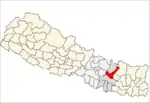 | |
| Rural municipalities | ||
| Former VDCs |
| |
This article is issued from Wikipedia. The text is licensed under Creative Commons - Attribution - Sharealike. Additional terms may apply for the media files.