Khandala, Satara
Khandala is a taluka in the Satara district in Maharashtra, India. The Nira River passes through the region. Khandala Taluka is situated on the northern side of Satara district. Khandala, Shirwal and Lonand are large towns in the taluka. Khandala got separated from Wai Taluka along with Mahabaleshwar for easier administration. The Nira River flows from the northern border of the taluka. "VEER" is the largest dam on the Nira River in Khandala. The southern border is covered with "MAHADEVACHE DONGAR", meaning Mahadev Hills.
Khandala | |
|---|---|
city | |
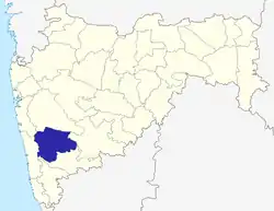
 Khandala Location in Maharashtra, India | |
| Coordinates: 18.03°N 74.01°E | |
| Country | |
| State | Maharashtra |
| District | Satara |
| Government | |
| • Body | Khandala Panchayat |
| Elevation | 700 m (2,300 ft) |
| Population (2011) | |
| • Total | 6,832 |
| Languages | |
| • Official | Marathi |
| Time zone | UTC+5:30 (IST) |
| Area code(s) | 02169 |
| Vehicle registration | MH-11 |
| Website | www.satara.nic.in |
Geography
Khandala is located at (18.03N,74.01E), approximately 55 km south of the city of Pune (Devanagari: पुणे). It has an average elevation of 700 metres (2300 feet). It is surrounded by the mountainous region of the Sahyādris; the boundaries of the taluka (sub-district) called Khandala are as follows—to the east of Khandala are the talukas of Phaltan and Baramati, to the west lies the taluka of Wai and Bhor, the northern border abuts the Purandar Taluka in Pune district and the south border is shared with the Wai and Koregaon. The headquarters of the taluka of Khandala is the city by the same name, populated by about 7000 people. Khandala is 50 km from Mahabaleshwar, 25 km From Wai, 45 km. from Satara, 55 km. from Pune, 230 km. from Mumbai. Khandala is situated on the Pune-Satara section of National Highway 48. Khandala is a major city on the way to hill stations such as Mahabaleshwar and Panchgani from Pune.
Demography[1]
The total population of Khandala, according to the 2011 Census, is 6,832. Of this,187 are Scheduled Tribes (STs) and 1,090 are Scheduled Caste (SC). The sex ratio of the population in Khandala is 3,301 females per 3,531 males. The literacy rate in the city is 91.12 per cent, 93.99 for males and 88.08 for females.
Tourism
Khambatki Ghat gives best view of Khandala throughout the year. Ghat is situated on southern border. "Subhangad" is fort of Maratha Empire near Shirwal. During "waree" of Aashadhi Ekadashi Palkhi of Shree DNyaneshwar Maauli halts at Lonand. "Ashwasnan" takes place at Nira River."Shree Datta Temple" is at village Morve viz. 13 km from east of Khandala.Choupaty of Veer Dam near village Tondal 12 km from Shirwal. Wing is famous for agritourism. Madhyavarti Oos Sanshodhan Kendra is situated at Padegaon, where research on sugarcane takes place. Lonand is connected by railway. Khandala and Shirwal are situated on Pune-Satara Highway. Krantisinh Nana Patil College of Veterinary Science is near Shirwal on Pandharpur Road.
Villages in Khandala[2]
- Ahire
- Ajnuj
- Ambarwadi
- Andori
- Asawali
- Atit
- Balu Patalachiwadi
- Bavada
- Bavakalwadi
- Bhadavade
- Bhade
- Bhatghar
- Bholi
- Bori
- Dapkeghar
- Deoghar
- Dhanagarwadi
- Dhavadwadi
- Ghadagewadi
- Ghatdare
- Golegaon
- Guthalwadi
- Harali
- Javale
- Kanhavadi
- Kanheri
- Karadwadi
- Karnvadi
- Kavathe
- Kesurdi
- Khandala
- Khed
- Koparde
- Limbachiwadi
- Lohom
- Lonand
- Loni
- Mariaichiwadi
- Mhavashi
- Miraje
- Morve
- Naigaon
- Nimbodi
- Padali
- Padegaon
- Palashi
- Pargaon
- Pimpare
- Pisalwadi
- Rajewadi
- Salav
- Sangavi
- Shedagewadi
- Shekhmirwadi
- Shindewadi
- Shirwal
- Shivajinagar
- Sukhed
- Tondal
- Wahagaon
- Wadgaon
- Waghoshi
- Wanechiwadi
- Wathar
- Wing
- Zagalwadi
References
- "Khandala Village Population - Khandala - Satara, Maharashtra". www.census2011.co.in. Retrieved 23 March 2019.
- "Villages & Towns in Khandala Taluka of Satara, Maharashtra". www.census2011.co.in. Retrieved 23 March 2019.
Satara district topics | ||
|---|---|---|
| History |
|  |
| Battles | ||
| Rivers | ||
| Dams | ||
| Lakes |
| |
| Ghats | ||
| Caves | ||
| Cities and towns | ||
| Villages | ||
| Places to see | ||
| Monuments | ||
| Transport | ||
| Education | ||
| Lok Sabha constituencies | ||
| Vidhan Sabha constituencies | ||
| Culture | ||