Khlung District
Khlung (Thai: ขลุง, pronounced [kʰlǔŋ]) is the southernmost district (amphoe) of Chanthaburi Province, eastern Thailand.
Khlung
ขลุง | |
|---|---|
.jpg.webp) Waterfall, Namtok Phlio National Park | |
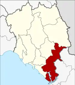 District location in Chanthaburi Province | |
| Coordinates: 12°27′17″N 102°13′17″E | |
| Country | Thailand |
| Province | Chanthaburi |
| Seat | Khlung |
| Area | |
| • Total | 756.038 km2 (291.908 sq mi) |
| Population (2005) | |
| • Total | 55,044 |
| • Density | 72.8/km2 (189/sq mi) |
| Time zone | UTC+7 (ICT) |
| Postal code | 22110 |
| Geocode | 2202 |
Geography
Neighboring districts are (from the northwest clockwise) Laem Sing, Mueang Chanthaburi, Makham, Pong Nam Ron of Chanthaburi Province, Bo Rai, Khao Saming, and Laem Ngop of Trat Province. To the southeast is the Gulf of Thailand.
Administration
The district is divided into 12 sub-districts (tambons), which are further subdivided into 90 villages (mubans). Khlung is a town (thesaban mueang) which covers tambon Khlung. There are a further 11 tambon administrative organizations (TAO).
| No. | Name | Thai name | Villages | Pop. | |
|---|---|---|---|---|---|
| 1. | Khlung | ขลุง | - | 11,259 | |
| 2. | Bo | บ่อ | 10 | 6,715 | |
| 3. | Kwian Hak | เกวียนหัก | 10 | 4,400 | |
| 4. | Tapon | ตะปอน | 6 | 3,274 | |
| 5. | Bang Chan | บางชัน | 6 | 3,735 | |
| 6. | Wan Yao | วันยาว | 8 | 5,346 | |
| 7. | Sueng | ซึ้ง | 11 | 4,830 | |
| 8. | Map Phai | มาบไพ | 6 | 2,350 | |
| 9. | Wang Sappharot | วังสรรพรส | 9 | 2,859 | |
| 10. | Trok Nong | ตรอกนอง | 6 | 2,358 | |
| 11. | Tok Phrom | ตกพรม | 11 | 3,844 | |
| 12. | Bo Wen | บ่อเวฬุ | 7 | 4,074 |
External links
This article is issued from Wikipedia. The text is licensed under Creative Commons - Attribution - Sharealike. Additional terms may apply for the media files.
