Kirkkonummi
Kirkkonummi (Finnish pronunciation: [ˈkirkːoˌnumːi]; Swedish: Kyrkslätt, Finland Swedish: [ˈtɕyrːkslet] (![]() listen), Sweden Swedish: [ˈɕʏ̂rːkslɛt]) is a municipality of 40,055 inhabitants (31 July 2020)[2] in southern Finland. The literal meaning of the words "Kirkkonummi" and "Kyrkslätt" in English is "church heath".
listen), Sweden Swedish: [ˈɕʏ̂rːkslɛt]) is a municipality of 40,055 inhabitants (31 July 2020)[2] in southern Finland. The literal meaning of the words "Kirkkonummi" and "Kyrkslätt" in English is "church heath".
Kirkkonummi
Kirkkonummi – Kyrkslätt | |
|---|---|
Municipality | |
| Kirkkonummen kunta Kyrkslätts kommun | |
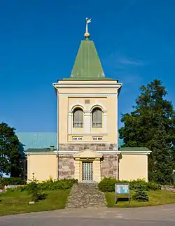 Kirkkonummi church | |
 Coat of arms | |
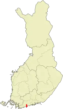 Location of Kirkkonummi in Finland | |
| Coordinates: 60°07′N 024°26′E | |
| Country | |
| Region | Uusimaa |
| Sub-region | Helsinki sub-region |
| Charter | 1330 |
| Municipal manager | Tarmo Aarnio |
| Area (2018-01-01)[1] | |
| • Total | 1,017.01 km2 (392.67 sq mi) |
| • Land | 366.10 km2 (141.35 sq mi) |
| • Water | 649.91 km2 (250.93 sq mi) |
| Area rank | 209th largest in Finland |
| Population (2020-07-31)[2] | |
| • Total | 40,055 |
| • Rank | 27th largest in Finland |
| • Density | 109.41/km2 (283.4/sq mi) |
| Population by native language | |
| • Finnish | 77.9% (official) |
| • Swedish | 18.5% |
| • Others | 3.6% |
| Population by age | |
| • 0 to 14 | 23.3% |
| • 15 to 64 | 67% |
| • 65 or older | 9.7% |
| Time zone | UTC+02:00 (EET) |
| • Summer (DST) | UTC+03:00 (EEST) |
| Municipal tax rate[5] | 19% |
| Website | www.kirkkonummi.fi |
The municipality is located just outside the Helsinki Metropolitan Area, bordering the city of Espoo in the east. Other neighbouring municipalities are Vihti and Siuntio. The distance from the municipal centre to central Helsinki is some 30 kilometres (20 mi). Kirkkonummi also has excellent train and bus connections to other parts of the Greater Helsinki area, and many of its inhabitants commute daily to Helsinki.
The municipality covers an area of 1,017.01 square kilometres (392.67 sq mi) of which 649.91 km2 (250.93 sq mi) is water.[1] The population density is 109.41 inhabitants per square kilometre (283.4/sq mi). Over the recent years, Kirkkonummi has faced the highest population growth rate in the country, over 3% per annum.
Major population centres in Kirkkonummi include the municipal centre, Masala, Veikkola, Kantvik and the Upinniemi naval garrison area. In addition to these, there are dozens of smaller villages. Geographically, Kirkkonummi has two famous peninsulas, namely Porkkala and Upinniemi, the latter one of which houses a major Finnish naval base. Porkkala is also on one of the main bird migration routes in the Baltic Sea region. Additionally, Kirkkonummi has a large central plains area, through which a railway goes from Helsinki to Turku as well as extensive lake areas, much of which is relatively untouched wilderness.
Kirkkonummi has been populated from the Stone Age to the present day as evidenced by the first Stone Age rock paintings found in Finland that are located by lake Vitträsk in the central lake region of Kirkkonummi. Incidentally, these paintings were found by the famous Finnish composer Jean Sibelius himself. The southern half of the municipality was leased to the Soviet Union between 1945 and 1956 for use as a naval base as part of the peace settlement that ended the hostilities between the Soviet Union and Finland during World War II. Signs of this time include concrete bunkers, other fortifications and the remains of an airbase.
Other places of interest located in Kirkkonummi include the medieval stone church in the municipal centre, the wooden church in the village of Haapajärvi as well as the Hvitträsk manor designed by Finnish architects Eliel Saarinen, Herman Gesellius and Armas Lindgren.
Politics
Results of the 2011 Finnish parliamentary election in Kirkkonummi:
- National Coalition Party 30.7%
- Social Democratic Party 16.8%
- True Finns 16.3%
- Swedish People's Party 14.3%
- Green League 10.1%
- Centre Party 4.4%
- Left Alliance 3.6%
- Christian Democrats 2.3%
International relations
See also
References
- "Area of Finnish Municipalities 1.1.2018" (PDF). National Land Survey of Finland. Retrieved 30 January 2018.
- "Suomen virallinen tilasto (SVT): Väestön ennakkotilasto [verkkojulkaisu]. Heinäkuu 2020" (in Finnish). Statistics Finland. Retrieved 13 September 2020.
- "Population according to language and the number of foreigners and land area km2 by area as of 31 December 2008". Statistics Finland's PX-Web databases. Statistics Finland. Retrieved 29 March 2009.
- "Population according to age and gender by area as of 31 December 2008". Statistics Finland's PX-Web databases. Statistics Finland. Retrieved 28 April 2009.
- "List of municipal and parish tax rates in 2011". Tax Administration of Finland. 29 November 2010. Retrieved 13 March 2011.
- "Ystävyyskunnat" (in Finnish). Municipality of Kirkkonummi. Retrieved 23 August 2019.
External links
![]() Media related to Kirkkonummi at Wikimedia Commons
Media related to Kirkkonummi at Wikimedia Commons
- Municipality of Kirkkonummi – official website
| Municipalities |  | |
|---|---|---|
| Former municipalities |
| |
50 most populous municipalities in Finland (city or town status marked in bold) | ||||||||||||||||||||||||||||||||||||||||||||||||||||||||||||||||||||||||||||||||||||||||||||||||
|---|---|---|---|---|---|---|---|---|---|---|---|---|---|---|---|---|---|---|---|---|---|---|---|---|---|---|---|---|---|---|---|---|---|---|---|---|---|---|---|---|---|---|---|---|---|---|---|---|---|---|---|---|---|---|---|---|---|---|---|---|---|---|---|---|---|---|---|---|---|---|---|---|---|---|---|---|---|---|---|---|---|---|---|---|---|---|---|---|---|---|---|---|---|---|---|---|
| ||||||||||||||||||||||||||||||||||||||||||||||||||||||||||||||||||||||||||||||||||||||||||||||||
