Sastamala
Sastamala (Finnish pronunciation: [ˈs̠ɑs̠t̪ɑˌmɑlɑ]) is a town and municipality of Finland. It was created January 1, 2009, when the municipalities of Vammala, Äetsä and Mouhijärvi were consolidated into a single town. Later, Kiikoinen also joined Sastamala in 2013.
Sastamala | |
|---|---|
Town | |
| Sastamalan kaupunki Sastamala stad | |
 Onkiniemenkatu in Vammala, an administrative centre of Sastamala. | |
 Coat of arms | |
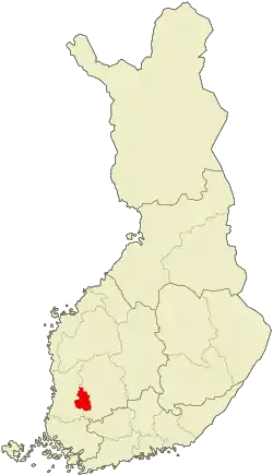 Location of Sastamala in Finland | |
| Coordinates: 61°20.5′N 022°54.5′E | |
| Country | |
| Region | Pirkanmaa |
| Sub-region | South Western Pirkanmaa sub-region |
| Charter | 2009 |
| Seat | Vammala |
| Government | |
| • Town manager | Jarkko Malmberg |
| Area (2018-01-01)[1] | |
| • Total | 1,531.75 km2 (591.41 sq mi) |
| • Land | 1,291.42 km2 (498.62 sq mi) |
| • Water | 96.14 km2 (37.12 sq mi) |
| Area rank | 49th largest in Finland |
| Population (2020-07-31)[2] | |
| • Total | 24,140 |
| • Rank | 43rd largest in Finland |
| • Density | 18.69/km2 (48.4/sq mi) |
| Population by native language | |
| • Finnish | 98.7% (official) |
| • Swedish | 0.2% |
| • Others | 1.2% |
| Population by age | |
| • 0 to 14 | 16.7% |
| • 15 to 64 | 61.8% |
| • 65 or older | 21.5% |
| Time zone | UTC+02:00 (EET) |
| • Summer (DST) | UTC+03:00 (EEST) |
| Municipal tax rate[5] | 20% |
| Website | www.sastamala.fi |
It is located in the Pirkanmaa region. The town has a population of 24,140 (31 July 2020)[2] and covers an area of 1,531.75 square kilometres (591.41 sq mi) of which 96.14 km2 (37.12 sq mi) is water,[1] making it the largest municipality in the Pirkanmaa region in terms of area. The population density is 18.69 inhabitants per square kilometre (48.4/sq mi). The municipality is unilingually Finnish.
Neighbouring municipalities are Huittinen, Hämeenkyrö, Ikaalinen, Kankaanpää, Kokemäki, Lavia, Nokia, Punkalaidun, Ulvila, Urjala and Vesilahti. The city of Tampere is located 51 kilometres (32 mi) from Sastamala.
There are two highways through Sastamala: Highway 11 between Pori and Nokia and Highway 12 between Rauma and Kouvola.
Sights and happenings
- Vanhan kirjallisuuden päivät, book festival
- Sastamala Gregoriana, early music festival
- Skicenter Ellivuori
- Pirunvuori ("Devil's Mountain")
- St. Olaf's Church
- Herra Hakkaraisen talo
- Culturehouse Jaatsi
- Lakeside Golf Vammala
- Sarkia museum
- Keikyä museum
- Kokemäenjoki
International relations
Twin towns — Sister cities
Sastamala is twinned with:
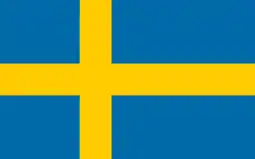 Skövde, Sweden
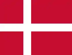 Ringsted, Denmark
 Halden, Norway
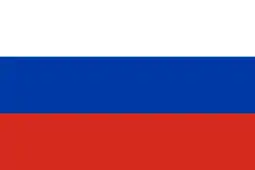 Kashin, Russia
 Kuressaare, Estonia
 Vásárosnamény, Hungary
See also
References
- "Area of Finnish Municipalities 1.1.2018" (PDF). National Land Survey of Finland. Retrieved 30 January 2018.
- "Suomen virallinen tilasto (SVT): Väestön ennakkotilasto [verkkojulkaisu]. Heinäkuu 2020" (in Finnish). Statistics Finland. Retrieved 13 September 2020.
- "Population according to language and the number of foreigners and land area km2 by area as of 31 December 2008". Statistics Finland's PX-Web databases. Statistics Finland. Retrieved 29 March 2009.
- "Population according to age and gender by area as of 31 December 2008". Statistics Finland's PX-Web databases. Statistics Finland. Retrieved 28 April 2009.
- "List of municipal and parish tax rates in 2011". Tax Administration of Finland. 29 November 2010. Retrieved 13 March 2011.
External links
![]() Media related to Sastamala at Wikimedia Commons
Media related to Sastamala at Wikimedia Commons
- Town of Sastamala – Official website (in Finnish)
| Municipalities |  | |
|---|---|---|
| Former municipalities |
| |
50 most populous municipalities in Finland (city or town status marked in bold) | ||||||||||||||||||||||||||||||||||||||||||||||||||||||||||||||||||||||||||||||||||||||||||||||||
|---|---|---|---|---|---|---|---|---|---|---|---|---|---|---|---|---|---|---|---|---|---|---|---|---|---|---|---|---|---|---|---|---|---|---|---|---|---|---|---|---|---|---|---|---|---|---|---|---|---|---|---|---|---|---|---|---|---|---|---|---|---|---|---|---|---|---|---|---|---|---|---|---|---|---|---|---|---|---|---|---|---|---|---|---|---|---|---|---|---|---|---|---|---|---|---|---|
| ||||||||||||||||||||||||||||||||||||||||||||||||||||||||||||||||||||||||||||||||||||||||||||||||
| Authority control |
|---|